Issue Date: Sunday, June 5th, 2022
Issue Time: 9:25AM MDT
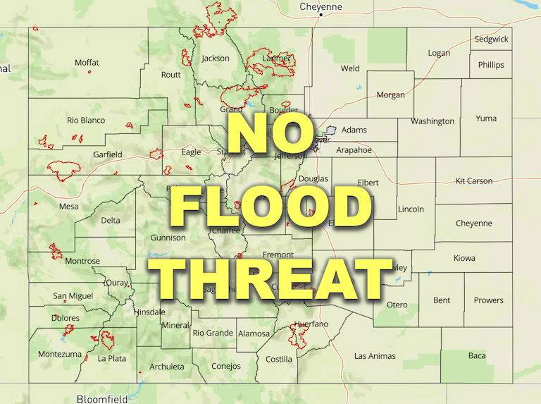
— Flooding is NOT expected today
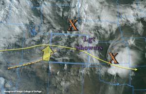
A quieter weather day is on tap as a weak ridge begins to build overhead. There are currently some ongoing light showers and cloud cover over the eastern plains associated with a departing shortwave (orange “X”, north). These should begin to wind down anytime now as the shortwave moves east with the westerly flow aloft. Out west, PW has risen to 0.53 inches at Grand Junction, which is helping produce the mid and upper-level clouds seen in the visible satellite imagery below. Still present in the sounding is a very dry surface layer, which means the isolated storms that develop this afternoon with upslope flow and some weak mid-level energy (north of I-70) will likely produce more brief wind/virga than meaningful rainfall. Nonetheless, it’s good to have a break from critical fire weather conditions.
PW at Denver was measure at 0.54 inches with a similar moisture profile to Grand Junction. One small difference was that there was a little bit better moisture measured in the boundary layer. This remaining moisture is expected to mix out from west to east through this afternoon as another surface Low develops over the Northeast Plains. This means that isolated, weak storms that do develop with the residual moisture over the Front Range and push into the Urban Corridor should produce only limited rainfall. Gusty outflow winds will likely attend the storms as well.
An area of stronger storms is anticipated to develop over the eastern plains along a dry line this afternoon. It is likely that the dry line sets up just west of the eastern Colorado border, which should constrain the areal impact of the storms. That also means that the richer surface moisture is likely to be located east of our border, limiting the heavy rainfall potential. Additionally, the storms are forecast to move at 25-30 mph, so between these two factors, rain rates are expected to remain under flood threat criteria. Therefore, flooding is NOT expected today.
Today’s Flood Threat Map
For more information on today’s flood threat, see the map below. If there is a threat, hover over the threat areas for more details, and click on burn areas to learn more about them. For Zone-Specific forecasts, scroll below the threat map.

Zone-Specific Forecasts:
Northeast Plains & Southeast Plains:
Stronger storms will develop this afternoon along a dry line as some mid-level energy moves through the flow to help kick the storms off. It is possible that the dry line sets up just east of the state, leaving the border counties rainless. There is less of a severe threat today, and if thunderstorms fire over the eastern border counties, they should quickly move to the east. Max 1-hour rain rates up to 1 inch along with small hail and gusty outflow winds will be possible under the stronger storms. Flooding is NOT expected.
Primetime: 2:30PM to 7PM
Front Range, Northern Mountains, Central Mountains, Northwest Slope, Urban Corridor & Palmer Ridge:
Isolated storms are forecast to develop mostly north of I-70 today into tonight. A second round of rainfall and cloud cover is likely over the Northwest Slope and Northern Mountains overnight into tomorrow morning. Over the Northwest Slope, only light rainfall is expected today with more notable totals by morning (up to 0.15 inches). Over the Front Range, Northern Mountains and Urban Corridor 30-minute rain rates up to 0.20 inches are possible. Flooding is NOT forecast.
Primetime: 2PM to Ongoing
Southeast Mountains, Raton Ridge, San Luis Valley, Southwest Slope, Grand Valley & San Juan Mountains:
Rainfall is not anticipated over these zones today, so flooding is NOT expected. Afternoon high temperatures should reach into the upper 80Fs across the lower elevations and Raton Ridge, 80F for the SLV and 70Fs for the mountain valleys.
