Issue Date: Thursday, June 2nd, 2022
Issue Time: 11:00 AM MDT
Summary:
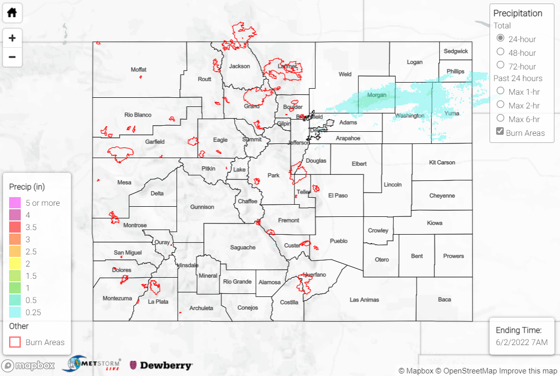
A shortwave trough moving across the state on the first day of meteorological summer brought continued precipitation east of the Divide for the first half of the day before drying commenced. Precipitation totals across the state were 0.25” or less, with the heaviest amounts approaching 0.50” once again falling along I-76 in the Northeast Plains. A CoCoRaHS observer near Hillrose reported 0.44”, which was the highest observation reported. A few high elevations along the Urban Corridor reported a trace of snow.
The flood advisory for the Green River expired this morning, and flows are slowly returning to normal following the dam release. Flows on creeks and rivers across the state are also returning to normal after the precipitation the last few days.
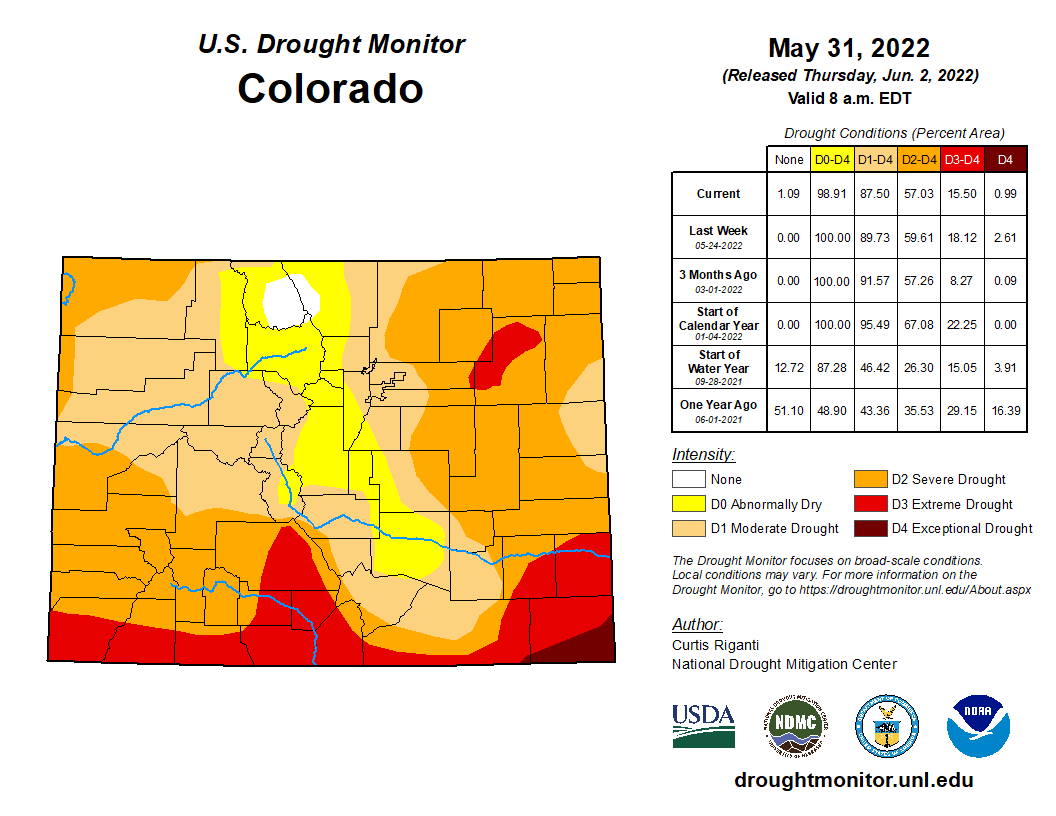
The updated U.S. Drought Monitor was released this morning, and for the first time in a long time, a small patch of white appeared; this patch across the Northern Mountains is the only region in the state no longer experiencing drought conditions. All five drought intensities saw reductions in percent coverage across the state thanks to the precipitation over the last week.
There was no flooding reported yesterday. For precipitation estimates in your area over the last few days, check out the map below.

