Issue Date: Saturday, May 28th, 2022
Issue Time: 8:30AM MDT
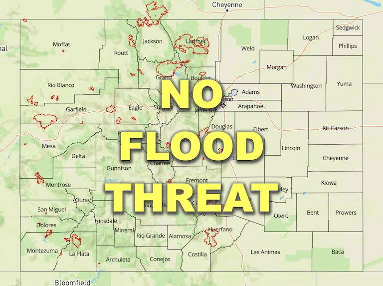
— Flooding is NOT expected today
— Red Flag Warnings in effect for southern Colorado
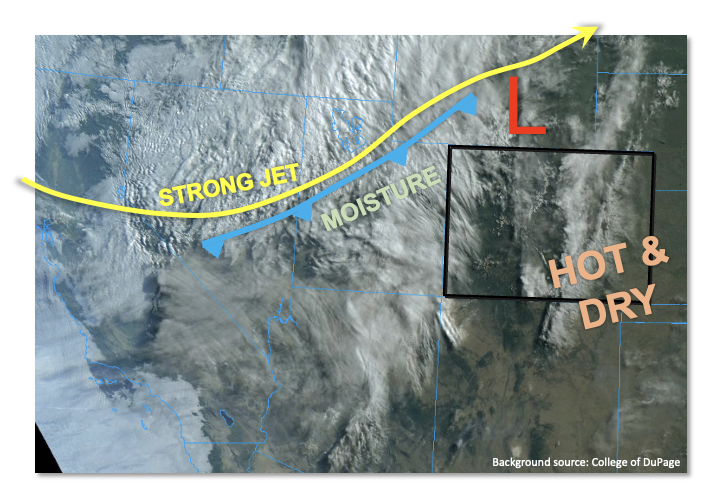
The first day of the Memorial Day weekend will bring about a major change to our weather pattern, swapping out heat for cooler, wetter (and whiter) weather beginning late this afternoon. As shown in the visible satellite image, below, the driver of the pattern change will be a strong Pacific-origin cold front that is currently draped to the north and west of Colorado. Supported by another strong jet streak, the mid and upper-level dynamics will cause lee-side cyclogenesis this afternoon, deepening a low pressure over southeast WY and eastern CO. While morning PW at Grand Junction and Denver was a paltry 0.40 inches, higher PW can be seen on the visible satellite image over the Great Basin. By late afternoon, PW will increase to near 0.7 inches over northwest Colorado causing a notable uptick in rain showers and isolated storms initially, then transitioning to rain and snow showers. Instability of up to 400 J/kg could briefly exist this afternoon over parts of the Northern Mountains, Northwest Slope and Central Mountains. However, with unidirectional steering flow exceeding 25 mph, any storms that do form will be short-lived, quick moving and more of a gusty wind threat, compared to rainfall. Thus, flooding is NOT expected today.
Speaking of wind, has anyone missed the gusty winds? Well, if you have, you are in luck because the strong jet stream and deep boundary layer will cause a 6-8 hour period of very gusty winds across almost the entire state this afternoon. With very dry air still anchored over mainly southern Colorado, the wind + low humidity + heat combination will cause a potent situation for spreading any wildfires. Thus, Red Flag Warnings are in effect across mainly the drier southern half of our state. Please be cautious with outdoor fires.
Today’s Flood Threat Map
For more information on today’s flood threat, see the map below. If there is a threat, hover over the threat areas for more details, and click on burn areas to learn more about them. For Zone-Specific forecasts, scroll below the threat map.
Zone-Specific Forecasts:
Northern Mountains, Central Mountains, Front Range, Northwest Slope & Grand Valley:
Partly cloudy early then mostly cloudy, cooler and very windy with scattered to widespread rain showers along with a few thunderstorms. Max 1-hour rainfall up to 0.4 inches an hour is possible. Flooding is NOT expected today, but up to 0.9 inches of liquid equivalent is expected to accumulate over the higher terrain of the Northern and Central Mountains by tomorrow morning.
Primetime: 2PM through the overnight hours
Northeast Plains, Southeast Plains, Urban Corridor, Palmer Ridge, San Juan Mountains, Southwest Slope, San Luis Valley, Southeast Mountains & Raton Ridge:
Partly cloudy, hot and windy today with high temperatures 5 – 18F above normal (hottest anomalies over the eastern plains). Isolated showers and weak storms are possible over the San Juan Mountains later this afternoon. An isolated weak storm cannot be ruled out over the Northeast Plains right along the NE/KS/CO tri-border area. Max 1-hour rainfall up to 0.3 inches. Thus, flooding is NOT expected today.
Red Flag Warnings are in effect for large parts of the area for this afternoon and evening, and even through Sunday for southeast Colorado.

