Issue Date: Tuesday, May 24th, 2022
Issue Time: 10:30AM MDT
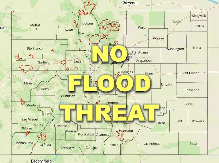
— Flooding is NOT expected today
— Red Flag Warnings in effect for parts of Southwest Slope
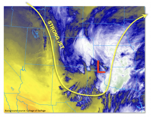
As we approach June, it becomes less and less likely that we get widespread precipitation events without some kind of flood threat. Fortunately, today is one of those days. As seen in the water vapor image, below, a deep trough is currently centered over Colorado, and supported by strong jet streak dynamics. To the east, a surface low pressure currently sits over western Oklahoma and is expected to move slowly east-northeast through the day. Light precipitation is ongoing over the Southeast Plains and will continue throughout the day, as weak warm air advection from the low circulation will force relatively warm moist air to rise and condense as it is pushed into Colorado. PW this morning was 0.47 and 0.35 inches at Denver and Grand Junction, respectively, and will stay steady or drop especially over central and western Colorado. Without any meaningful instability over eastern areas, only light or perhaps briefly moderate rain intensity is expected. Though all of it will of course be mighty welcome.
Further west over the higher terrain, very cold mid and upper-level temperatures are moving into the state. Combined with at least some solar insolation peeking through the clouds this morning and afternoon, this will destabilize the atmosphere to produce CAPE of up to 500 J/kg. However, with such cold temperatures and swift storm motion, the main form of precipitation will be snow, or more appropriately: thundersnow! Very impressive, though brief, snow rates are expected today with up to 1-2 inches of snow possible over 15-30 minutes this afternoon. However, flooding is NOT expected.
Lastly, subsidence behind this disturbance will bring down drier air from the mid-levels of the atmosphere, which along with gusty winds has prompted Red Flag Warnings for lower-elevation parts of southwest Colorado.
Today’s Flood Threat Map
For more information on today’s flood threat, see the map below. If there is a threat, hover over the threat areas for more details, and click on burn areas to learn more about them. For Zone-Specific forecasts, scroll below the threat map.
Zone-Specific Forecasts:
Northeast Plains, Southeast Plains, Urban Corridor, Raton Ridge & Palmer Ridge:
Mostly cloudy with rain showers and weak isolated storms expected to increase in coverage this afternoon. The best coverage will be over the Southeast Plains. Max 1-hour rainfall up to 0.4 inches is possible, but flooding is NOT expected. Up to 1.75 inches of precipitation is expected to fall by late tonight.
Primetime: Ongoing to 11PM
Northern Mountains, Front Range, Central Mountains, San Juan Mountains, San Luis Valley & Southeast Mountains:
Partly cloudy early then mostly cloudy with scattered to numerous snow showers and weak thunderstorms. Max 1-hour liquid equivalent up to 0.4 inches possible, which could lead to a quick 1-2 inches of snow in less than 1 hour. The snow level will vary between 7,000 and 8,500 feet. Flooding is NOT expected today.
Primetime: 12PM through 8PM
Grand Valley, Southwest Slope & Northwest Slope:
Mostly sunny early then partly cloudy, breezy and cool with isolated rain and snow showers possible during the afternoon. An isolated storm cannot be ruled out. Max 1-hour rainfall up to 0.3 inches. Flooding is NOT expected today.
Red Flag Warnings are in effect for parts of the Southwest Slope as gusty winds and lower humidity are expected this afternoon.
Primetime: 12PM through 6PM

