Issue Date: Monday, May 23rd, 2022
Issue Time: 2:05PM MDT
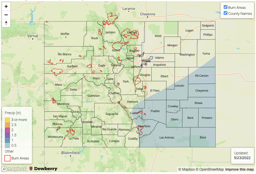
Valid Dates: 5/24 – 6/7
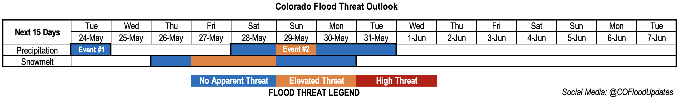
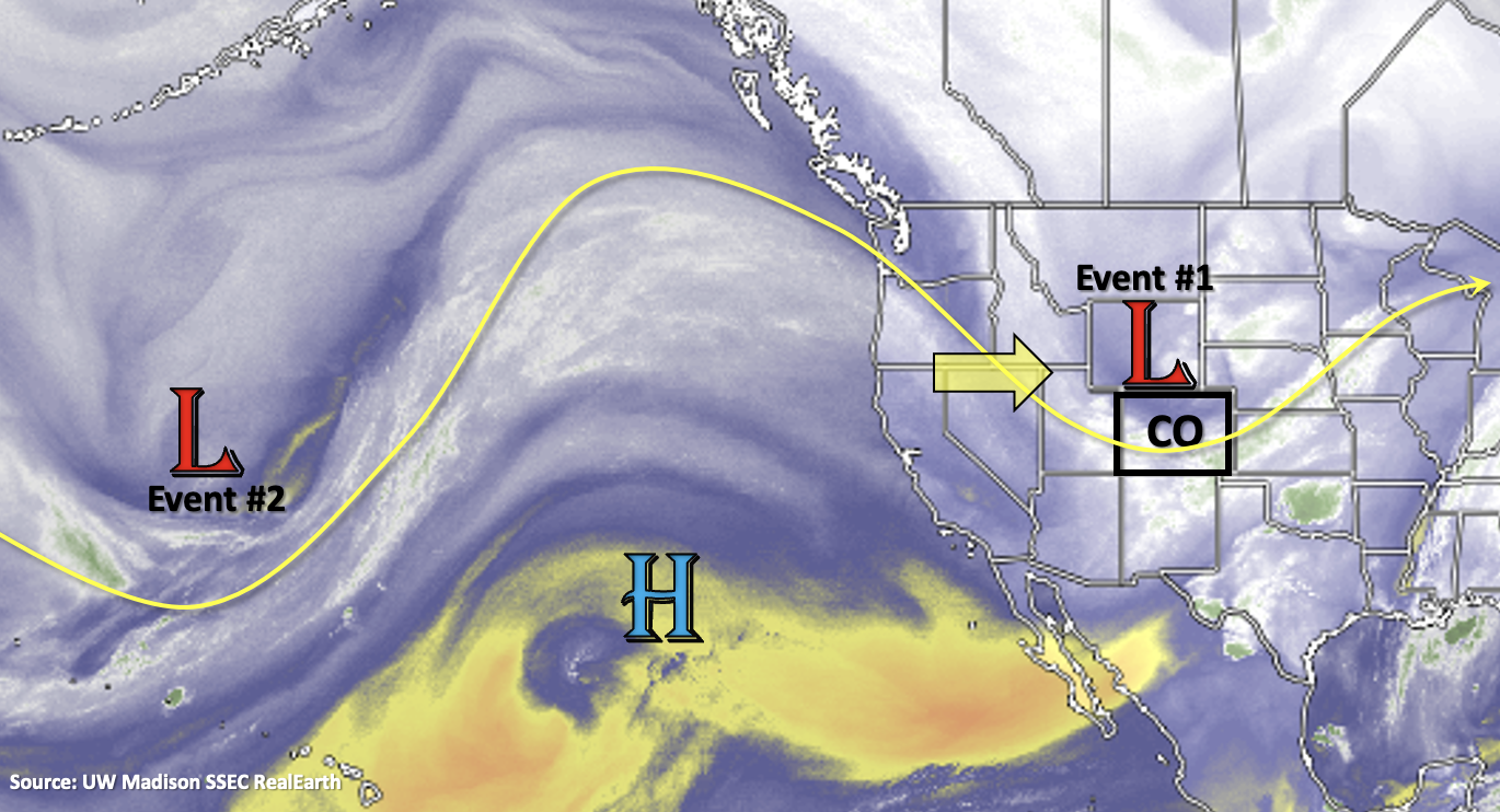
The amplified pattern will stick around for the week and last into Memorial Day weekend, which means relatively active weather continues minus a pause in precipitation that begins mid-week. The slow-moving trough will sit over the state today, and tonight’s precipitation over the eastern plains and Southeast Mountains should continue into tomorrow. The Low eventually moves to the eastern border by early afternoon, and the wrap around precipitation should begin to diminish over the eastern plains by the evening hours. This will end Event #1 with some additional afternoon precipitation forecast tomorrow over the Front Range, Southeast Mountains, and western Palmer/Raton Ridge.
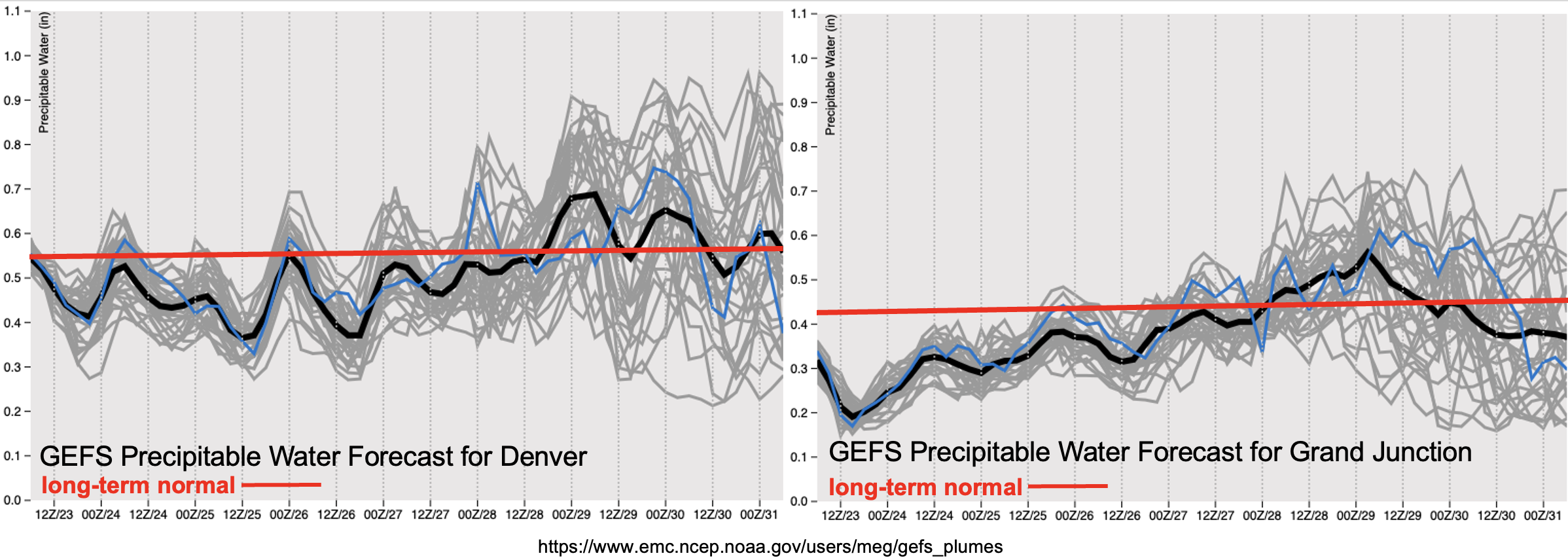
For today and tomorrow, PW remains below normal over western Colorado. A shortwave and a slight uptick in moisture is forecast to move through the area during the afternoon tomorrow, so isolated, light precipitation may be possible over the mountains near the Continental Divide. More widely scattered storms are forecast to develop over the Front Range and Southeast Mountains during the afternoon and evening hours. With steering flow becoming NNW behind the trough, accumulation should mostly stick to the mountains, but widely scattered storms may spill into the adjacent eastern plains.
Subsidence and drying moves in on Wednesday as the ridge axis shown above pushes eastward. Expect near normal temperatures to return for the majority of the state as the warmer air fills in from west to east. By Thursday, looking at above average temperatures for the forecast and much above average high temperatures for Friday as well. This is anticipated to begin the next round of widespread melting. More on that below.
There will likely be an uptick in moisture again for the holiday weekend, which is associated with the next incoming trough (Event #2). Low confident on the details, but it looks like the trough should drop another cold front through the state late Saturday or Sunday. Whether or not this trough lingers near the state or there’s a second shortwave that moves through the flow, there may need to be an extension to the Elevated threat on Thursday (next FTO).
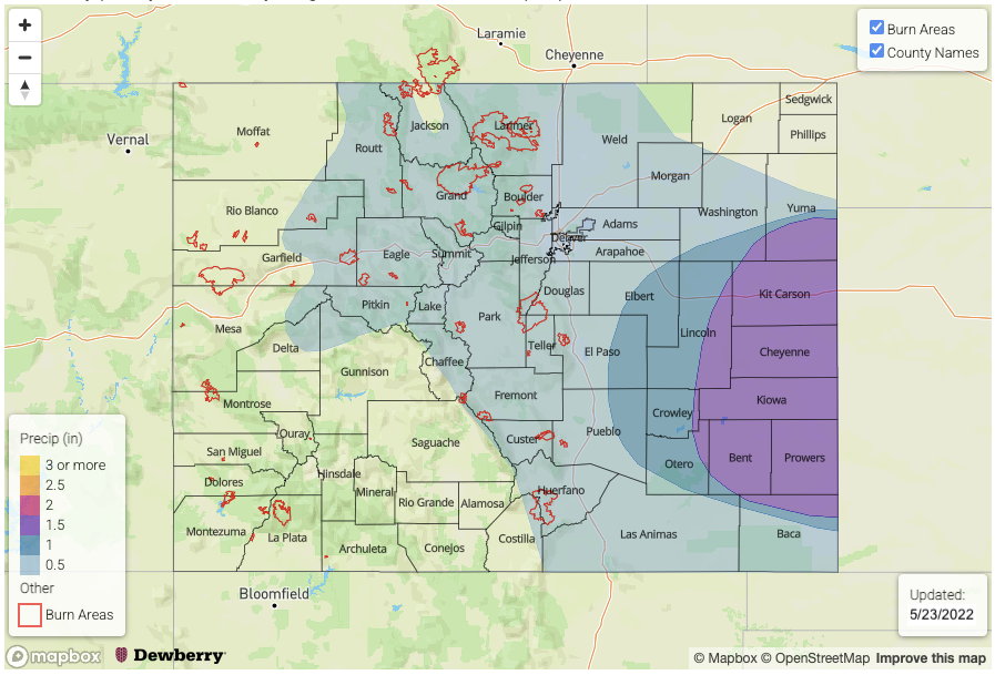
High temperatures rebound into the 90Fs (lower elevations) and 70Fs (mountain valleys) by Thursday and Friday, which means the next round of snow melt will begin. There’s still quite a bit of snow over the northern mountains at the higher elevation sites. Paired with the widespread snow over over the lower elevation mountains from this last event, significant melting could cause local streams and creeks to run high. Less worried about the larger rivers at the moment, especially as they have receded quickly from the melting over the weekend, but we will be watching the gages along the South Platte, Arkansas and Cache La Poudre rivers. Over western Colorado, there is still some decent snowpack over the Grand Mesa and Elk Mountains, so local streams and creeks may be running high by this weekend over these regions. While large riverine flooding is not anticipated at this time, an Elevated threat has been issued for smaller streams and creeks across the higher elevations on Friday and Saturday.
Event #1: Tuesday (5/24)
No Apparent flood threat for stratiform rainfall (east) and rain/snow mix (west).
This is a quick 1-day event to round out Event #1 from last week’s FTO. Expect stratiform, wrap around precipitation to continue near the Low over the Southeast Plains, Southeast Mountains and Raton Ridge as it tracks east. This will fall as snow down to about ~9.5K feet, and the rainfall (east) is forecast to end by the evening hours. There should be some decent, localized accumulation throughout the day (up to 0.75 inches), but there is NO Apparent flood threat at this time. Additional scattered mountain rain/snow mix will be possible during the afternoon favoring areas near the Continental Divide for accumulation. The Front Range could receive isolated totals just under 1 inch. Rainfall may spill into the immediate adjacent plains with the best chance for this occurring over the Palmer Ridge and Southeast Plains. There is No Apparent threat issued with rainfall winding down statewide by late evening.
Event #2: Saturday – Tuesday (5/28 – 5/31)
Elevated/No Apparent flood threat for Memorial Day weekend when rainfall returns to the forecast.
Still a lot of uncertainty with this forecast, but it’s looking more likely that rainfall will return to the state over Memorial Day weekend. There’s enough moisture return both east and west with the next system, that scattered to numerous storms may be possible. It looks like a cold front will drop through the state sometime late on Saturday or Sunday. Could see some longer duration rainfall and heavier rainfall near the eastern border during this time, so there has been an Elevated threat issued for this reason. Cooler temperatures should stick around through Monday and Tuesday, possibly into Wednesday, along with the chance for scattered precipitation.