Issue Date: Monday, May 23rd, 2022
Issue Time: 10:25AM MDT
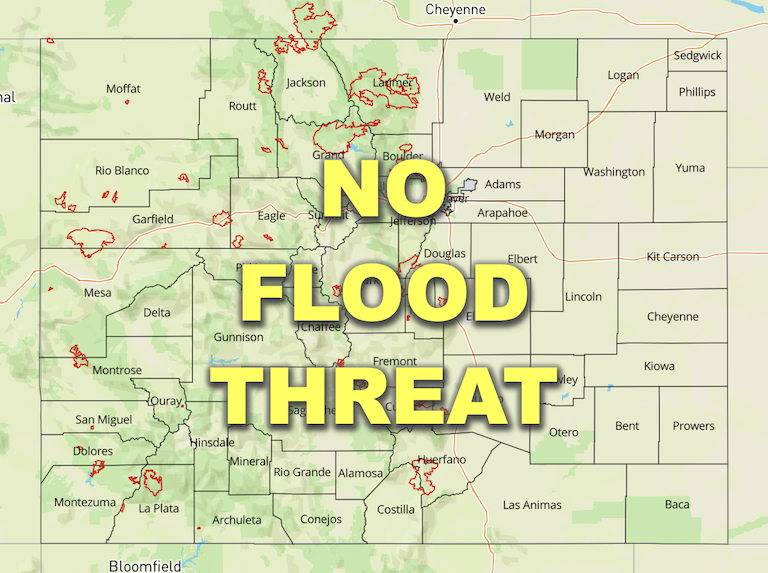
— Flooding is NOT expected today
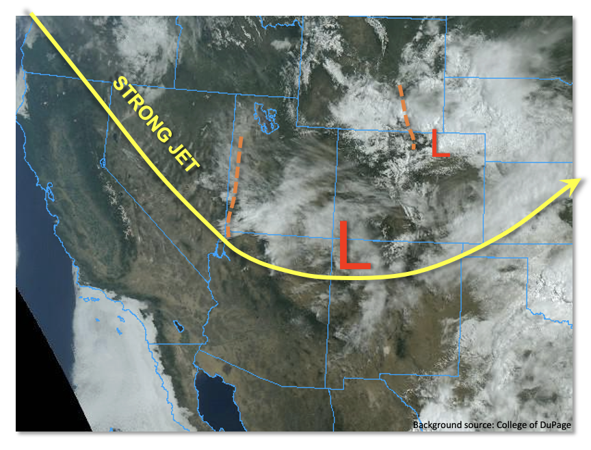
From the perspective of atmospheric dynamics, the next 36-48 hours will excite many meteorologists across Colorado. As shown in the visible satellite image below, a large trough remains in place over the western United States. A new strong jet streak was noted this morning, entering the Great Basin from the northwest. Despite the fact that the jet streak itself has winds exceeding an impressive 180 mph, the trough is actually nearly stationary. Instead, the incoming jet streak will “dive” over the Four Corners and provide synoptic-scale upward motion over the next 48 hours for Colorado. This will favor cool temperatures and relatively widespread precipitation, especially east of the Continental Divide.
PW at Denver and Grand Junction this morning was 0.51 and 0.26 inches, respectively. However, with low-level flow turning more southerly over time, moisture advection will become a factor, and help raise PW to nearly 1 inch over far southeast Colorado. Precipitation coverage will be most widespread over eastern Colorado today. However, the vast majority of the rain (and higher elevation snow) will be non-convective. The highest rain intensity from convective storms will be found along the NM and OK borders where broken clouds will still allow for solar heating to support instability of perhaps 700 J/kg. Yet, due to the expect widespread coverage of showers and storms, this instability will be quite localized and fleeting, only lasting for 1 to, at most, 3 hours. Thus, overall, while we expect some brief moderate to heavy rainfall this afternoon and early evening, flooding is NOT expected. Isolated severe weather will be possible for the far southeast portions of the Southeast Plains.
Today’s Flood Threat Map
For more information on today’s flood threat, see the map below. If there is a threat, hover over the threat areas for more details, and click on burn areas to learn more about them. For Zone-Specific forecasts, scroll below the threat map.
Zone-Specific Forecasts:
Southeast Plains & Raton Ridge:
Becoming overcast with numerous showers and storms developing by mid-afternoon. Max 1-hour rainfall up to 1.1 inches right along OK/NM border (especially Baca County) with max 3-hour rainfall up to 2.0 inches possible. Some ponding of water is possible for low lying areas, but flooding is NOT expected today. An isolated severe storm cannot be ruled out, especially with the early round of storms. Light/moderate rain and snow will continue into the overnight hours.
Primetime:
3PM to 8PM, with lighter rain/snow continuing into overnight hours
Northeast Plains, Northern Mountains, Front Range, Urban Corridor, Central Mountains, Palmer Ridge & Southeast Mountains:
Mostly cloudy and cool today with scattered showers and embedded, isolated storms possible this afternoon. Max 1-hour rainfall 0.7 inches (east) and 0.5 inches (west). The snow level will range from 7,500 – 9,000 feet today. Flooding is NOT expected today.
Primetime: 11AM to 7PM
Grand Valley, San Juan Mountains, Southwest Slope, San Luis Valley & Northwest Slope:
Partly cloudy and cool today with high temperatures of 5-10F below normal. Isolated rain and higher elevation snow showers will be possible, mainly for the higher elevations of the San Juan Mountains and adjacent valley. Max 1-hour rainfall up to 0.2 inches. Flooding is NOT expected today.

