Issue Date: Monday, May 23rd, 2022
Issue Time: 11:15 AM MDT
Summary:
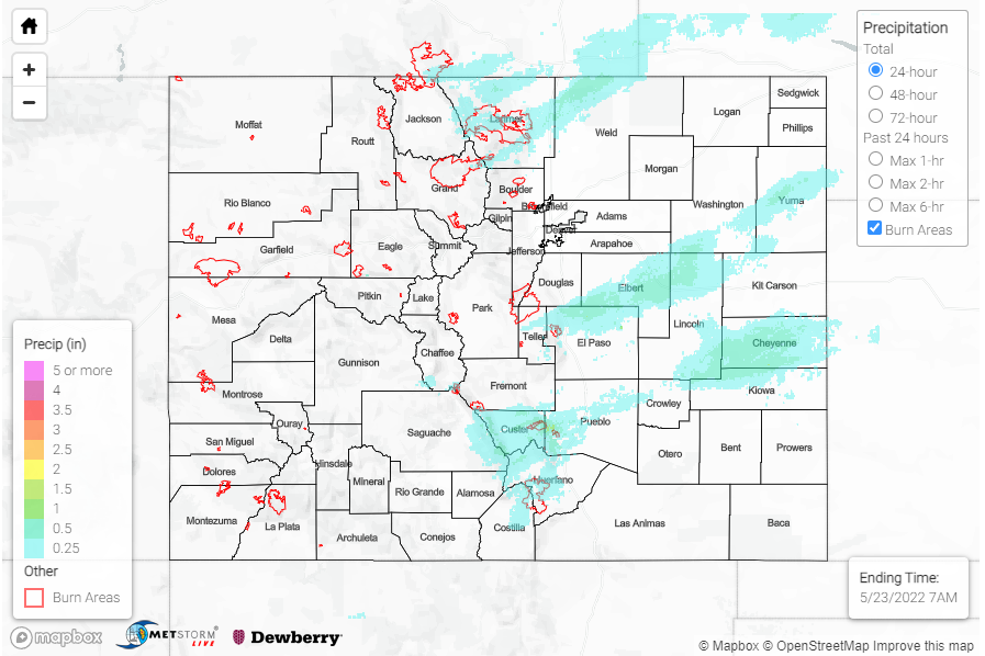
Sunday saw a continued wintry mix of snow and rain for the southern portion of the Urban Corridor and Palmer Ridge. Though it was raining or snowing off and on for much of the day, precipitation totals are modest in this region, hovering from 0.25-0.30 inches for the Monument Area and 0.16-0.29 inches in Limon – all from CoCoRaHS observers. However after a completely snowless April, Colorado Springs is now on track for the 5th snowiest May on record.
This has been such an odd year for snow in southern Colorado. We saw no snow in April, typically our second snowiest month of the year in Colo. Springs, & 10 inches in May! This year now holds the 5th snowiest May of all time in COS. Seasonally we’re still way behind 2021 #cowx pic.twitter.com/hG0pZKLXqT
— Sam Schreier (@SamASchreier) May 23, 2022
By late evening and overnight, precipitation expanded to the Southeast Mountains and Southeast Plains, with snow continuing to fall at higher elevations. A few notable totals from observers include 0.95 inches in Buelah (Pueblo County) and 0.80 inches in La Veta (Huerfano County), from 12 inches of snow depth. There was also overnight rain for Northern Front Range, Urban Corridor, and Northeast Plains last night, both the CoCoRaHS and Fort Collins gauge network have observations between 0.15-0.35 across town and the adjacent foothills.
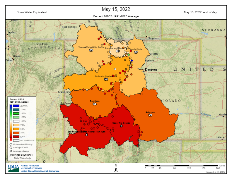
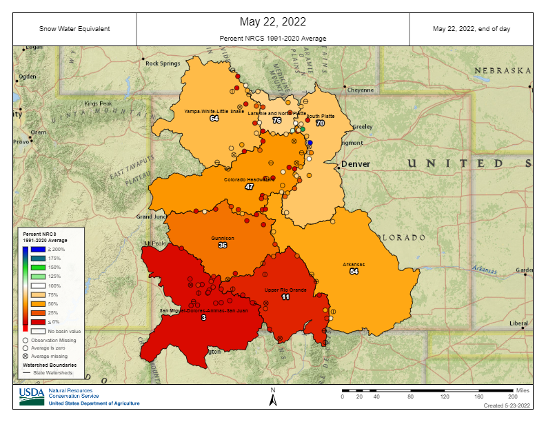
The system that impacted Central-Southern Colorado over the weekend was beneficial in rebounding some mountain snowpack after what was initially going to be a very early melt out, especially for the Arkansas basin. The top and bottom maps show basin-wide snow water equivalent (SWE) % of normal on May 15 and May 22, 2022. So even though May 22 is one week later, there was an increase in the % of normal SWE in the Arkansas basin from 29% on May 15 to 54% on May 22. Obviously 54% of normal is still not ideal, especially with the ongoing drought conditions, but it’s better than nothing. The Upper Rio Grande, South Platte, and Gunnison basins also saw a bit of a boost from this snowstorm as well. Basins in Northern and Western Colorado saw a typical decrease in SWE over the course of a week.
There was no flooding reported yesterday. For precipitation estimates in your area over the last few days, check out the State Precipitation Map below.


