Issue Date: Sunday, May 22nd, 2022
Issue Time: 9:55AM MDT
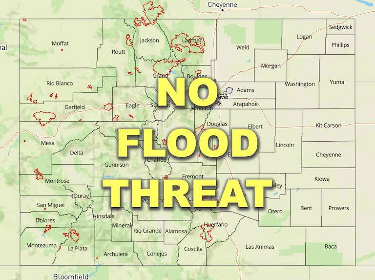
— Flooding is NOT expected today
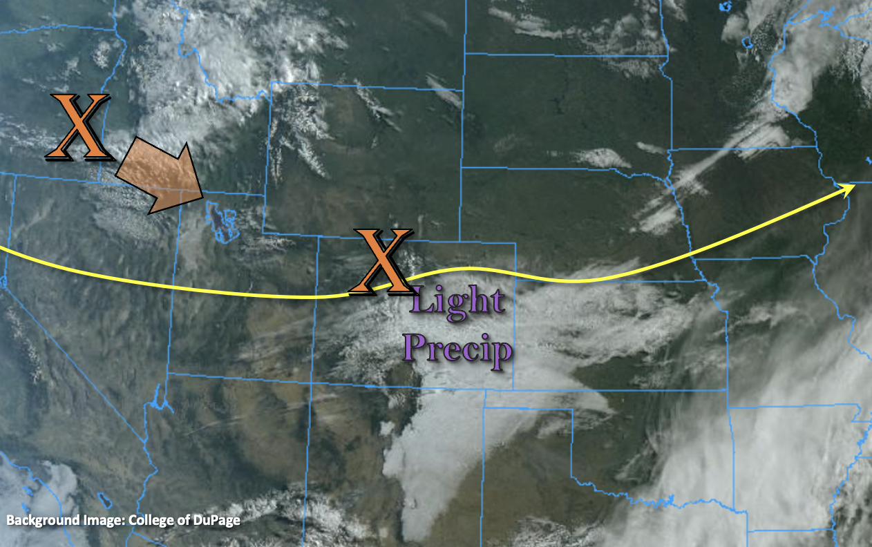
It will finally start to get warmer today with the ongoing snow and rain across the Palmer Range/southern Front Range beginning to diminish as the jet and mid-level energy move out of the area. Zonal flow from the jet stream, that is currently located over eastern Colorado, is forecast to begin to weaken through the morning, although there will still be a good speed max that remains over the Palmer Ridge and Southeast Plains late this afternoon into the overnight hours. This should provide some extra lift for storms that develop over the area this afternoon and help keep some light precipitation going over the Southeast Plains tonight. Westerly winds aloft are expected to shift to more WSW as the next shortwave digs south into Utah (orange “X” below). This shortwave is expected to produce some mid-level lift across the state, and paired with the diurnal flow, should help develop isolated precipitation over the mountains this afternoon. PW has dropped to 0.26 inches at Grand Junction, so west, expect the precipitation to be confined to the higher elevations. Storms that attempt to develop across the lower elevations are forecast to produce more wind than measurable rainfall.

Over eastern Colorado, PW was measured at 0.36 inches in Denver and is likely close to 0.50 inches over the Southeast Plains, so it has dried out a little bit when compared to the last couple of days. Southerly surface winds will gain an easterly component with the diurnal flow late this afternoon, which typically favors precipitation development over the Palmer Ridge and northern Front Range/Urban Corridor. With only light to moderate rainfall forecast for the afternoon and evening hours, flooding is NOT anticipated. Precipitation is forecast to continue over the Southeast Plains/Palmer Ridge/Southeast Mountains and northern Front Range tonight. With a cold front pushing in from the northwest, it should help to lower the freezing line over Front Range fairly quickly. So, anticipate some more snowfall by morning for the mountain zones east.
One last note, with the warmer temperatures and snow line dropping today, rain on snow may be possible over isolated areas. This could help increase local runoff and cause a spike in streamflow. The only AHPS station currently approaching “Action” stage is the Arkansas River near Avondale. While there have been steady increases to the streamflow up north as well, base flows were fairly low to start, so not anticipating any flood risk today.
Today’s Flood Threat Map
For more information on today’s flood threat, see the map below. If there is a threat, hover over the threat areas for more details, and click on burn areas to learn more about them. For Zone-Specific forecasts, scroll below the threat map.

Zone-Specific Forecasts:
Front Range, Southeast Mountains, Palmer Ridge, Urban Corridor, Northeast Plains, Raton Ridge & Southeast Plains:
High temperatures over the lower elevations should reach into the upper 50Fs (north) and 60Fs (south). Over the mountains, it will still be quite cool with highs reaching into the 40Fs for the foothills and remaining in the 30Fs for the higher elevation valleys.
Isolated precipitation is forecast for the mountains today with precipitation forecast to continue over the northern Front Range and Southeast Mountains tonight. Max liquid equivalent up to 0.85 inches will be possible through tomorrow morning. Over the plains, isolated totals up to 0.60 inches will be possible. Due to the gradual nature of the rainfall and snow at the higher elevations, there is NO flood threat issued.
Primetime: Ongoing
Central Mountains, Northern Mountains, San Juan Mountains, Northwest Slope, San Luis Valley, Grand Valley & Southwest Slope:
It’s going to start heating back up with highs across the lower elevations reaching into the upper 60Fs and 70Fs. Afternoon high temperatures across the mountain valleys should reach into the 40Fs and low 50Fs. Isolated precipitation is forecast for the mountains near the Continental Divide this afternoon/evening with overnight snow forecast for the eastern San Juan Mountains. Isolated liquid totals up to 0.30 inches will be possible by morning. It could get breezy this afternoon with winds from the west forecast to be in the 15 to 20 mph range as the trough apprroaches. A cold front looks to slide in from the northwest this evening, keeping overnight lows chilly for the northwest corner.
Primetime: 11AM to 6AM