Issue Date: Sunday, May 22nd, 2022
Issue Time: 10:45 AM MDT
Summary:
By morning yesterday, the cold front and associated widespread precipitation was draped across the Southeast Plains back west to the Southeast Mountains, with coverage over the Palmer Ridge and southern portions of the Front Range and Urban Corridor. For high elevations, precipitation consisted of very wet, slushy snow, while the Eastern Plains had a wintry mix of sleet and rain. With the continued south-southwest progression of the system, precipitation tapered off from north to south, stopping briefly in the evening for the Southeast Plains and Raton Ridge; while snow and showers continued overnight, lingering into this morning, for the Urban Corridor and Palmer Ridge.
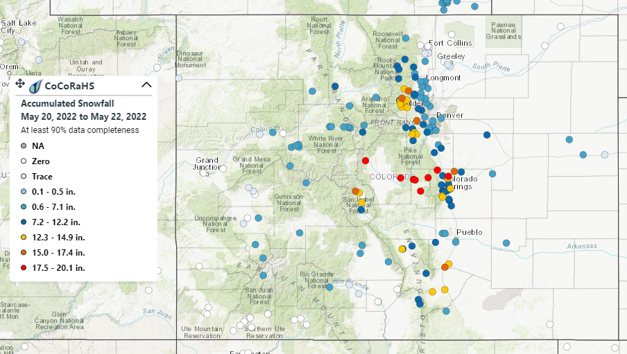
It will likely take a day or two for final snowfall totals to come in, but observations from CoCoRaHS observers from May 20-22 can be seen in the map below.

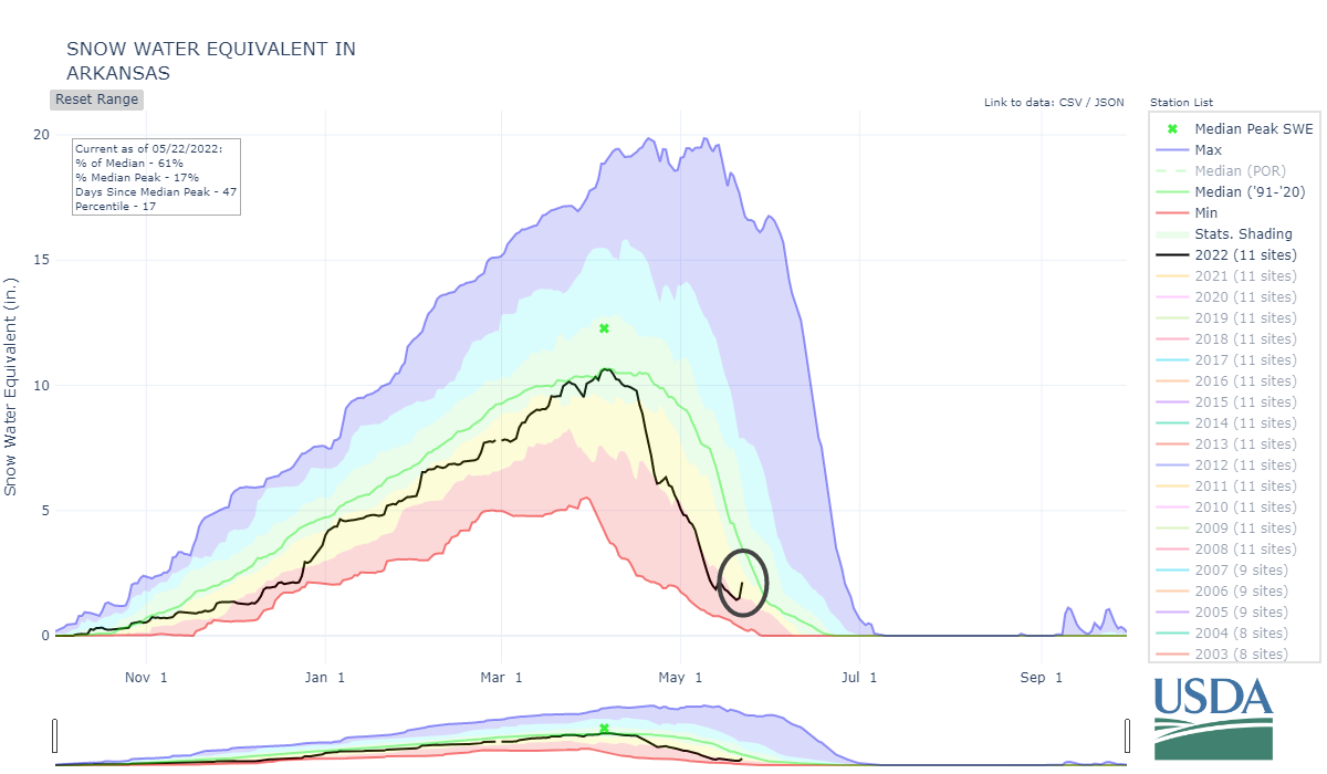
This was a huge event for Central and Southern Colorado. A west-east transect can be seen across Park-Teller-El Paso Counties with several snow total observations over 17.5 inches the 3-day period. Colorado Springs and Pueblo both set record snowfall totals for the past few days. Mountain snow helped to give a late season boost to the dwindling snowpack across the state, particularly in the Arkansas basin in Southeast Colorado, as seen in the plot of Snow Water Equivalent below.
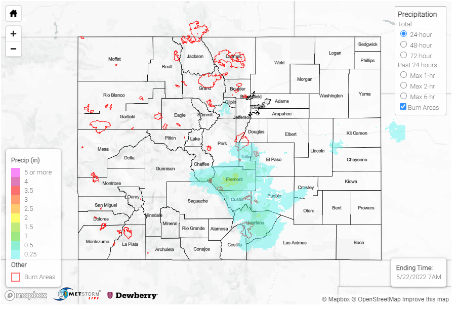
No flooding was reported yesterday. If you look at the 72-hour MetStorm Live QPE in the bottom map, you can see the past few days have been a great precipitation event for most of Colorado. This can also be used to understand how snowfall totals translate into liquid equivalent precipitation. While the Western Slopes and Grand Valley remained dry from this event, temperatures were still cold. Grand Junction set their record low temperature yesterday, reaching down to 29 degrees overnight.

