Issue Date: 8/19/2015
Issue Time: 7:52 AM
NO FLOOD THREAT IS FORECAST.
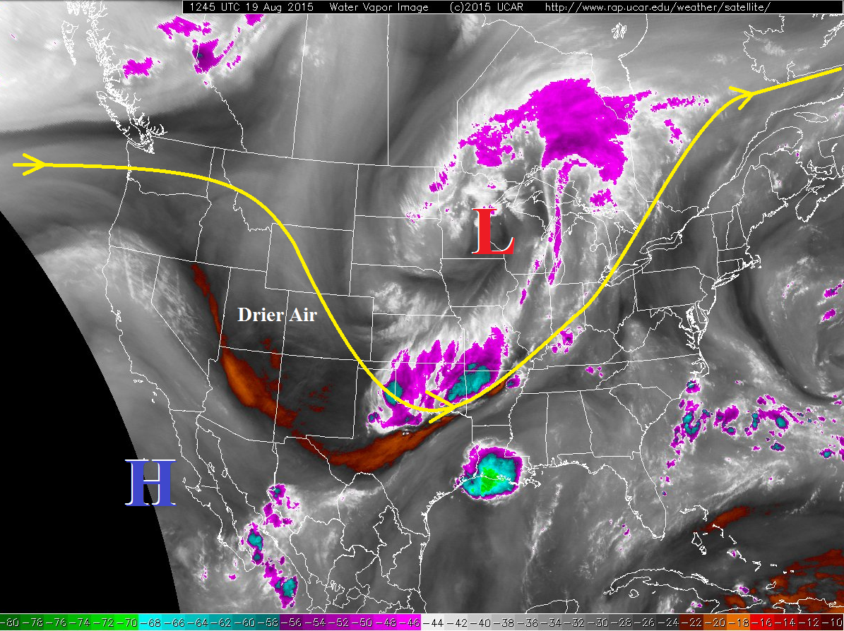
Today’s forecast discussion will be short and sweet. After the passage of the cool front yesterday, and the upper-level disturbance overnight/this morning, dry and stable air will take up residence across Colorado today. After the line of weak showers over the Southeast Plains dissipates/exits the state, there will not be any more precipitation today. High temperatures will be cooler than average. Tomorrow morning’s low temperatures will be cool, once again, with clear skies and light winds expected overnight.
Today’s Flood Threat Map
For more information on today’s flood threat, see the map below (hover over threat areas for more details). For Zone-Specific forecasts, jump below the map.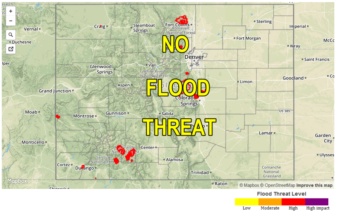
Zone-Specific Forecasts
Front Range , Urban Corridor, Northeast Plains, Raton Ridge, Palmer Ridge, and Southeast Plains, and Southeast Mountains:
Mostly sunny skies and dry, with highs in the 60s and 70s for lower elevations, 40s and 50s in the mountains. Clear skies and light winds overnight will bring temperatures to a chilly feeling tomorrow morning; a few record lows will be threatened.
Northern Mountains, Central Mountains, San Luis Valley, Northwest Slope, San Juan Mountains, Southwest Slope, and Grand Valley:
Mostly sunny and dry, with temperatures similar to yesterday’s highs. Winds will be breezy during the afternoon, calming overnight.