Issue Date: Thursday, May 19th, 2022
Issue Time: 11:35 AM MDT
Summary:
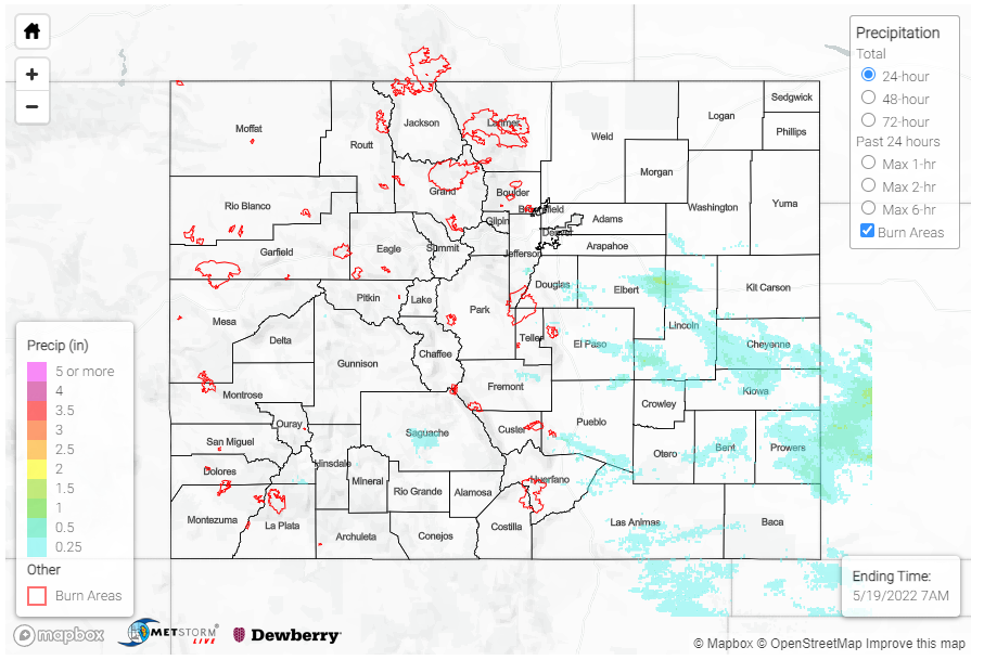
Early afternoon yesterday saw isolated storm development along the Southern Front Range Mountains, Urban Corridor, and Palmer Ridge, which quickly developed into a line of thunderstorms, some severe, extending from Castle Rock to Limon. As the afternoon progressed, widespread scattered storms also developed in portions of the Central, San Juan, and Southeast Mountains, along with the Raton Ridge. As storms moved eastward off the mountains and onto the plains, they were able to tap into rebounding atmospheric moisture and continue to grow in areal extent.
A total of 8 severe thunderstorm warnings were issued yesterday for cells across the Palmer Ridge and Southeast Plains. The biggest threat from these storms was high winds and damaging hail, though there were still some impressive precipitation totals. One CoCoRaHs observer near Limon reported 0.93 inches of precipitation yesterday, and there were several 0.50+ inch observations in the surrounding area. In Holly, which was included in the region of “Low” flood threat yesterday, an observer reported 0.75 inches of rain. Overall precipitation totals range between Trace-0.60 inches across the southeast quadrant of the state.
Thankfully there were no flood reports yesterday associated with these storms, but there were reports of large hail and damaging winds. A storm chaser east of Two Buttes in Prowers Country reported up to 1.25 inch hail. A bit further north in Hartman, a trained spotter reported downed power lines and utility poles on County Road 28. A 61 mph gust was also recorded in Springfield, near the OK-KS borders.
For rainfall estimates in your area, check out the MetStorm Live QPE below.
