Issue Date: Monday, May 9th, 2022
Issue Time: 11:30 AM MDT
Summary:
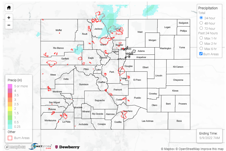
Yesterday saw some modest precipitation associated with a shortwave’s passage through the Northwest Slope and Northern Mountains during the late evening and overnight hours, with snow falling at higher elevations. A CoCoRaHS observer in Oak Creek, in Routt County, received 1.5 of snow yesterday (though only 0.10 inches of liquid equivalent), and left the following remark on their daily report:
“Well, woke up to a snowy surprise. Also, noting that there is a pink tinge to the snow. Desert dust? It was very windy the last 24 hours.”
Based on their note, a bit of tint to the snow along with the noted high winds makes their guess of desert dust the likely culprit. Generally, precipitation totals were between Trace-0.15 inches for the Northwest Slope, Northern Mountains, and a bit of spillover to the Front Range and Urban Corridor. The rest of the state remained dry.
The main weather story for yesterday though was the continued wind. High wind reports were recorded all over Western and Southern Colorado, though conditions were blustery really everywhere. Gusts over 80 mph were recorded in Huerfano, San Miguel, Garfield, and Pueblo counties – including an 86-mph guest in Walsenburg yesterday afternoon!
There were no flood reports yesterday. For rainfall estimates in your area, check out the MetStorm Live QPE below.
