Issue Date: Sunday, May 8th, 2022
Issue Time: 10:30 AM MDT
Summary:
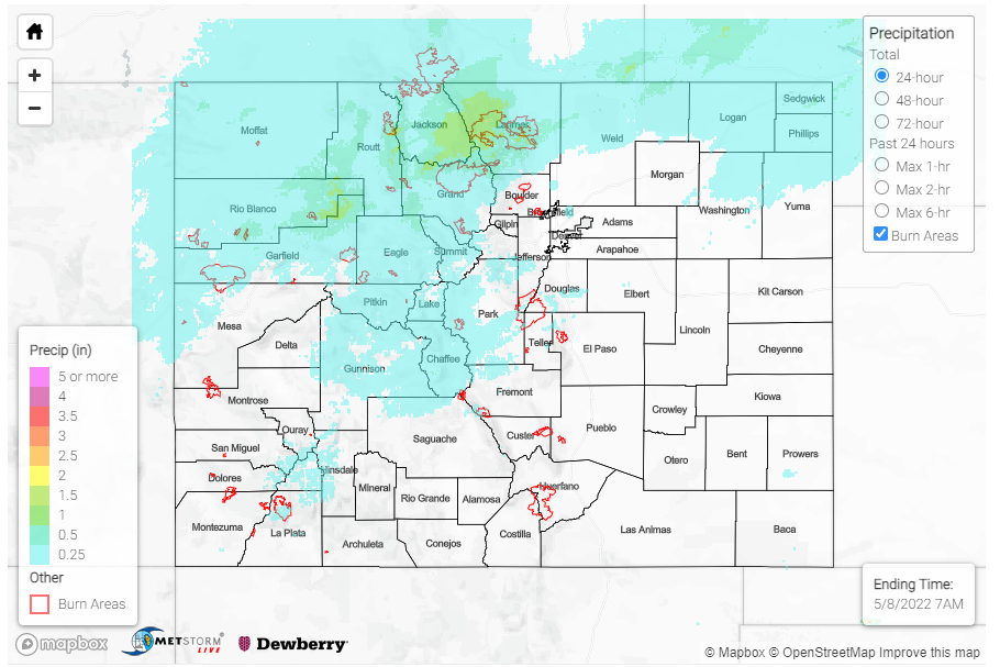
A frontal passage traversed the state yesterday, bringing additional moisture in the late afternoon to overnight hours for Northern Colorado. Rain, heavy at times, was reported for much of the Northwest Slope and Northern Mountains, as well as northern portions of Front Range Mountains and Urban Corridor. Snow was also reported at some of the higher elevations, including Cameron Pass. Notable precipitation totals from CoCoRaHS observers across the state include:
- 0.50 in Grand Lake– where observers noted this was the first rain report for their gauge of the season
- 0.48 in Kremmling
- 0.44 in Steamboat Springs
- 0.34 in Estes Park and
- 0.05-0.25 across Fort Collins
Non-thunderstorm wind gusts were also reported all across the Western Slopes and Grand Valley. The Grand Junction NWS Office shared the following tweet with peak wind gusts from yesterday.
Here’s a list of some of the highest gusts that were recorded today. Unfortunately many of these could be exceeded again tomorrow afternoon. #utwx #cowx pic.twitter.com/MpPYFNHtPY
— NWS Grand Junction (@NWSGJT) May 8, 2022
While wind speeds were not nearly as high as out west, windy conditions kicked up a dust storm along in the Urban Corridor/Palmer Ridge yesterday as well. Southern Colorado remained largely dry, with those high winds providing all the ingredients for critical fire weather.
There were no flood reports yesterday. For rainfall estimates in your area, check out the MetStorm Live QPE below.
