Issue Date: Sunday, May 8th, 2022
Issue Time: 8:55AM MDT
— Flooding is NOT expected today
— Widespread Red Flag Warnings in effect
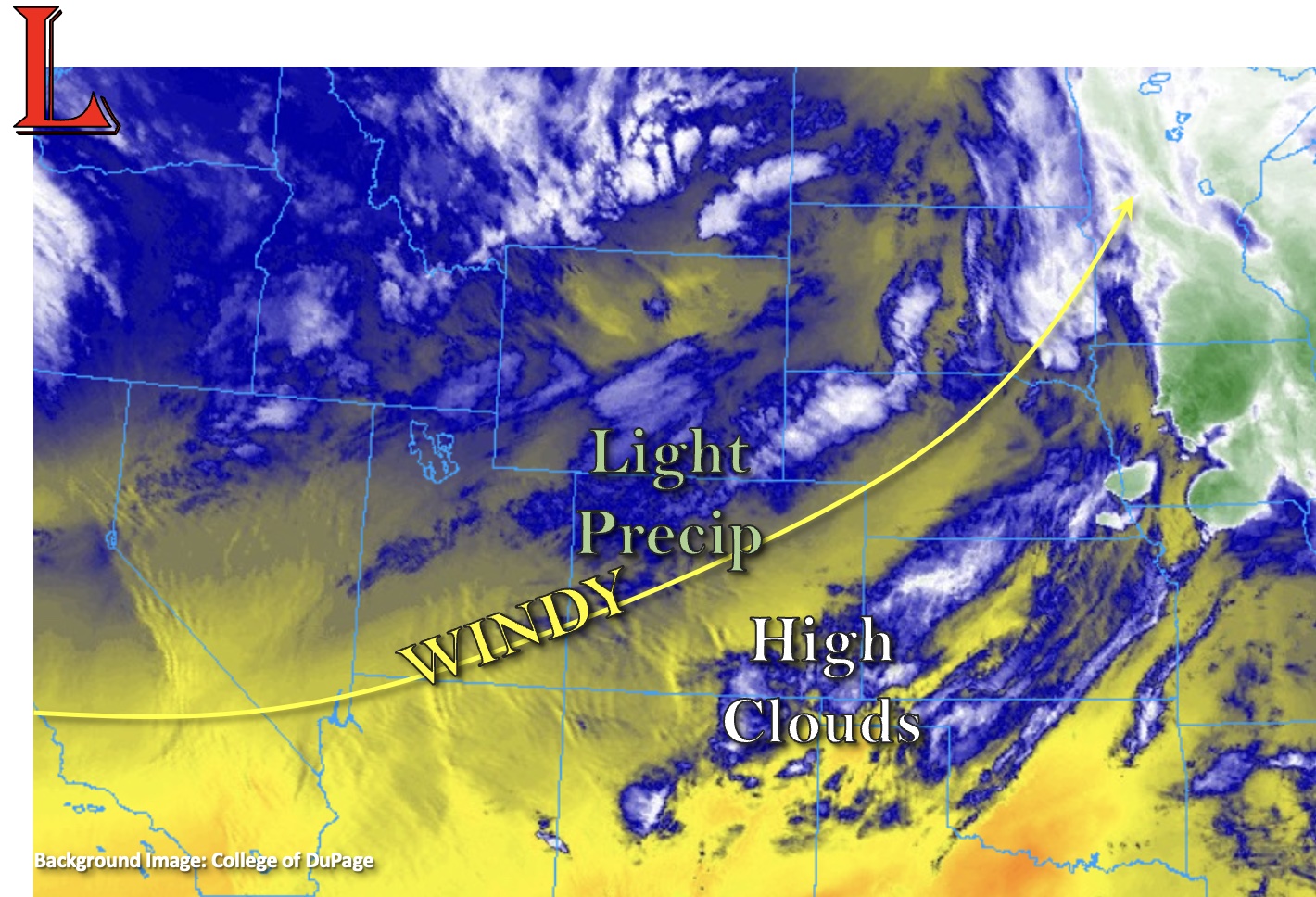
The unseasonably warm early May temperatures will continue for another day, and highs are expected to reach into the 70Fs and low 80Fs across the lower elevations with upper 80Fs forecast over southeast Colorado. This morning, there are some light showers occurring over the northern mountains and high clouds over the southwest corner of the state as shown in the water vapor imagery below. As the Low over the Pacific Northwest slowly begins to move inward today, southwest flow is forecast to increase across the state. This will usher in a very dry air mass and mix out any residual moisture from yesterday over the mountains. Just how dry is it? PW to our south of our border was measuring just under a quarter of an inch this morning.
This very dry air mass will help to drop dew points into the teens, which will limit rainfall chances to nearly zero across the state this afternoon and evening. There is a slight chance for some light precipitation over the elevated regions of the Northwest Slope and Northern Mountains overnight as a weak shortwave moves through the flow, but accumulation should remain minimal with plenty of virga. As anticipated, there is NO flood threat issued today.
Additionally, the mixing down of strong upper-level winds and development of a surface Low over the Palmer Ridge will cause very windy conditions for most of the state. Expect strong southwest winds to develop over western Colorado and the mountains by midday, and (lighter) SSE winds to develop over the eastern plains. As one can imagine, the very dry air mass paired with strong surface winds means that high fire danger will continue, and a large portion of the state is under a Red Flag Warning. Moreover, a High Wind Warning has been issued for the south-central portion of the state. More details can be found in the zone-specific forecasts below and from your local NWS office.
Today’s Flood Threat Map
For more information on today’s flood threat, see the map below. If there is a threat, hover over the threat areas for more details, and click on burn areas to learn more about them. For Zone-Specific forecasts, scroll below the threat map.

Zone-Specific Forecasts:
Northern Mountains, Front Range, Northwest Slope, Urban Corridor & Northeast Plains:
As the day continues, it’s likely that the dry air mass moving over the state will cut down on the chances for much, if any, afternoon and evening precipitation accumulation over the Northern and northern Front Range Mountains. A shortwave moves through the same area overnight, which may cause some light precipitation and snow to fall for the highest elevations for this region (northern border). Localized totals could reach up to 0.50 inches. Slightly cooler temperatures are forecast today, although highs will still reach into the mid-70Fs. Wind chances and fire danger are also less compared to south of I-70, although spotty windy conditions are possible over the northern and western high terrains (20-25 mph).
Primetime: 10PM to 6AM
Palmer Ridge, Southeast Plains, Southeast Mountains, Raton Ridge, Central Mountains, San Luis Valley, San Juan Mountains, Grand Valley, & Southwest Slope:
Very high fire danger today, so avoid activities that could create a spark. At least a portion of each of these forecast regions is under a Red Flag Warning. In addition to the large Red Flag Warning, a High Wind Warning has been issued for the south-central portion of the state. Over the San Luis Valley, sustained winds in the 30-40 mph range are forecast with gusts up to 65 mph possible. Over the southern Central/Southeast Mountains and Raton Ridge southwest winds in the 40-50 mph are forecast with gusts up to 85 mph possible over the mountain regions. High temperatures will reach into the upper 80Fs over the eastern plains, 60Fs for the mountain valleys and 70Fs for the lower elevations west and central. Rainfall is NOT forecast today.