Issue Date: Saturday, May 7th, 2022
Issue Time: 8:48AM MDT
— Flooding is NOT expected today
— Widespread Red Flag Warnings in effect
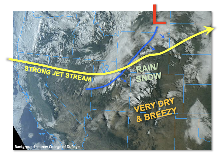
A very strong jet stream is positioned mainly zonally (i.e. east/west) across the western United States. To its north, a large-scale trough will begin its grip on the west coast for the foreseeable future, sending an array of disturbances that will graze Colorado over the next 7 days. One such disturbance will be passing through today, led by a cool front currently draped across WY and UT. With limited instability, extremely fast steering wind and only modest moisture, precipitation amounts are expected to stay on the lighter side, with two parts of the state being favored. First, over the Northern Mountains, a couple of rounds of precipitation are expected this afternoon and into the evening/overnight hours delivering perhaps up to 0.5 inches of liquid equivalent by tomorrow morning. Second, along the NE/KS border of the Northeast Plains, an isolated storm cannot be ruled out this afternoon, then followed by scattered showers accompanying the frontal passage overnight. Overall, flooding is NOT expected today.
The big story, of course, will be the very windy conditions almost statewide, which has prompted widespread Red Flag Warnings covering three quarters of our state. Please be careful today and do your part to limit wildfire potential.
Today’s Flood Threat Map
For more information on today’s flood threat, see the map below. If there is a threat, hover over the threat areas for more details, and click on burn areas to learn more about them. For Zone-Specific forecasts, scroll below the threat map.

Zone-Specific Forecasts:
Northwest Slope, Central Mountains, Northern Mountains:
Increasing clouds and cooler with scattered to numerous rain showers, mixing with snow by later in the afternoon especially over the higher elevations. Thunder is also possible. Max 1-hour rainfall up to 0.3 inches. Flooding is NOT expected today.
Another round of precipitation in the form of rain and snow is expected overnight, with up to 0.5 inches of liquid equivalent possible over the favored higher west-facing peaks by tomorrow morning.
Primetime: Noon through the overnight hours
Northeast Plains:
Mostly sunny and hot today with breezy conditions developing by afternoon. An isolated thunderstorm cannot be ruled out right along the KS border. Max 1-hour rainfall limited to 0.5 inches as storms will quickly leave into KS/NE. Later in the evening, a cool front passage will lead to scattered showers over northeastern areas close to the NE/KS border. Up to 0.5 inches of welcome rainfall could occur over a few hours. Flooding is NOT expected today.
Primetime: 3PM to 6PM, then again late evening and into overnight hours
Front Range, Urban Corridor, Southeast Plains, Grand Valley, San Juan Mountains, Southwest Slope, San Luis Valley, Northwest Slope, Southeast Mountains & Raton Ridge:
Partly cloudy and very warm this afternoon with very windy conditions developing by afternoon. Gusts exceeding 60mph are expected across most of the higher terrain. Flooding is NOT expected today.
Widespread Red Flag Warnings are in effect for most of this area. Stay tuned to NWS for updates. Please be careful and do your part in preventing wildfires.