Issue Date: Friday, May 5th, 2022
Issue Time: 9:40 AM MDT
Summary:
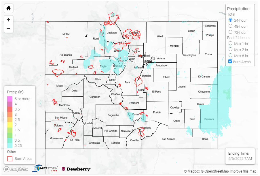
As expected, yesterday saw clear skies and beautiful weather across the state. There were some lingering early morning showers along the tail-end of a line of storms extending from Eastern Colorado through Central Nebraska. Precipitation totals were very light – less than 0.10 inches of rain, though the MetStorm QPE in the map below indicates higher totals. CoCoRaHS observers in Cheyenne County reported between just Trace – 0.07 inches of rain.
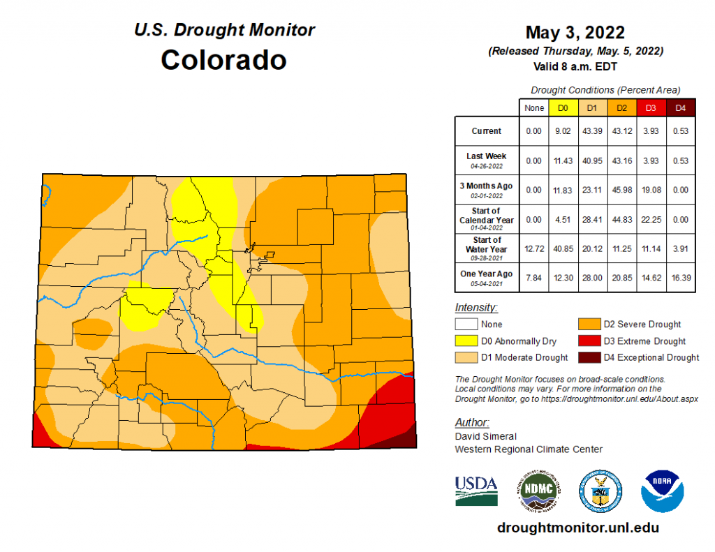
The most recent U.S. Drought Monitor Statistics released yesterday (shown below) indicate little change between last week, though any additional rainfall from Tuesday-Thursday is not included in this update. Over 80% of Colorado is still experiencing between Moderate (D1) to Severe (D2) Drought. We won’t see until next week’s update how the wet start of the month has really impacted drought conditions.
There were no flood reports yesterday. For rainfall estimates in your area, check out the MetStorm Live QPE below.

