Issue Date: Friday, May 6th, 2022
Issue Time: 8:45AM MDT
— Flooding is NOT expected today
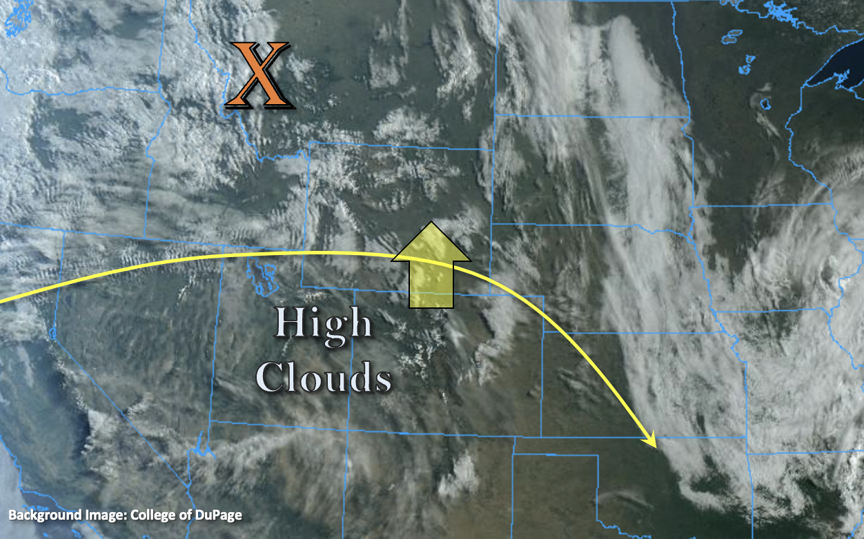
The ridging pattern that established itself yesterday will persist and build today, which paired with westerly winds, is expected to increase afternoon high temperatures statewide. The visible satellite imagery (below) shows a weak shortwave to our north with a larger shortwave coming in behind it. Not a lot of moisture with this initial portion of the system, as can be seen by only broken high clouds over the Southwest in the image below. Lack of moisture and large-scale lift over the state mean that dry conditions are forecast once again. So, flooding is NOT expected. Overall, it’s looking at another warm and pleasant day ahead.
The passing trough, and a surface Low developing to our northeast, will cause breezy westerly/northwesterly flow by noon. Strong wind gusts (45-55 mph) are forecast over the highest elevations of the North, Central and Front Range Mountains, and to a lesser extent over the Southeast Mountains by late morning. These should begin to subside by late afternoon. Another Red Flag Warning has also been issued over the San Luis Valley.
Today’s Flood Threat Map
For more information on today’s flood threat, see the map below. If there is a threat, hover over the threat areas for more details, and click on burn areas to learn more about them. For Zone-Specific forecasts, scroll below the threat map.

Zone-Specific Forecasts:
Northern Mountains, Southeast Mountains, Front Range & Central Mountains:
No rain is anticipated this afternoon or evening, but there will likely be an increase in cloudiness throughout the day. Windy conditions (from the west) are forecast by late morning and should last through late afternoon. Gusts could reach 45 to 55 mph over the highest peaks. Afternoon high temperatures for the mountain valleys are forecast to reach into the mid-60Fs.
Palmer Ridge, Urban Corridor, Northeast Plains, Southeast Plains & Raton Ridge:
Dry conditions are forecast today with an increasing west/northwest breeze by this afternoon. Gusts could reach up to 30 mph over portions of the eastern plains and Palmer Ridge. Afternoon high temperatures will be on the rise with the downslope winds lending a helping hand there, and highs are expected to reach into the 80Fs.
San Luis Valley, San Juan Mountains, Grand Valley, Northwest Slope & Southwest Slope:
Clear conditions and warming temperatures are forecast today with highs reaching into the 80Fs across the lower elevations and 60Fs for the mountain valleys. Rainfall is not forecast today. A Red Flag Warning has been issued again for the San Luis Valley. Up to date information for that warning can be found on the NWS Pueblo site.