Issue Date: Wednesday, May 4th, 2022
Issue Time: 10:00 AM MDT
Summary:
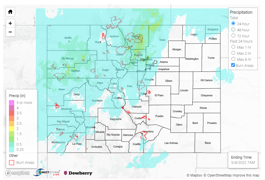
Another low-pressure system entered the state yesterday from the west, bringing widespread precipitation for Western and Northern Colorado by the afternoon. For the high elevations, this brought a wintry mix of rain and snow; and by late evening the eastward progression brought showers to the Urban Corridor, with some lingering sprinkles well into this morning.
Starting from west to east, CoCoRaHS observers in the Grand Valley and Northwest Slope reported up to 0.82 inches of precipitation in Palisade (Mesa County) and 0.69 in Rangely (Rio Blanco County). In Grand Junction, precipitation totals range from 0.10-0.30 across town, with similar magnitude values along the I-70 corridor moving eastward. In addition to showers, much of western Colorado experienced high winds yesterday – a 65 mph non-thunderstorm gust was reported in Hotchkiss (Delta County).
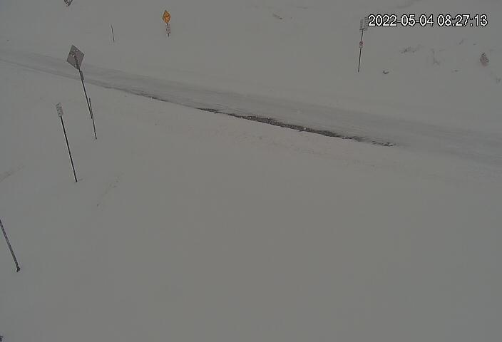
An estimated 8 inches of snow was reported at Never Summer SNOTEL in Gould, and 7 inches at the Willow Park SNOTEL near Cameron Pass, both in Larimer County. Across the Northern and Central mountains, SNOTEL stations picked up between 1-4 inches of snow. CDOT has also issued a safety closure for US6 between I-70 and Loveland pass from the snow, and the Live View webcam shows snowpacked road conditions this morning.
 US-6, Loveland Pass looking west at 8:27 am (Courtesy of CDOT)
Ashton Altieri of CBS4 also shared the following image of snow in Winter Park this morning!
Mountain snow is no joke for this late in the season.
Tabernsash just reported 6 inches and they should get at least another 2-4 through tonight (Winter Park is pictured).@DaveCBS4 @ChrisCBS4 @LaurenCBS4 #cowx #4wx pic.twitter.com/PGp1dDhefP— Ashton Altieri (@AshtonCBS4) May 4, 2022
Moving to the Front Range Mountains, some notable totals include a CoCoRaHS observer in Nederland (Boulder County) that reported 0.97 inches of precipitation with 2.8 inches of snow starting about 8pm, mixed with some freezing rain, and 0.78 inches was reported in Drake (Larimer County). For the Urban Corridor, highest precipitation totals fell up against the foothills and western edge of the Denver Metro Area. Between 0.4-0.7 inches of precipitation was reported across Fort Collins between CoCoRaHS observers and the city’s gauge network. Similarly, 0.25-0.5 was reported across the Northwest Denver Suburbs out to Boulder, with totals decreasing to the southeast. For example, 0.28 was reported at a MHFD gauge in Arvada compared to 0.04 in Parker.
Conditions remained generally dry for Southern Colorado, with smoke in the air from the explosive Cooks Peak and Hermits Peak fires in northern New Mexico, accompanied by their own Red Flag warnings.
There were no flood reports yesterday. For rainfall estimates in your area, check out the MetStorm Live QPE below.
