Issue Date: Monday, May 2nd, 2022
Issue Time: 3PM MDT
Valid Dates: May 3 – May 17
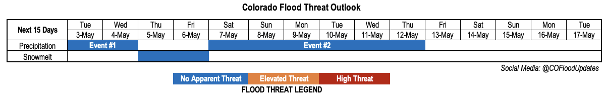
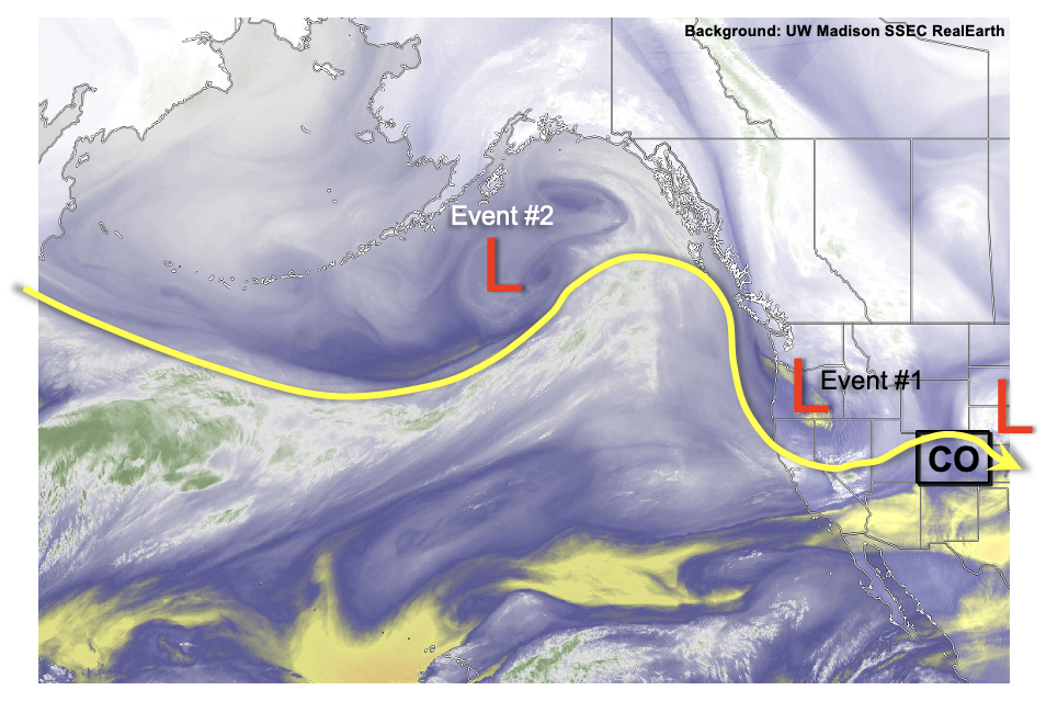
After a windy, dusty and mainly dry April across most of our state, a welcome change towards wetter (and whiter!) conditions began today. Fortunately, this is not just a one-off event. Instead, as shown in the water vapor image, below, an active eastern Pacific storm track will deliver several disturbances into Colorado. The first disturbance, Event #1, will be a quick hitting passage that will produce widespread high-elevation snow, with more scattered and lighter precipitation east of the Continental Divide. The second event (Event #2) looks more interesting, yet more uncertain. A large-scale trough that is currently in the Gulf of Alaska, is expected to slowly move southeastward. Almost all guidance has it cutting off from the main flow, while maintaining its strength over the western United States. The uncertainty arises as to how far east it makes it before cutting off, and slowing down.
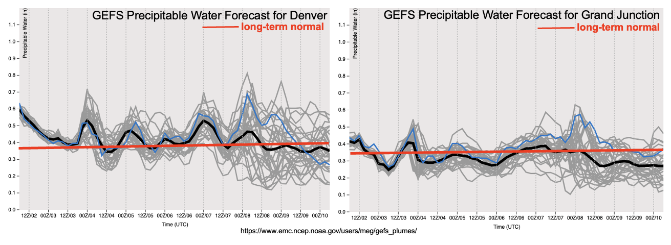
As shown in the GEFS ensemble PW plumes, below, Event #2 can be seen as the slight spike mainly in the Denver forecast on May 7 and May 8. Thereafter, uncertainty increases but there is loose consensus of synoptic scale support of precipitation, which is great news after our dry April.
The other bit of good news, at least from the water supply perspective, is generally below normal temperatures are expected over the next two weeks, especially over the higher terrain. However, in advance of Event #2, most of southern and central Colorado will experience a ~48 hour period of very warm afternoon temperatures (and a pulse of snow-melt mainly in the central and southern high terrains). Overall though, the snowpack is expected to hold firm into mid-May.
The identified precipitation events are described in more detail below.
Event #1: Tuesday-Wednesday (May 3 – May 4)
No Apparent Flood Threat As High Terrain To Experience Welcome Snowfall
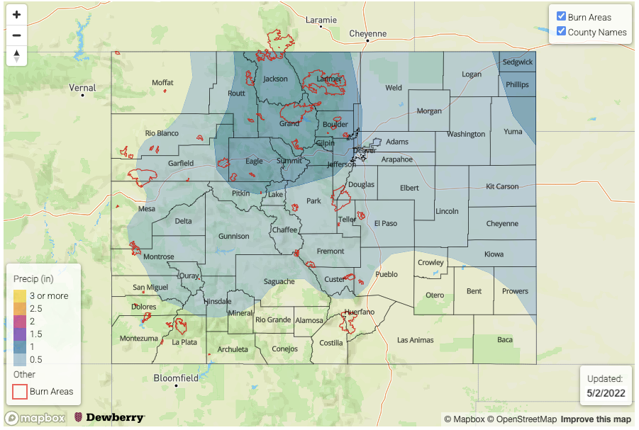
A 24-48 hour period of snowfall is expected across mainly the higher terrain beginning Tuesday afternoon and continuing on through Wednesday. The higher parts of the Front Range, Northern Mountains and Central Mountains could see up to 1.0 inch of liquid equivalent, which is excellent news for the late season snowpack.
Further east, in lower elevations, the odds of precipitation are lower but at least scattered showers are expected over the Urban Corridor, Palmer Ridge and Northeast Plains. However, less than 0.5 inches of rainfall is expected at this time.
Event #2: Saturday – Thursday (May 7 – May 12)
Plenty Of Uncertainty But Prolonged Period Of Precipitation Possible; No Apparent Flood Threat At This Time
The development of the aforementioned large-scale, possibly cut-off trough somewhere over the Great Basin will put Colorado in a favorable position for prolonged on-and-off precipitation beginning late this weekend. At this time, it appears that widespread parts of the state, especially the northern half, should see over 0.5 inches of rain and higher elevation snowfall. The climatologically favored parts of the Northern Mountains and Front Range could see above 1.0 of liquid equivalent.
The heavy rainfall potential will likely be suppressed but may develop along the far east border with KS and OK as Gulf of Mexico moisture may get drawn into our state. At this time, this remains a rather small possibility and more detail will come with the next Outlook, on Thursday.