Issue Date: Sunday, September 26th, 2021
Issue Time: 9:10AM MDT
— Flooding is NOT expected today
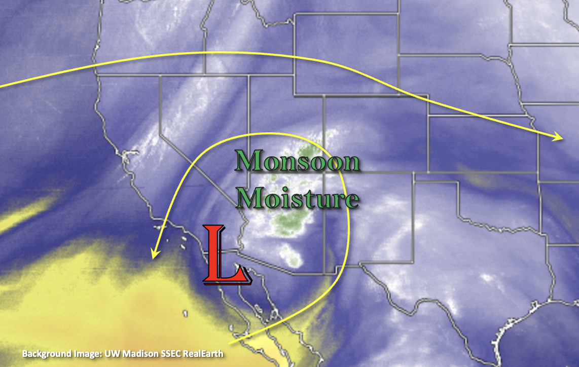
Finally, there’s a change in the weather pattern today. The cutoff Low, from a few days back, will start to meander to the northeast and center itself on the New Mexico/Arizona border by tomorrow morning. There’s a good lump of monsoon moisture being circulated around the Low, which can be seen by the white/green shades in the water vapor imagery below. This moisture plume is expected to continue to move into the far southwest corner of the state and help spark some scattered afternoon and evening storms over the high terrains in the area.
Soundings out of Flagstaff and Albuquerque show robust moisture throughout the atmospheric column, so that likely means more widespread coverage of rainfall with a couple weak thunderstorms possible over the southwest corner. With the dryness of the air mass overhead from the few days, it’s likely that it will take a bit to moisten the boundary layer. Slower steering flows should help do this, so anticipating an increase in rainfall rates and accumulations by early this evening. Rainfall rates should remain just under flood threat criteria and dry soils are expected to absorb much of the rainfall and subsequent runoff. So, outside of nuisance road and low-lying area ponding, flooding is NOT expected.
Elsewhere, dry northwest and westerly flow aloft is forecast, which should keep precipitation chances near zero and allow temperatures to continue to rise. Afternoon high temperatures will make today feel more like summer than fall. High clouds will likely develop as the moisture plume moves northeast this afternoon into tomorrow morning.
Today’s Flood Threat Map
For more information on today’s flood threat, see the map below. If there is a threat, hover over the threat areas for more details, and click on burn areas to learn more about them. For Zone-Specific forecasts, scroll below the threat map.

Zone-Specific Forecasts:
Southeast Mountains, San Juan Mountains & Southwest Slope:
Scattered storms will return to the southwest high terrains this afternoon and evening with a couple high-based showers possible over the Southeast Mountains. Accumulations over the Southeast Mountains should remain under 0.15 inches. Over the high terrains of the Southwest Slope and San Juan Mountains, max 1-hour rain rates up to 0.80 inches per hour and isolated accumulations up to up to 0.90 inches will be possible. In addition to moderate rainfall, storms may produce some strong outflow winds and small hail. Outside of nuisance ponding, flooding is NOT expected. Storms should end as instability drops off with the setting sun.
Primetime: 2PM to 9:30PM
Central Mountains, Northern Mountains, Grand Valley, Northwest Slope & San Luis Valley:
Anticipate an increase in mid and high cloud cover (south to north) this afternoon and into tomorrow, but today should remain dry. Afternoon high temperatures will likely reach into the mid to upper 80Fs for the Grand Valley and upper 70Fs for the mountain valleys. Flooding/rainfall is NOT expected.
Front Range, Urban Corridor, Northeast Plains, Southeast Plains, Raton Ridge & Palmer Ridge:
It’s going to be a hot day ahead with highs reaching into the upper 80Fs (adjacent plains) and 90Fs (eastern plains). Mountain valley locations will likely reach the 80F marker. High cloud cover is anticipated to move in this afternoon and overnight associated with the moisture plume to our southwest. Rainfall is not forecast, so there is NO flood threat issued.