Issue Date: Sunday, September 26th, 2021
Issue Time: 9:00 AM MDT
Summary:
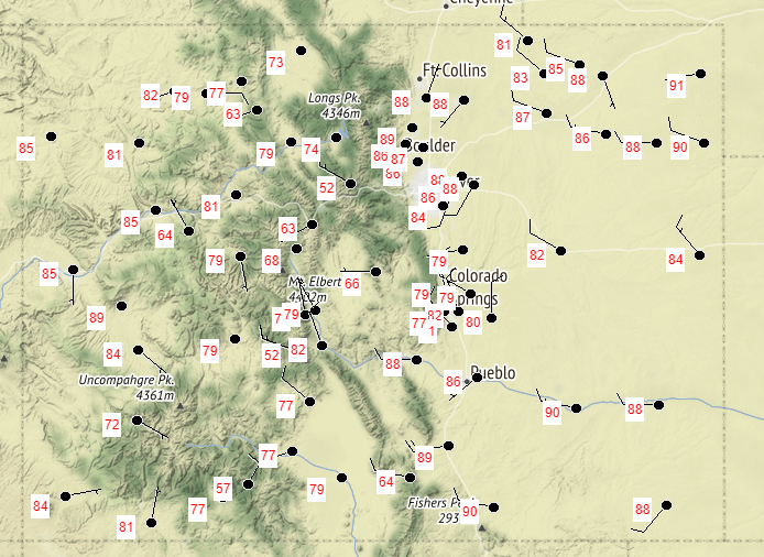
Saturday saw another day with the weather pattern across Colorado dominated by the building high-pressure ridge in the west. This, combined with very dry air, acted to prevent any rainfall and allowed for temperatures to continue to creep up well above seasonal normal. The map below shows yesterday’s high temperatures from all NWS reporting stations across Colorado. Highs were in the 80s (even reaching 90 degrees in a few spots) along the Western Slopes, Grand Valley, Urban Corridor, Raton Ridge, and Eastern Plains. The high elevations of the Northern, Central, San Juan, and Southeast Mountains were in the 70s, along with portions of the Palmer Ridge. As expected, no flooding was reported on Saturday.
Click Here For Map Overview

