Issue Date: Saturday, September 25th, 2021
Issue Time: 8:50AM MDT
— Flooding is NOT expected today
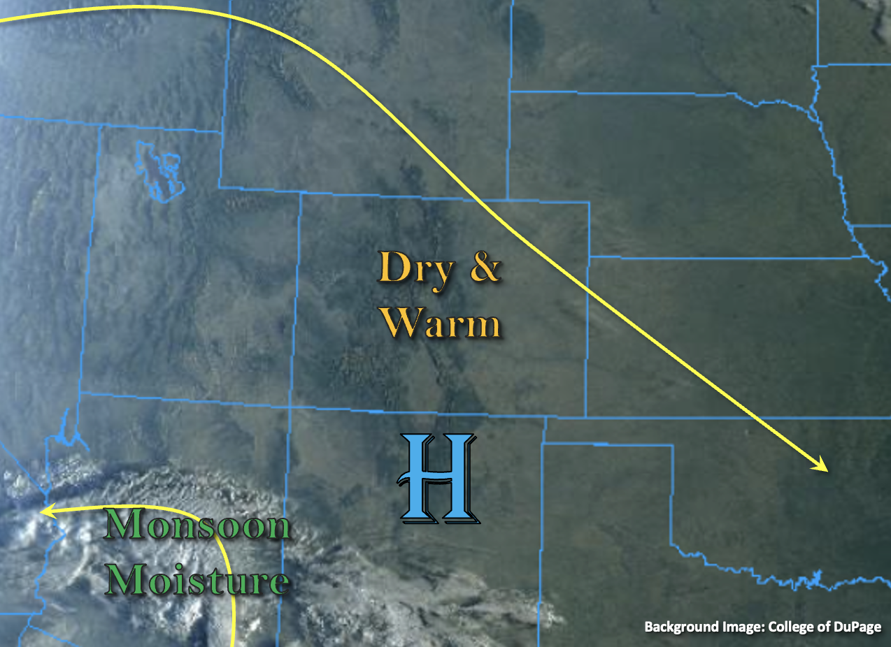
High pressure will continue to build across the state today with the ridge axis sliding overhead by this evening. This will help to produce warmer temperatures with highs today generally running 7F to 12F above normal. The visible satellite imagery below shows no clouds over the state, which exemplifies the dryness of the air mass. PW was measured just above 0.40 inches at Denver and Grand Junction this morning, which means that it will be too dry, once again, for any rainfall to develop. Breezy conditions are forecast over the eastern plains through early afternoon, and westerly/northwesterly surface winds are forecast to pick up over the mountains by this afternoon (north/central). This may elevate fire weather conditions for a brief window this afternoon into this evening.
Over the far southwest corner of the image below, monsoon moisture has started to move counterclockwise around an upper-level Low. This is the same disturbance that cut itself off from the main flow a couple days back. This moisture plume is expected to stay south of the border today, although some mid and high level clouds will likely move into the southwest corner of the state overnight. With only some broken cloud cover forecast over the southern high terrains by later this afternoon, flooding is NOT expected.
Today’s Flood Threat Map
For more information on today’s flood threat, see the map below. If there is a threat, hover over the threat areas for more details, and click on burn areas to learn more about them. For Zone-Specific forecasts, scroll below the threat map.
Zone-Specific Forecasts:
Southeast Mountains, Front Range, Urban Corridor, Northeast Plains, Southeast Plains, Raton Ridge & Palmer Ridge:
It’s going to be a hot day by late September standards. Highs across the lower elevations will reach into the mid to upper 80Fs with mid to upper 70Fs for the mountain valleys. Outside of some afternoon cloud cover over the southern Front Range and Southeast Mountains, it should be clear day ahead. So, NO flood threat is issued. Breezy conditions are forecast over the far eastern plains through early afternoon with south and southwesterly winds reaching between 10 and 18 mph. By this afternoon, westerly and northwesterly winds will pick up over the Front Range reaching between 10 and 15 mph. This may cause elevated localized fire weather conditions.
Central Mountains, Northern Mountains, San Juan Mountains, Grand Valley, Northwest Slope, San Luis Valley, & Southwest Slope:
Highs today will reach into the upper 80Fs for the Grand Valley and into the 80Fs for other valley locations. Mountain valleys could reach into the mid 70Fs. No rainfall is forecast today, although some mid and upper level cloud cover is expected to move into the southwest corner of the state overnight. This should help keep overnight low temperatures a little warmer for the region. Breezy afternoon conditions should be anticipated over portions of the Northern/Central Mountains and Northwest Slope where surface winds could gust up to 30 mph (Northern Mountains). With the dry air overhead, this will likely elevate local fire weather conditions. Flooding is NOT forecast today.