Issue Date: Thursday, September 23rd, 2021
Issue Time: 9:50 AM MDT
Summary:
Thanks to the high-pressure ridge dominating the weather across Colorado, no precipitation was reported yesterday. Temperatures also continued to rise to above seasonal normal, with highs in the upper 70s and low 80s for much of the state. As expected, no flooding was reported on Wednesday. For rainfall estimates in your area, including antecedent rainfall, check out the State Precipitation Map at the bottom of today’s post.
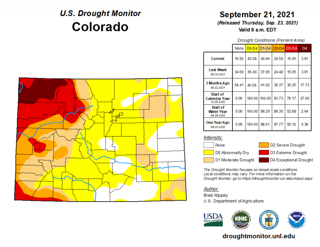
Today’s Drought Monitor update for conditions as of Tuesday, September 21 show drought expanding across much of Colorado. Last week, 34.6% of the state was not experiencing any type of drought, compared to only 16.92% as of this week. West of the divide, conditions remained largely the same, though with much of the region experiencing “D1 Moderate” to “D4 Exceptional” drought. The main expansion has been in “D0 Abnormally Dry” conditions across a large swatch of Central and Southern Colorado, covering portions of the San Juan Mountains, San Luis Valley, Front Range Mountains, Urban Corridor, Palmer Ridge, and Southeast Plains. Additionally, in the Southeast Plains areas of “D1 Moderate” drought have expanded from last week and a small area on the Oklahoma border in Baca County has been increased to “D2 Severe” drought. Only small pockets of Eastern Colorado remain with no drought conditions.
Click Here For Map Overview

