Issue Date: Wednesday, September 22nd, 2021
Issue Time: 9:15AM MDT
— Flooding is NOT expected today
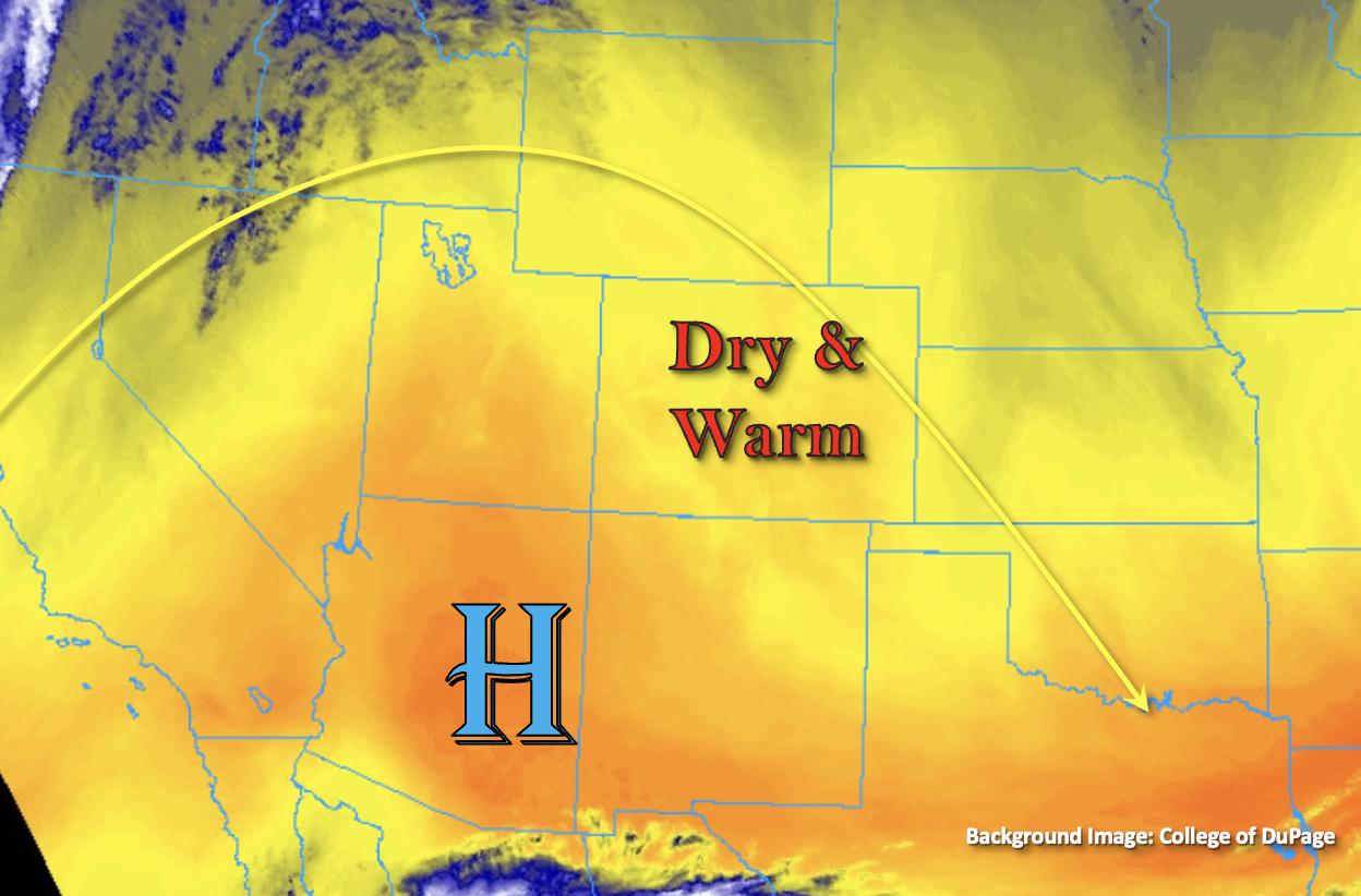
It’s officially the first day of Fall, but the above average temperatures and calm weather that are forecast will make you think that it is still summer. High pressure will dominate the flow over the state, which will help produce these mild conditions as the ridge axis is pushed overhead. The water vapor imagery below shows the dry air mass is still in place, and PW at Grand Junction and Denver was measured at 0.29 inches and 0.27 inches, respectively. That should keep the rainfall chances right around zero today, and dry upper levels should also limit the chances for afternoon cloud cover to develop. This evening, lift and a little moisture from next incoming trough is expected to produce some high cloud cover over the northwest corner of the state. While this is not expected to produce any precipitation, it may help keep overnight and early morning temperatures a little warmer than the last couple of nights. As expected, flooding is NOT forecast today.
Today’s Flood Threat Map
For more information on today’s flood threat, see the map below. If there is a threat, hover over the threat areas for more details, and click on burn areas to learn more about them. For Zone-Specific forecasts, scroll below the threat map.
Zone-Specific Forecasts:
Central Mountains, Northern Mountains, San Juan Mountains, Grand Valley, Northwest Slope, San Luis Valley, & Southwest Slope:
Today’s high temperatures should reach the upper 70Fs to low 80Fs across the lower elevations and into the 70Fs for the mountain valleys. There may be some patchy breeziness over the Northwest Slope and Central Mountains this afternoon, but critical fire weather is not anticipated. Rainfall is also not forecast today, so flooding is NOT expected. Tonight, some high clouds may develop over the northwest corner of the state, which would potentially help keep overnight lows a little warmer. Overnight lows may reach below freezing for the SLV again, so stay tuned into NWS Pueblo for any Freeze Warnings that may be issued.
Southeast Mountains, Front Range, Urban Corridor, Northeast Plains, Southeast Plains, Raton Ridge & Palmer Ridge:
It definitely won’t feel like the first day of Fall with the warm temperatures and abundant sunshine that are forecast. Afternoon high temperatures should rebound into the 80Fs across the lower elevations with upper 70Fs forecast along the southern I-25 Corridor. Mountain valley high temperatures are forecast in the 70Fs. It may be a little breezy over the Front Range this afternoon with northwest surface winds in the 15-20 mph range. Rainfall is not forecast today, so flooding is NOT expected.