Issue Date: Wednesday, September 22nd, 2021
Issue Time: 10:00 AM MDT
Summary:
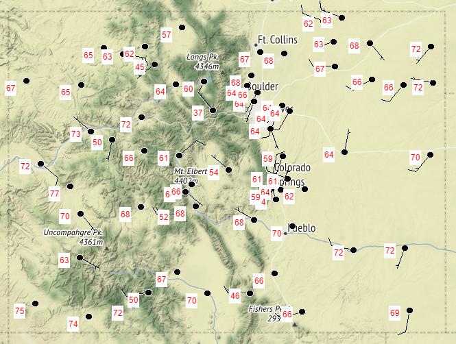
Tuesday began with some early morning showers associated with a weak frontal boundary on the far Southeast Plains, which quickly dissipated with daytime heating and the eastward progression of the larger scale departing trough. Total precipitation in this area was light, just less than 0.10 inches. For the rest of Colorado, it was a seasonably cool day. The following map shows yesterday’s high temperatures at all NWS stations, with highs in the 60s for most of the state, and low 70s for the Eastern Plains, Grand Valley, and Southwest Slope. Skies remained largely clear yesterday thanks to building high pressure, which will continue to dominate the weather pattern in the coming days.
Repairs at the Pueblo radar were also finished yesterday – the radar is now back online and operational.
KPUX radar has returned to operational status! The pedestal upgrade is complete. #COwx #Colorado
— NWS Pueblo (@NWSPueblo) September 21, 2021
No flooding was reported on Tuesday. For rainfall estimates in your area, check out the State Precipitation Map below.
Click Here For Map Overview

