Issue Date: Monday, September 13th, 2021
Issue Time: 3PM MDT
Valid Dates: 9/14 – 9/28

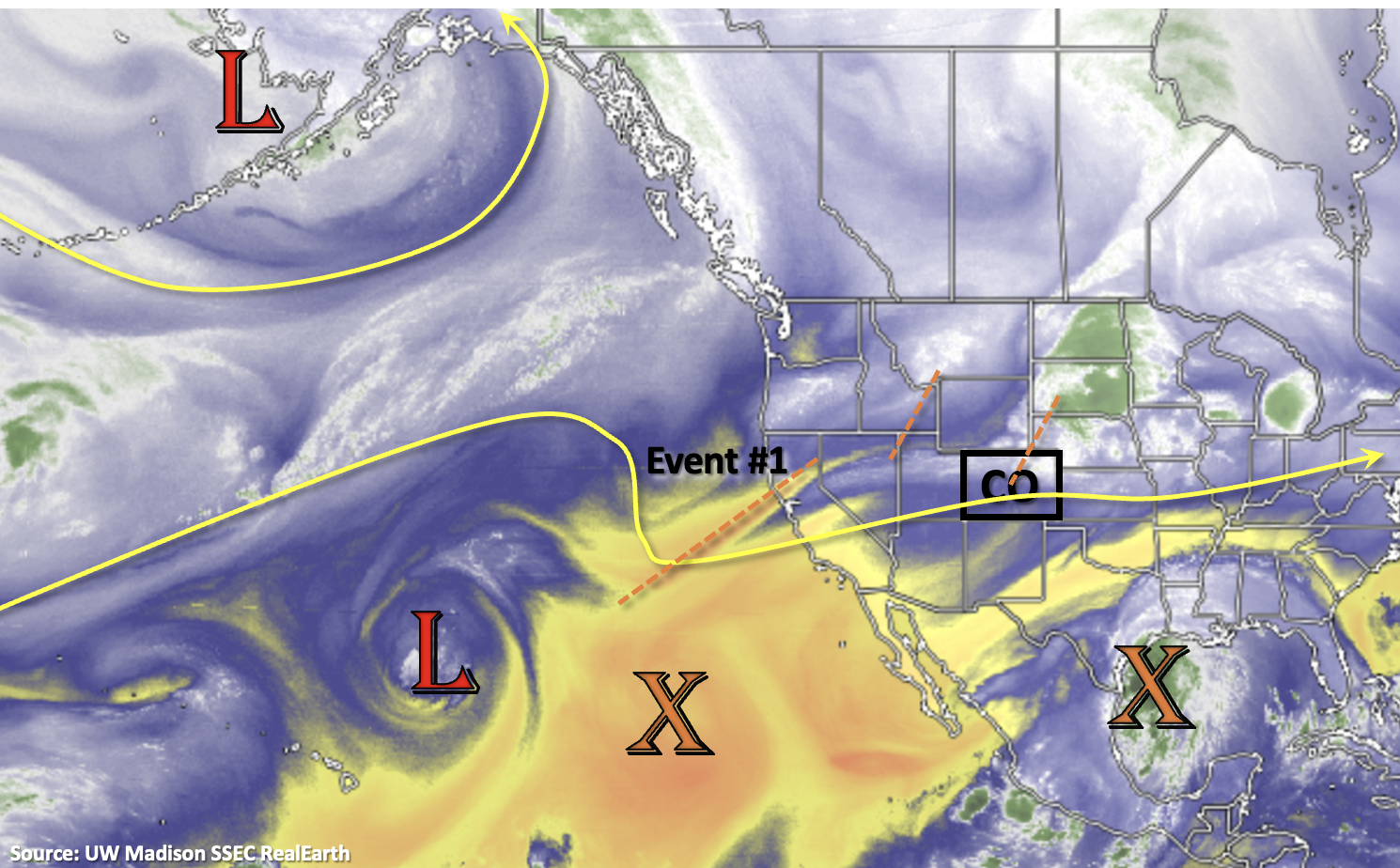
We’ve got a quick one-day event tomorrow that rounds out Event #1 from last Thursday’s FTO. Zonal flow should push another shortwave across the state, which will help spark some post-frontal upslope flow storms. This event is expected to only affect eastern Colorado (central and south) where there will be more instability and plenty of remaining moisture for storm development. It will likely be too stable for any rainfall north of the cold front that passes through this evening; however, the passage of the cold front means a return to cooler temperatures over the northern tier of Colorado. So, enjoy it because high temperatures quickly rebound by Wednesday, as north and northwesterly flow pull a very dry air mass overhead. Expect the above average temperatures to last through the weekend.
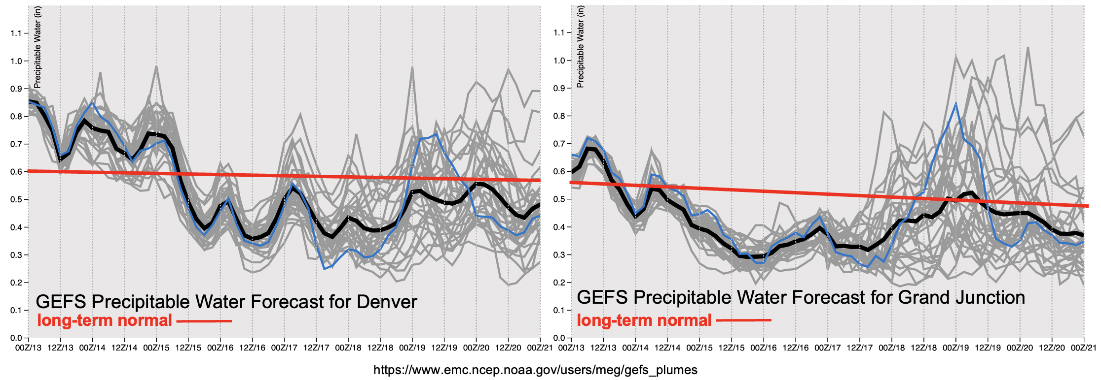
By tomorrow morning, PW over Grand Junction (right image, below) drops off well below the seasonal average. With the dry air overhead, and another round of above average temperatures through the end of the week, it’s likely that already dry fuels will continue to worsen. This could help cause an increase in fire danger over the northwest corner of the state towards the end of the week when surface winds look to increase between 15 and 20 knots (not shown). There’s a bit of uncertainty about some subtropical moisture making its way northward this weekend for rainfall over western Colorado. If there is moisture return, it will likely be elevated moisture, which could spark some high-based thunderstorms. These (possible) dry thunderstorms also have the potential to increase fire danger over the area on Saturday and Sunday. Over eastern Colorado, it’s likely that PW will stay below average after tomorrow. Precipitation chances should drop off with the drier air overhead, although a couple high-based storms over the mountains may be possible closer to the end of the week and into this weekend.
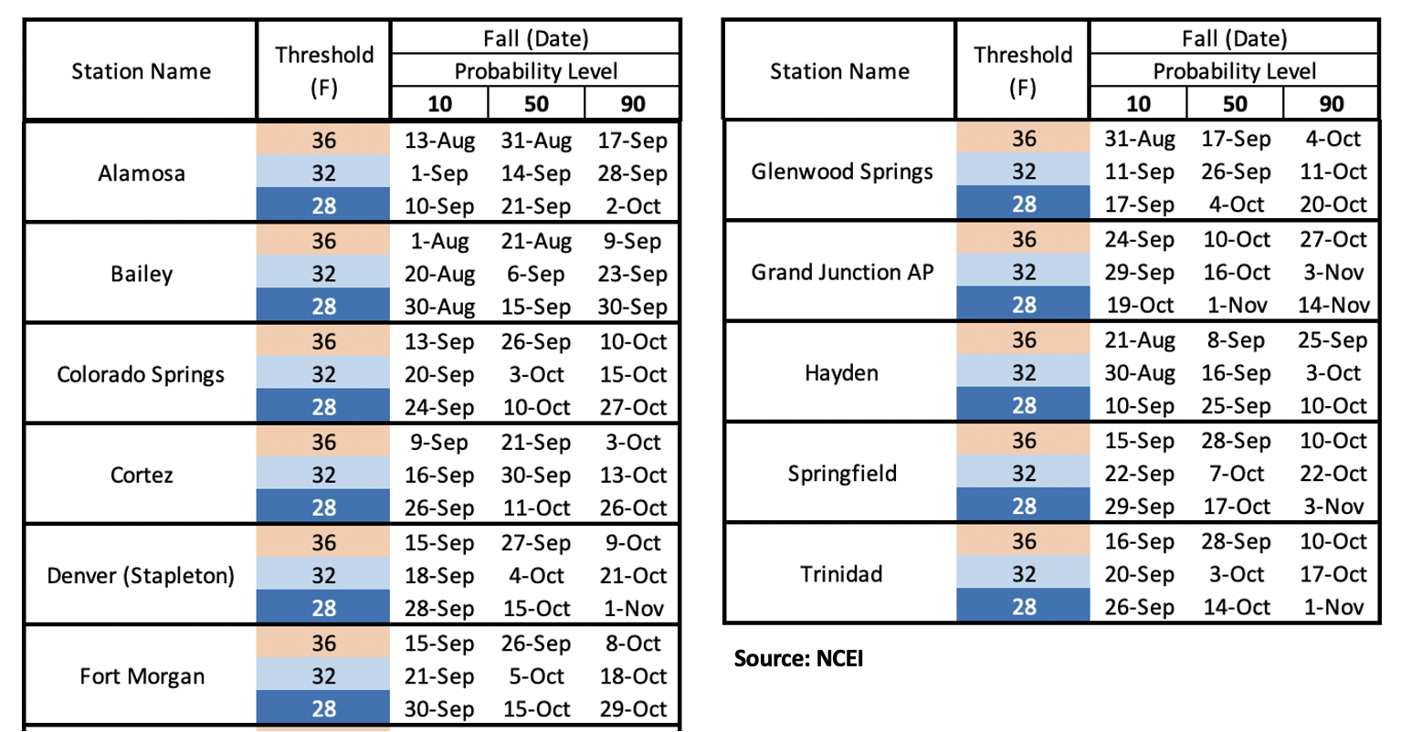
After another week of warm weather, it is looking likely that early next week we will see our first push of colder air from the north. It could get quite chilly Monday and/or Tuesday with snow possible at the highest elevations. With the passage of the cold front, it’s also likely that precipitation will return to the forecast. Right now, it’s looking more like a snow/stratiform rainfall event, so there is No Apparent flood threat for Event #2. The timing of the cold front’s passage is about right, because we are nearing the time for our first frost and freeze of fall. Below are a handful of locations across the state with freeze/frost dates. In the last column are the 10th, 50th and 90th percentile dates for each location and respective threshold. If you cannot find a location that’s near you, head on over to the NCEI site HERE.
Event #1: Tuesday (9/14)
NO APPARENT flood threat is issued for scattered post-frontal storms over eastern Colorado.
Post-frontal upslope storms are likely to fire tomorrow afternoon. This event will most likely affect eastern Colorado, both central and south. There’s a good chance that it will be too stable north of the front for any rainfall as well as over the far Southeast Plains. Some higher totals may be possible if better surface moisture can hang on and not be mixed out by the incoming, dry northwesterly flow. Max 1-hour rain rates up to 1 inch may be possible, but there is NO Apparent threat at this time as storms should be moving rather quickly. Faster storm motion to the southeast should limit the flood threat from any individual storm. In addition to rainfall, a couple severe storms are possible with large hail and damaging outflow winds being the main threats. These severe storms would most likely form east of I-25. More accurate details will be available tomorrow morning, so be sure to tune back into the FTB for the latest.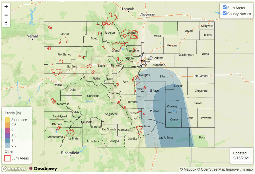
Event #2: Monday – Tuesday (9/20 – 9/21)
Our first real taste of fall will likely arrive next week, and with it, stratiform rainfall and snow (high elevations) should return to the forecast. NO APPARENT flood threat is issued.
Still a bit of time for this to play out, but it looks like our first real cold front of the season will arrive sometime early next week. Models are in fairly good agreement about the strength of this system, so we should see a major cool down with snow possible over the mountains. Not a lot of rainfall is anticipated with this event, and it’s likely most of the rain will be more stratiform in nature than convective. Be sure to tune into the next FTO (Thursday) as details will likely change and evolve over the next several days. No map has been drawn due to the precipitation amounts anticipated being under 0.50 inches.