Issue Date: Friday, September 10th, 2021
Issue Time: 9:15AM MDT
— Flooding is NOT expected today
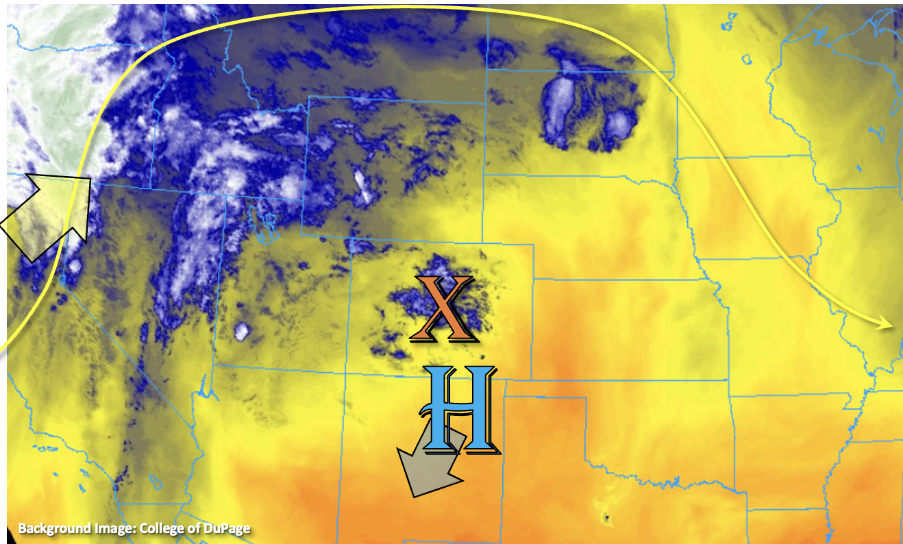
A change in the weather pattern is on its way, but before that, we have a very hot September day ahead. An incoming trough to our west will begin to move the center of the High slightly southward, but the ridging pattern will be able to hold on for one more day. This will help to produce daily record heat with a handful of areas nearing all-time monthly records. With the slight southward movement of the High from the incoming shortwave, a little mid-level energy and moisture has and will continue to move through the state. The combination of the two with the diurnal flow may produce some weak, isolated showers over the southern high terrains this afternoon and over the Northwest Slope later tonight. More virga than wetting rainfall is forecast with the high cloud bases, so accumulations should remain very light. Therefore, flooding is NOT forecast. As far as near surface smoke, it’s thickest this morning over the lower elevations of eastern Colorado. It should mix out throughout the day leading to blue skies for most. The one exception is over the far northeast corner of the state where visibility is forecast to remain in the 10 to 30 mile range.
Today’s Flood Threat Map
For more information on today’s flood threat, see the map below. If there is a threat, hover over the threat areas for more details, and click on burn areas to learn more about them. For Zone-Specific forecasts, scroll below the threat map.
Zone-Specific Forecasts:
Southeast Mountains, Front Range, Southeast Plains, Northeast Plains, Raton Ridge, San Luis Valley, Urban Corridor & Palmer Ridge:
It will likely be the last scorcher of the year today with mercury levels on the rise. High temperatures over the far eastern plains will reach 100F+ with high 90Fs for the I-25 Corridor. The San Luis Valley should reach around 90F with mountain towns in the 80Fs. A couple high based showers may be possible south this afternoon, but more cloud cover than wetting rainfall is forecast. Flooding is NOT expected today.
San Juan Mountains, Central Mountains, Northern Mountains, Southwest Slope, Grand Valley & Northwest Slope:
There will be a nice break from the near surface smoke today, and highs across the Grand Valley are forecast to reach into the mid-90Fs. Most of the lower elevations will reach into the low 90Fs with 80Fs forecast for the mountain valleys. As for rainfall, there might be an isolated, high-based shower over the San Juan Mountains this afternoon, and tonight, some high-based showers may clip the far northwest corner of the state. With more cloud cover than wetting rainfall forecast, flooding is NOT expected. Storms tonight over the Northwest Slope may produce some brief windy conditions as they become outflow driven.