Issue Date: Tuesday, September 7th, 2021
Issue Time: 8:30AM MDT
— Flooding is NOT expected today
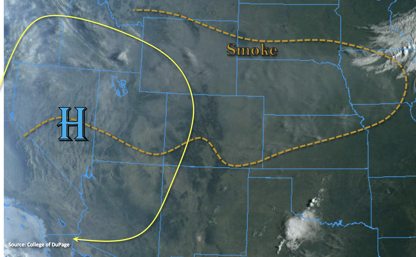
It’s a little bit of a warmer of a start to the morning than yesterday, and even though there are cloud-free skies, there’s still plenty of smoke across the state. North and northwest flow aloft will continue today as the High strengthens and moves slightly eastward. Between the subsidence from the High and the dry air still overhead, rainfall is not anticipated today. Afternoon and evening high temperatures should reach into the upper 80Fs and low 90Fs across the lower elevations with upper 70Fs to low 80Fs for the mountain valleys.
The flow around the High and a northerly component to the surface winds this afternoon will continue to advect more smoke into Colorado, which is marked in the visible satellite imagery below. The thickest near surface smoke is anticipated over the Northern/Central Mountains, Grand Valley and Northwest Slope by this evening. Pockets of visibility are forecast to drop between 5 and 10 miles with poor visibility expanding throughout the Northwest Slope and portions of the Northern Mountains by morning. Stay tuned into your local NWS office for the latest on Air Quality Alerts issued over the next few days.
Today’s Flood Threat Map
For more information on today’s flood threat, see the map below. If there is a threat, hover over the threat areas for more details, and click on burn areas to learn more about them. For Zone-Specific forecasts, scroll below the threat map.
Zone-Specific Forecasts:
San Juan Mountains, Central Mountains, Northern Mountains, Southwest Slope, San Luis Valley, Grand Valley & Northwest Slope:
Expect surface visibility to drop throughout the day with the ongoing fires and plume moving in from the north. Afternoon and evening high temperatures will reach into the 90Fs for the valleys and low 80Fs for the mountain valleys. Rainfall is NOT forecast today.
Southeast Mountains, Front Range, Southeast Plains, Northeast Plains, Raton Ridge, Urban Corridor & Palmer Ridge:
Too dry for any rainfall today with PW measured at 0.34 inches in Denver this morning. Smoky conditions will continue with visibility continuing to drop over the next 24 hours. Highs should reach the upper 80Fs into the low 90Fs over the Urban Corridor and eastern plains with mountain valleys in the upper 70Fs to low 80Fs. Flooding is NOT expected.