Issue Date: 8/10/2015
Issue Time: 1:46 PM
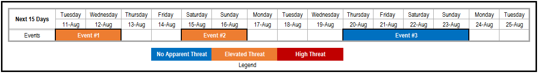
Another FTO, another discussion on the active atmosphere that continues to feed disturbances and moisture into Colorado. There are three events during this 15-day period, with the first two labeled “Elevated Flood Threats.” Event #3 earns the label “No Apparent Flood Threat” as there are still too many uncertainties to nail down, i.e., the exact track of the upper-level low, associated disturbances, and available moisture.
Event #1: Tuesday (8-11-2013) and Wednesday (8-12-2015)
Elevated Flood Threat as Upper-Level High Stubbornly Holds on to Moisture
**If you read the FTO from Thursday (08-06-2015), you will notice that what was referred to then as Event #1 has now been split into Events #1 and #2 for this FTO edition.**
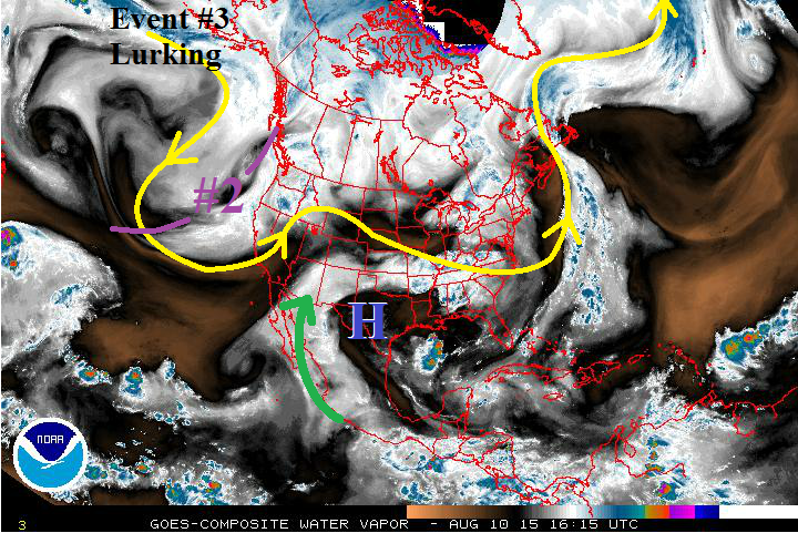
Event #1 is associated with the location of the upper-level High (blue “H” on water vapor image) and the monsoonal moisture (green arrow) that it is pulling into Colorado. As the high builds westward, it will keep Colorado under a fairly deep moisture plume with precipitable water values running above average through Wednesday for most locations. Deep moisture, and a couple of mid-/upper-level disturbances embedded in the southwest flow, will allow for any strong thunderstorms to hold heavy rain potential, especially across southern Colorado. By Thursday, the atmosphere will dry out a bit, even though the upper ridge will still be overhead. Isolated diurnal showers and thunderstorms will still be present for Thursday and Friday, but the flood threat looks to come to an end after Wednesday. Stay tuned to upcoming Flood Threat Bulletin’s for up-to-date information.

Event #2: Saturday (8-15-2015) and Sunday (8-16-2015)
Elevated Flood Threat as Upper-Level Low Moves across Northern Rockies
The upper-level low will finally get tired of meandering along the west coast and become transient, moving across the Northern Rockies during this time frame. Large-scale lift associated with this low will reach across Colorado, providing upper-level support for scattered showers and thunderstorms. On Sunday, the passage of the upper low will force a cool front through Eastern Colorado. In the wake of this front, during Sunday afternoon and evening, more widespread thunderstorms are expected for the eastern mountains and plains.
Event #3: Thursday (8-20-2015) through Sunday (8-23-2015)
No Apparent Flood Threat as Details are Still Emerging
Event #3 is currently lurking over the Northern Pacific Ocean, and details will emerge over the coming days. Right now, the storm track appears to be much the same as that taken by Event #2, so a repeat could be on tap. Stay tuned to upcoming FTO’s for more information.