Issue Date: Thursday, August 26th, 2021
Issue Time: 3PM MDT
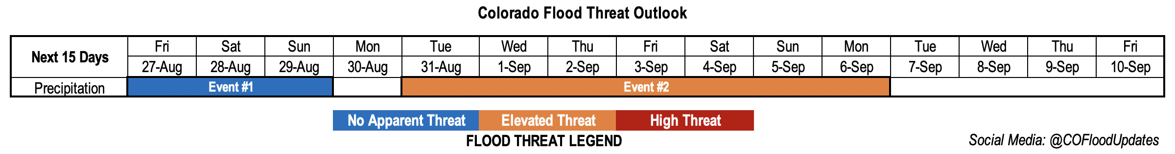
Valid Dates: 8/27 – 9/10
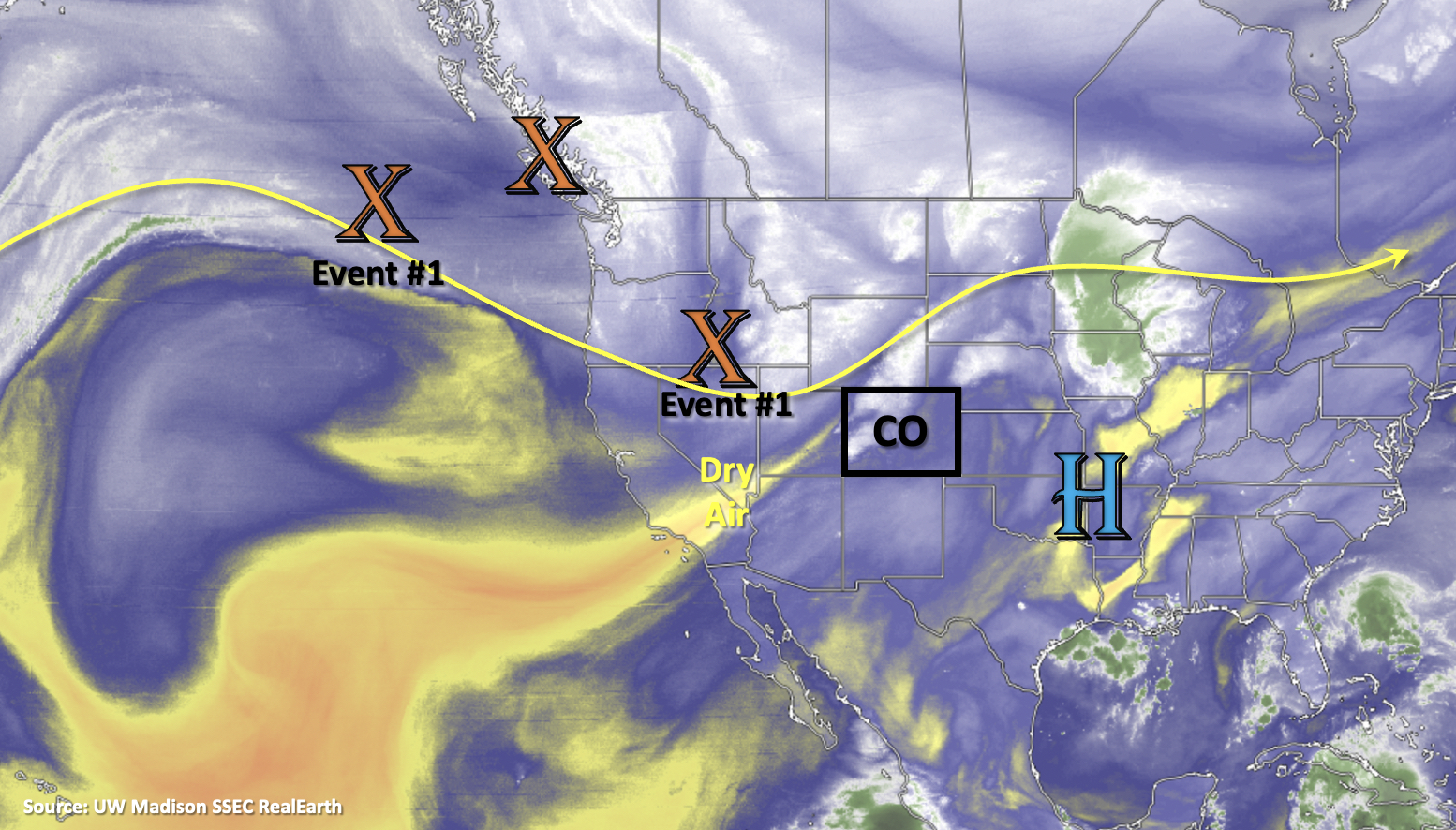
A general troughing pattern with a few shortwaves moving through the flow will help to produce isolated to scattered storms over the weekend (Event #1). However, this pattern should promote more westerly flow aloft, which will likely decrease the overall available moisture for storms and in turn, reduce the flood threat. For the most part, measurable rainfall should be confined to the mountains, and with the near surface moisture lacking, accumulations should be on the lower end. A quick moving cold front on Saturday could produce some stronger storms over the plains, if they can break the cap, and help with more widespread storm coverage Sunday over the eastern mountains. This scenario on Sunday would likely only occur if there was decent moisture return behind the front. More on that in the next section.
There will be a slight break in rainfall on Sunday/Monday as the dry air marked below moves into western, then eastern Colorado. Heading into Tuesday, the ridge begins to re-build over the state. A deepening trough to our northwest and a potential land-falling hurricane to our southeast could generate strong and sustained south/southeast flow across the state, which would pull sub-tropical moisture northward. The potential for this late season monsoon surge is looking more likely at this time, although there is still a lot of uncertainty around the amount of moisture and how far north it would travel.
There’s No Apparent flood threat for Event #1 as PW drops both east and west after today. Another accumulation inhibitor will be faster steering flows with the jet sitting at the base of the trough. Better chance for rainfall accumulation during this event will be south, closer to the moisture rotating around the High. Over eastern Colorado there is a slight bump in moisture behind that previously mentioned front, but even with PW at near average values, the flood threat remains low. Best chance for a flood threat would be over a small area of the far eastern plains on Saturday, which will depend a lot on the timing of the frontal passage. Overall, for Event #1 the main threats from the scattered storms will be gusty outflow winds and dangerous lightning.
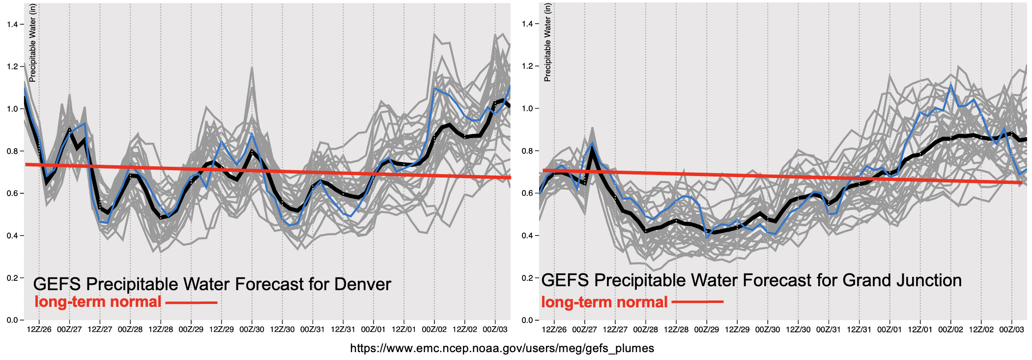
The PW images above do show an upward trend in values starting on Sunday with well-above average PW east and west by Thursday. The NAEFS (GEFS and GEPS) show PW values reaching from about 1 to up to 1.6 standard deviations above normal for Event #2. Equally, the EPS has been consistently picking up on this event over the last couple of days. With the potential for this one last monsoon surge, in what has been a long and robust season, an Elevated flood threat has been issued. Scroll below for more details about each event in this FTO.
Event #1: Friday – Sunday (8/27 – 8/29)
No Apparent flood threat for isolated to scattered, diurnal driven storms over the mountains and Northeast Plains for the weekend.
Storms on Friday will most likely occur over the southern Southeast and San Juan Mountains where there is a bit more residual moisture. On Saturday, storms coverage may pick up over the Front Range and Palmer Ridge in addition to another round of storms over the southern high terrains. There is the possibility for a couple stronger storms out east along the front, depending on when the front moves through on Saturday. So as far as the flood threat for FTB, this will be what we watch for Event #1. Sunday, it will be much cooler behind the front over eastern Colorado. More widespread storms over the eastern mountains will be possible in this post-front upslope flow scenario, as long as the atmosphere isn’t too stable.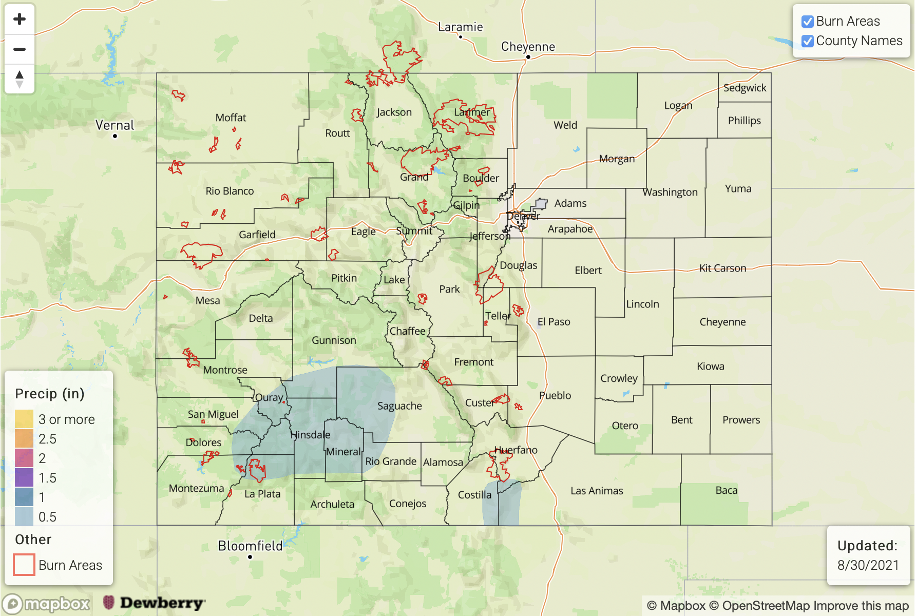
Event #2: Tuesday – Monday (8/31 – 9/6)
Late season moisture surge looking more likely, so an Elevated flood threat is issued.
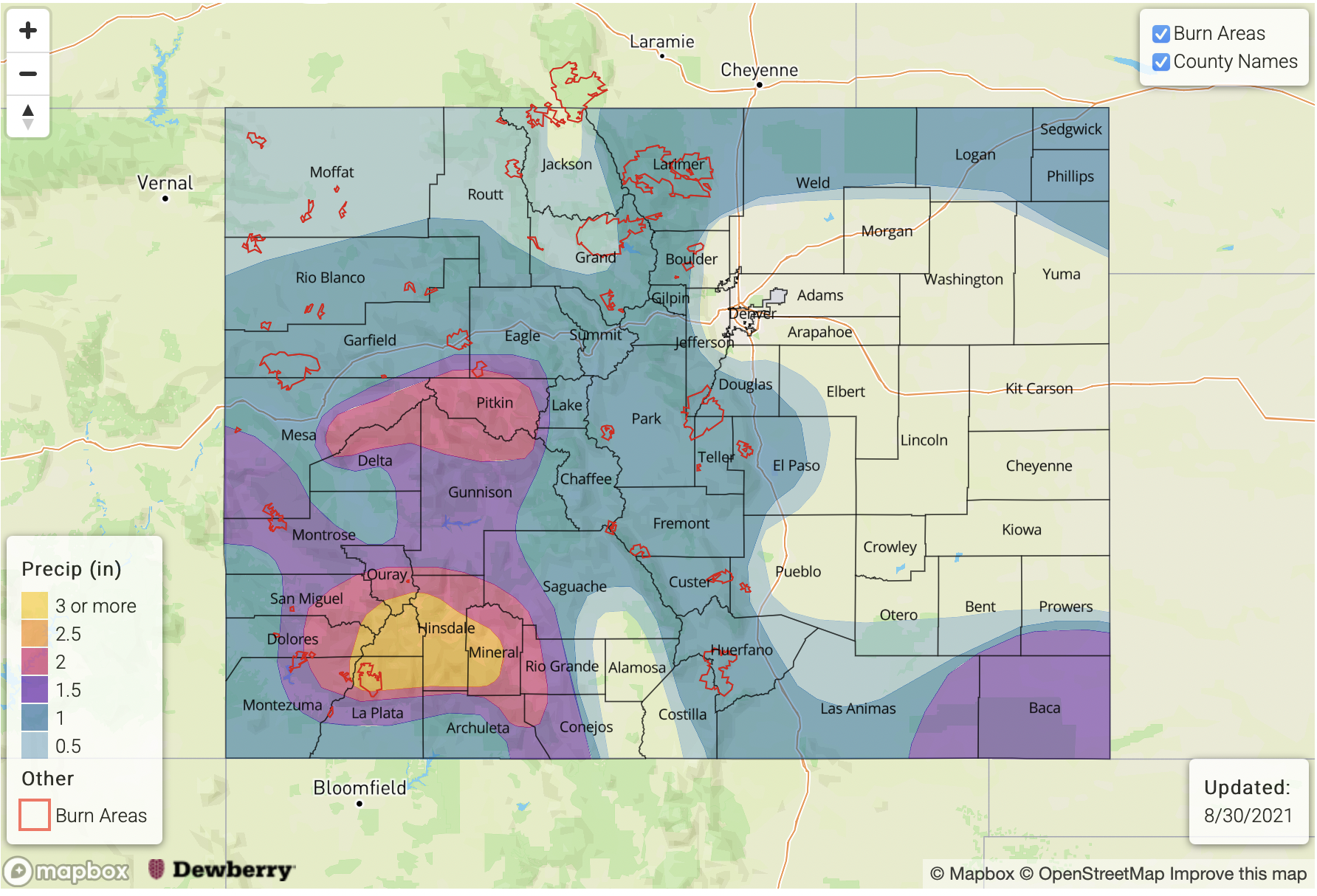
Like before, there is still a lot of uncertainty in the forecast this far out in regard to moisture amount and northward movement of the sub-tropical moisture. However, with all guidance consistently indicating a late season monsoon surge, it is worth putting out an Elevated flood threat. The precipitation map below is a combination of output from guidance and climatology. This looks like it will mostly be a western Colorado event, which is excellent for the ongoing drought. Late season events such as this are also good before we move into a more typically dry period in September. The highest peaks may end up seeing a dusting of snow, but for the most part, it looks like a rainfall event. More to come next week, so be sure to tune back in on Monday afternoon.