Issue Date: Thursday, August 12th, 2021
Issue Time: 9:30 AM MDT
Summary:
As discussed in the FTB yesterday, Colorado was nestled between two systems: a trough well to the north kept the northern half of the state dry, while monsoonal moisture was able to break into the state along the southern border, allowing for afternoon showers and thunderstorms. Overall rainfall totals remained modest, but a couple places picked up some decent accumulations according to CoCoRaHS observers, including 0.31 inches in Mancos and 0.27 in Chromo (just above the New Mexico border). Storms were more organized along the Raton Ridge and in the Southeast Plains near the Kansas and Oklahoma borders, though winds were a larger concern than heavy rain. The extra bit of moisture and instability allowed for some relief from the smoke in Southern Colorado.
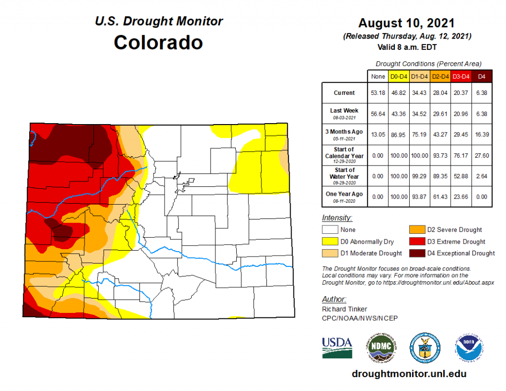
Drought monitor updates released today indicate that the hot and dry pattern is impacting the Northeast Plains. The area of D0 “Abnormally Dry” in the Northeast has expanded to several counties, and a small portion of Phillips and Yuma counties on the Kansas border have reached D1 “Moderate Drought” status. There was little change west of the divide, where conditions remain in D2 “Severe Drought” or worse.
Flooding was not reported on Wednesday. For rainfall estimates in your area, check out the State Precipitation Map below.
