Issue Date: Tuesday, August 10th, 2021
Issue Time: 9AM MDT
— Flooding is NOT expected today
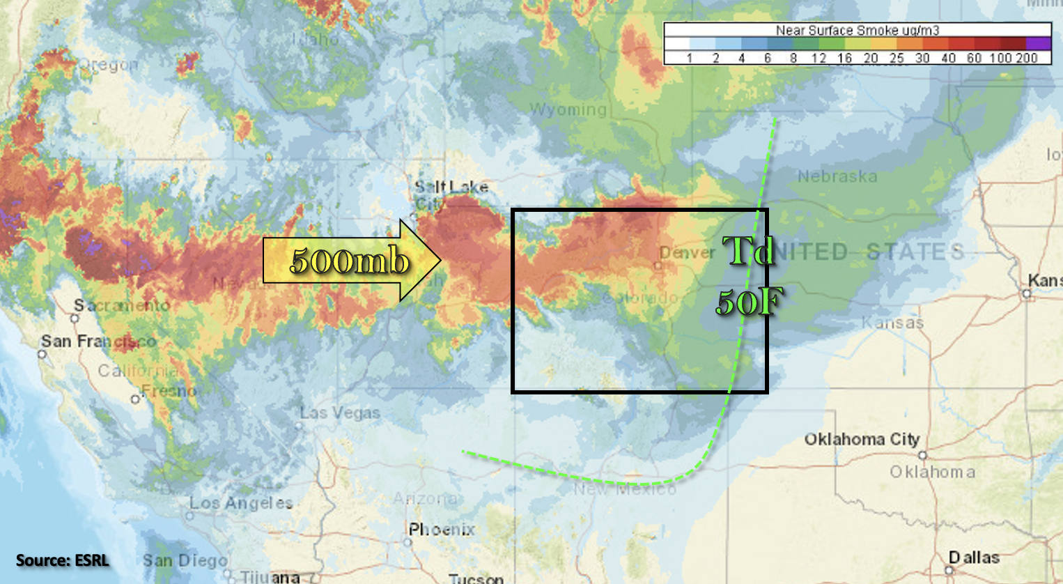
Shown below is the near surface smoke, which is being advected into the state from the west with the zonal flow pattern. The smoke today is expected to be heaviest over the northern half of the state, and the westerly flow will continue push the thicker plume over the Northern Mountains/Northwest Slope eastward throughout the day. It is likely that the Air Quality Alert will continue.
Also marked in the image below is the 50F dew point line, so moisture return behind a front that passed through overnight was underwhelming. Between PW at Denver and Grand Junction measured at 0.52 inches and 0.57 inches (respectively) and mid-level warming, not expecting much in the way of diurnally driven storms over the mountains this afternoon and evening. A few high-based storms may produce a little precipitation over the San Juan and eastern mountains, but the measurable rainfall will be limited. Besides the mountain storms, a couple storms could form over the climatologically favored Palmer Ridge and along a convergence boundary created by a surface trough to our southeast. A couple of those storms over New Mexico could steer into the far southeast corner of the state. With only light to moderate rainfall anticipated today, flooding is not forecast.
Today’s Flood Threat Map
For more information on today’s flood threat, see the map below. If there is a threat, hover over the threat areas for more details, and click on burn areas to learn more about them. For Zone-Specific forecasts, scroll below the threat map.

Zone-Specific Forecasts:
Northeast Plains, Raton Ridge, Palmer Ridge, Southeast Mountains, San Juan Mountains, Southeast Plains, Front Range & Urban Corridor:
The southern mountains, especially the San Juan Mountains, are closer to the next moisture plume, so they have the best chance for seeing some measurable rainfall over the mountains this afternoon and evening. A stray storm or two may be possible over the southern Front Range. Storm totals should remain under 0.10 inches and brief, but strong outflow winds will be possible. Additional storm development is possible over the southern Raton Ridge and Palmer Ridge. With high cloud bases, only moderate rainfall totals are forecast (up to 0.50 inches), so flooding is NOT expected today. High temperatures will reach into the 90Fs for the lower elevations with 80Fs over the mountains.
Primetime: 1:30PM to 10PM
Grand Valley, San Luis Valley, Northwest Slope, Northern Mountains, Central Mountains & Southwest Slope:
A couple weak showers will be possible along and near the I-70 corridor today. For the most part, storms will produce only virga or a few sprinkles. Stronger storms may also produce some brief, windy conditions as they become outflow driven with the dry surface layer. Elsewhere, it should remain dry and hot. High temperatures are forecast to reach the 90Fs over the lower elevations with upper 90Fs for the Grand Valley. Mountain valleys will reach into the mid to upper 80Fs. Flooding is NOT forecast.