Issue Date: Friday, August 6th, 2021
Issue Time: 9:50 AM MDT
Summary:
A much dryer day yesterday with some widely scattered afternoon storms on the Southwest Slope, San Juan Mountains, and Front Range Mountains. Precipitation totals were meager compared to what has been seen lately, Trace-0.11 inches. Then late evening into the night, storms developed on the Northeast Plains, again with low precipitation totals, less than 0.1 inches. The bigger weather story of the day was the increased some in the air from fires burning across the west, reducing air quality and visibility.
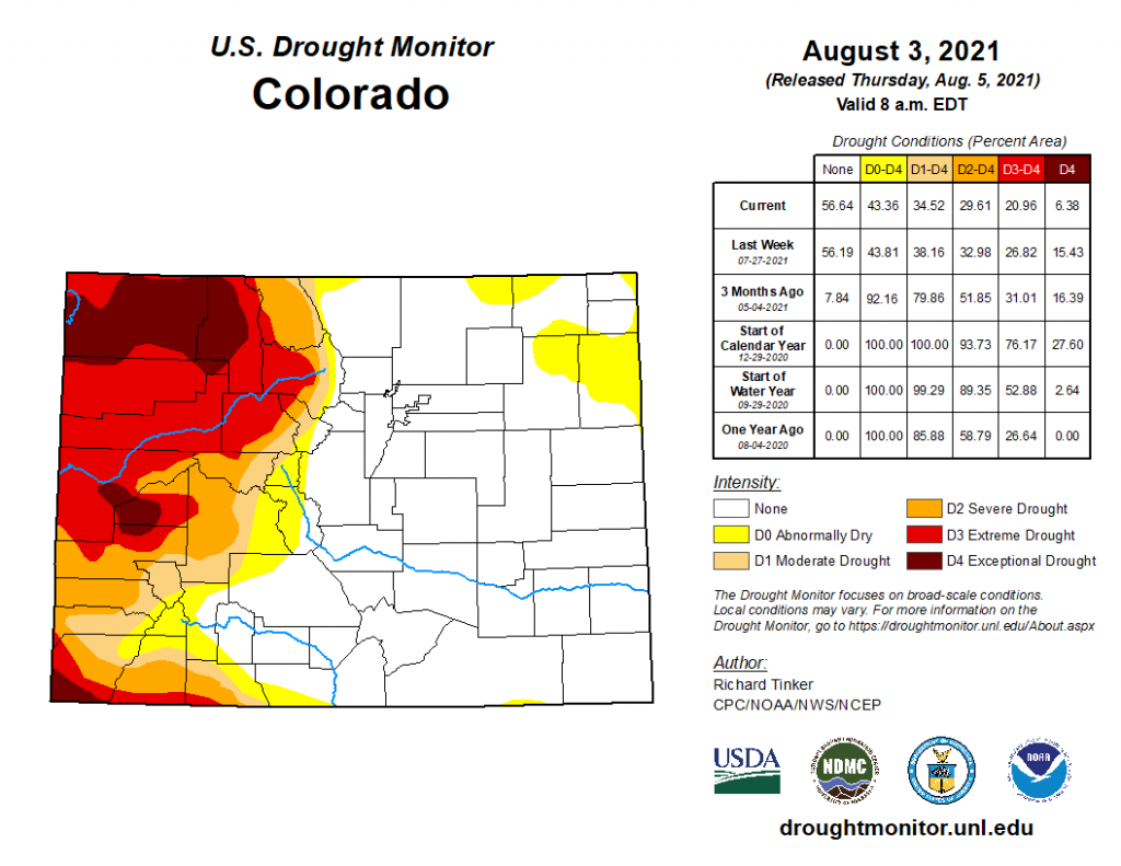
The latest drought monitor for Colorado was released yesterday (map below), reflecting conditions as of Tuesday, August 3rd. Several weeks of monsoonal moisture have not been enough to completely help Western Colorado’s Drought, but there have been improvements. The total area experiencing D4 “Exceptional Drought” has reduced by over half, especially on the Northwest Slope, and there have been improvements in regions experiencing D1-D3 drought as well. Most of the San Juan Mountains is no longer experiencing any drought conditions, which is a huge improvement from even 3 months ago. Conversely, dryer than normal weather in the Northeast Plains have led to some regions moving into D0 “Abnormally Dry” conditions.
For rainfall estimates in your area, check out the State Precipitation Map below.
