Issue Date: Thursday, July 29th, 2021
Issue Time: 10:35AM MDT
Summary:
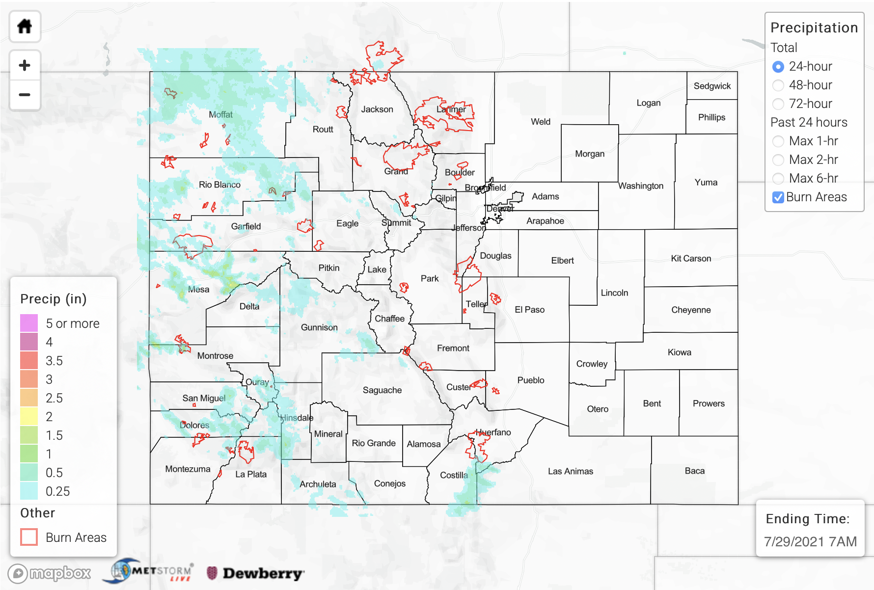
It has been a busy wet season with the last 13 days in a row receiving a flood threat, and yesterday was more of the same. So, we’ll just jump right in. On Wednesday, the Southeast Mountain/Raton Ridge intersect saw a few rounds of heavy rainfall producing storms due to slightly better moisture and instability across the southern border. Gages in the area recorded up to 0.55 inches of rainfall with storms lasting from about 1PM to 6:30PM. Radar estimated rainfall indicates between 1 and 2 inches of precipitation in the storm cores depending on the dataset used. As of this morning, flooding was not reported with these storms.
While it was pretty quiet to the east of the Continental Divide, outside of the storms discussed above, higher instability and moisture availability over western Colorado helped to generate some stronger storms that produced some torrential downpours and flooding issues. Slower steering flows to the west/northwest also aided in increasing local precipitation totals and the flood threat. Grand Junction also saw day 4 of measurable precipitation with two heavy rainfall reports (1.17 and 1.11 inches) over the west side of town that cause some street flooding. Gusts (~60 mph) from this severe thunderstorm caused some large branches to come down on the east side of town, and it also produced 1 inch hail. There was a debris flow at Exit 46 (Cameo) on I-70 at 7:20PM that closed both lanes of the highway. Near this debris flow, 1.05 inches of rainfall was observed by the public. A Flash Flood Warning was issued for the Pine Gulch burn area with this storm complex, but as of this morning, no flooding was reported.
Further south, there was another debris flow across Highway 145 near Placerville, CO (eastern San Miguel County). Radar estimated rainfall was up to 1.30 inches over this area. Finally, a CoCoRaHS stie in southern Archuleta County recorded 1.06 inches of rainfall, and once again lack of radars in the area likely underestimated rainfall over this region. Rainfall lingered over the Northwest Slope through about 2AM, but it was more stratiform in nature, so there were no flooding concerns. Tune into the FTO this afternoon to see how this ongoing rainfall has impacted the drought map.
To see rainfall estimates over your neighborhood over the last 24- to 72-hours, scroll down to our State Precipitation Map below.
Click Here For Map Overview
Note: The 24-hour, 48-hour and 72-hour total precipitation do not contain bias corrections today due to errors in the CoCoRaHS data. This means there may be underestimations in QPE over the southwest and southeast corners of the state.
