Issue Date: Tuesday, July 27th, 2021
Issue Time: 9:05AM MDT
— A LOW flood threat has been issued for the Grand Valley, Southwest Slope, San Juan Mountains, Southeast Mountains, Raton Ridge and Southeast Plains
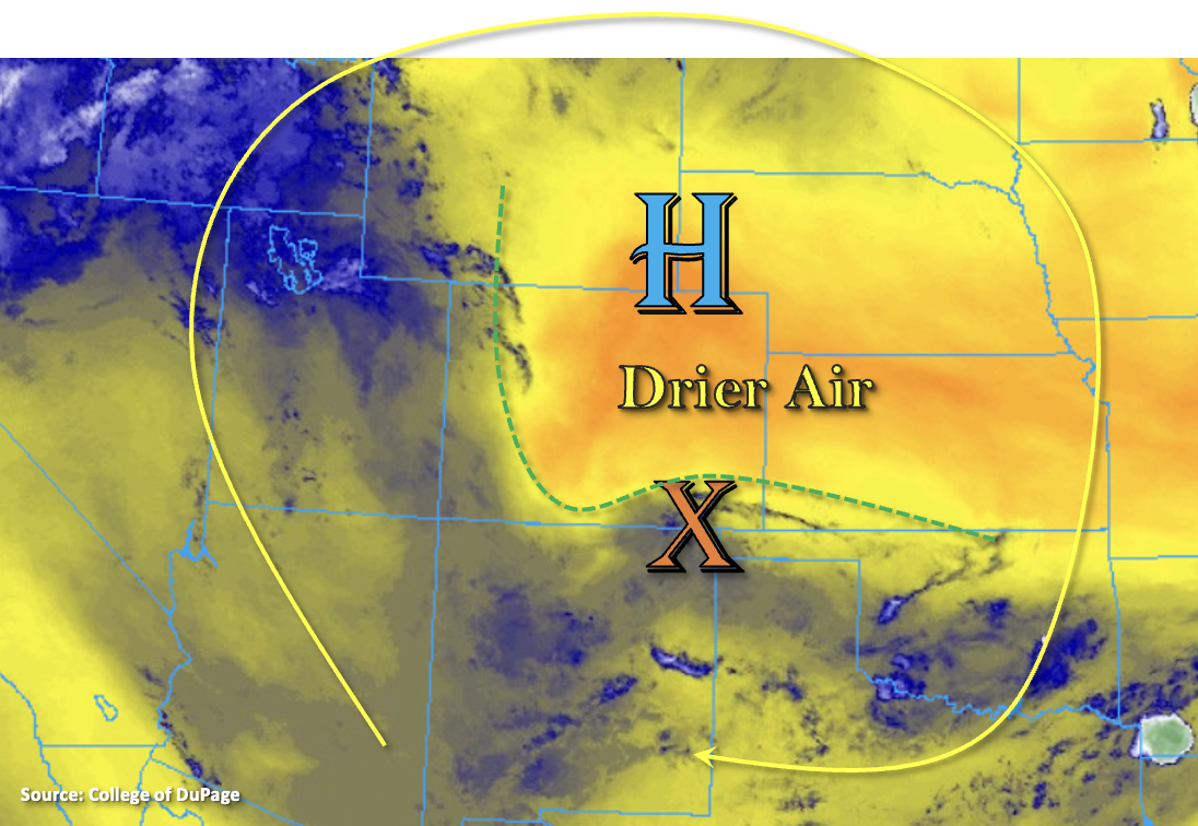
The ridge marked below will continue to strengthen over the next few days, which will be the main influence on our weather pattern through next week. The more northerly location of the High this morning has helped to pull a much drier air mass over a large portion of the state. This can be seen by the orange/yellow shades in the water vapor imagery below, and Denver’s PW has dropped to 0.47 inches. There is still monsoon moisture to the south and west of the dashed green line below (blue shades), and PW at Grand Junction remains around 1.10 inches. So, plenty of moisture for local, heavy rainfall again this afternoon and evening. Also marked in the water vapor imagery below is a subtle, but well-defined shortwave that will move west throughout the day (orange “X”). This will likely trigger more widespread coverage of rainfall over the southern elevated terrains west this afternoon. Generally categorizing the day, it is a rinse and repeat pattern of yesterday.
For most of the state, another hot and dry day is ahead. However, heavy rainfall chances return to the San Juan Mountains and elevated regions of the Southwest Slope and Grand Valley with that incoming shortwave providing extra lift and slower steering flows continuing. Additional heavy downpours will be possible over the southern Southeast Mountains and Raton Ridge within that remaining plume of monsoon moisture. A LOW flood threat has been issued with the main threats being mud flows and debris slides (steeper terrains), road flooding, local stream/creek flooding and field ponding underneath the stronger storm cores.
Today’s Flood Threat Map
For more information on today’s flood threat, see the map below. If there is a threat, hover over the threat areas for more details, and click on burn areas to learn more about them. For Zone-Specific forecasts, scroll below the threat map.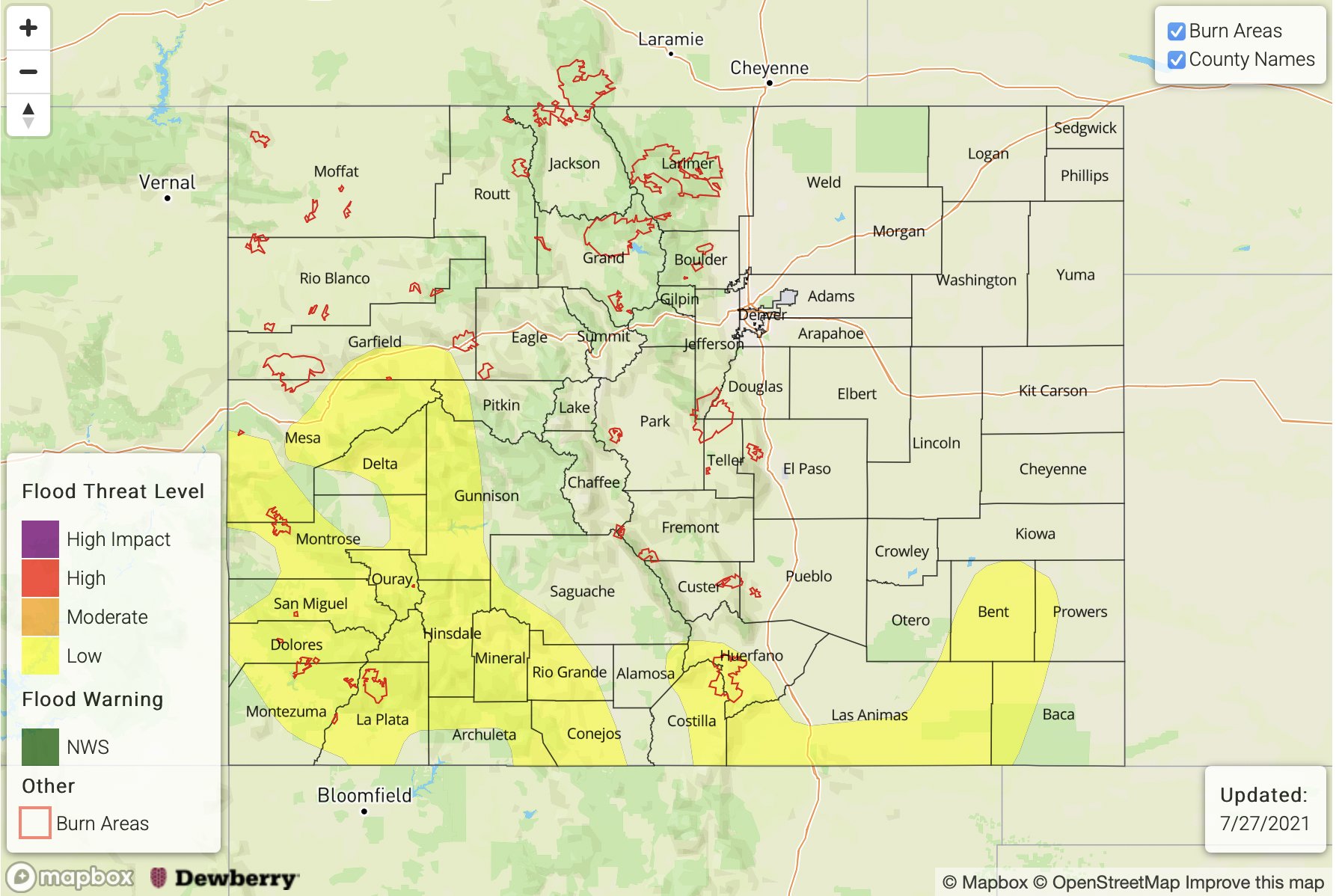
Zone-Specific Forecasts:
Grand Valley, Central Mountains, Southwest Slope, San Luis Valley & San Juan Mountains:
Storms should be more widespread south with more isolated storm coverage further north. Max 1-hour rain rates up to 1.75 inches (south) and 1.20 inches (north) will be possible. Local storm totals up to 2 inches will be possible over the western San Juan Mountains by morning if multiple storms are able to track over the same area. A LOW flood threat has been issued. Flood threats today include local stream flooding, mud flows/debris slides and road flooding in low-lying areas. Isolated showers may linger until 2AM, but the flood threat should end a couple hours past sundown. Stay tuned into your local NWS office for the latest on real-time warnings this afternoon.
Primetime: 12PM to 2AM
Southeast Mountains, Raton Ridge & Southeast Plains:
High monsoon moisture is still present across the southern border, which could aid in heavy rainfall producing storms this afternoon and evening. Max 1-hour rain rates up to 1.25 inches will be possible and storm totals (east) could reach up to 2.50 inches. Road flooding, local stream flooding, arroyo flooding and mud flows/debris slides (mtns) are all possible. A LOW flood threat has been issued.
Primetime: 12:30PM to 9:30PM
Front Range, Northern Mountains, Northwest Slope, Palmer Ridge, Urban Corridor and Northeast Plains:
Mostly dry and hot day is ahead. Highs will reach in the mid to upper-90Fs across the lower elevations with 80Fs for the mountains. Best chance for measurable rainfall will be over the mountains, and this is most likely over the Northern Mountains and Northwest Slope. Totals up to 0.50 inches will be possible. A weak, high-based storm or two could also develop over the climatologically favored Teller County region. Flooding is NOT forecast.
Primetime: 12:30PM to 9:30PM