Issue Date: Thursday, July 22nd, 2021
Issue Time: 12:35PM MDT
Valid Dates: 7/23-8/6
After a few recent monsoon seasons turned out to be “duds”, most notably 2020, 2021 is reminding is just how persistent higher terrain storm activity can be when enough monsoon moisture is present. As we repeat many times within our discussions, our unique topography can drive its own atmospheric circulation that generates storms activity. Although the monsoon can produce dangerous flooding anywhere, it is particularly troubling for fresh burn scar areas. The table below shows that, at this point, each of our six “major” burn scars that we track daily, has experienced flooding during 2021. Of the 14 separate events (note that some of the days actually had multiple separate runoff events), 13 of the 14 have occurred during the monsoon season. That is the bad news.
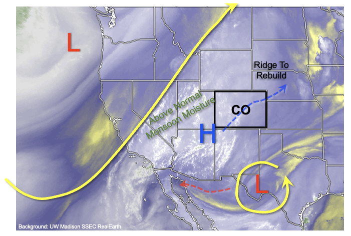
The good news is that new wildfire activity will be prevented as long as soil moisture is replenished with measurable rainfall every so often. Fortunately, as shown in the water vapor image, below, during the next 10 days, perhaps longer, we expect a very active monsoon to continue across the Four Corners and into western Colorado. West of the Continental Divide, PW is expected to remain 20-50% above normal as residual monsoon moisture moves around the region. Additionally, the ridge aloft that has been centered very close to Colorado in the recent days will re-emerge to the northeast/east of us and strengthen. One important ramification of this will be an increase in temperatures especially east of the Continental Divide where downsloping winds will produce 100F+ heat at lower elevations below 5,000 feet. However, the more relevant impact of such a ridge position will be to keep advecting fresh monsoon moisture from its “source” region of the highlands of western Mexico and the Gulf of California.
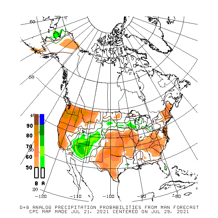
The map below from the Climate Prediction Center shows the composite anomalous precipitation (% of normal) that occurred on the top 10 matching days with the upper-level ridge over the Central Plains, as is being forecasted. Interestingly, despite general below normal precipitation over the western United States, the monsoon region stands out quite drastically with a 70% or greater chance of seeing above normal precipitation. Keep in mind that this analysis relies on heavily smoothed precipitation grids, implying an even greater chance of seeing above normal precipitation over the preferred regions of the San Juans, Central and Northern Mountains over the next 10 days or so. Thereafter, uncertainty increases as guidance suggests the ridge will move closer to Colorado, which would tend to promote some drying. However, it remains to be seen whether this occurs, since it will take some time to scour out so much moisture.
For this Outlook, we have identified a single, but prolonged precipitation Event, described in more detail below.
Event #1: Friday – Saturday (July 23 – July 31)
Persistent Elevated Flood Threat For Higher Terrain
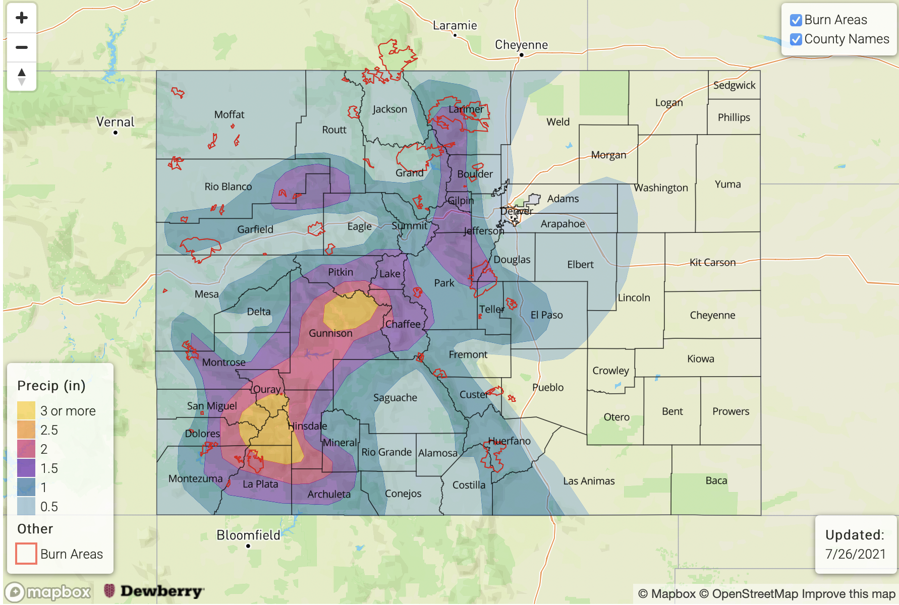
Although plenty of day-to-day variability is expected in terms of the exact positioning and peak intensity of heavy rainfall, we expect daily showers and thunderstorms to cover the high terrain over this period. In terms of rainfall intensity, 1 inch per hour or greater intensity appears very likely daily with even higher storm total amounts. However, during particularly active days, up to 2 inches per hour of rainfall could occur. The preferred areas will be entire higher terrain, with the exception of the Southeast Mountains that will be more susceptible to subsidence and intrusions of drier air from the east.
In all, we expect that widespread locations in the higher terrain will experience at least 2 inches of rainfall over the course of this event, with isolated locations likely exceeding 3 inches. Even higher totals will be possible depending on the favorability of setups that cannot be determined with this kind of lead time. In terms of impacts, isolated flash flooding, mud flows and debris slides will be likely throughout the Event. However, smaller basins such as creeks and tributaries will also be susceptible to riverine flooding given that repeated days with precipitation will increase base flows.
Please check in on daily Flood Threat Bulletins for the latest updates, and pay attention to National Weather Service products for real-time warnings and advisories.


