Issue Date: 8/4/2015
Issue Time: 9:25AM
Summary:
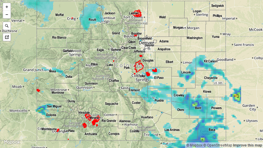
A vigorous atmospheric disturbance skirted across western Colorado, using monsoon moisture to fuel scattered to widespread thunderstorm activity for most areas except for the Northeast Plains. The first wave of thunderstorms began shortly after noon in the Southeast Plains and Northwest Slope. By mid-afternoon, heavy rainfall was being reported over many locales. Some of the more impressive 24-hour totals were 2.75 inches in Bent County, 1.14 inches in Pueblo County and just under 1 inch in Routt County (an observer reported about 0.35 inches in 15 minutes falling near Steamboat Springs). A long list of counties saw very short-term heavy rainfall that amounted to anywhere between 0.5 to 0.9 inches. A flash flood report came in from Cheyenne County around 5PM, as water was flowing over a road.
A second wave of thunderstorms developed over the Southwest Slope where short-term heavy rainfall was noted, along with 1 inch hail and even several funnel reports. A flash flood report was received from Dolores County where up to 2 inches of rainfall may have fallen over a very localized area. A separate wave of storms developed over the Southeast Mountains, and moved eastward producing heavy rainfall over a 15-30 minute period of time.
In all, about 14 warnings and advisories were issued by the National Weather Service offices covering the state. Of these, all but one were flash flood / flood related. Certainly another busy weather day across our state.
For an estimate of 24-hour rainfall that occurred in your area, please check out our radar based map below. Note that because a radar’s beam cannot penetrate through mountainous terrain, rainfall amounts in the Flat Top, Park and Gore mountain ranges may be underestimated.