Issue Date: Monday, July 19th, 2021
Issue Time: 2:40PM MDT
Valid Dates: 7/20 – 8/3
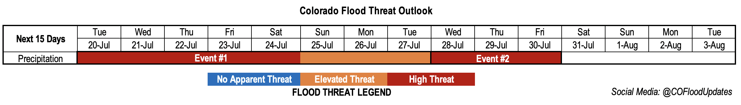
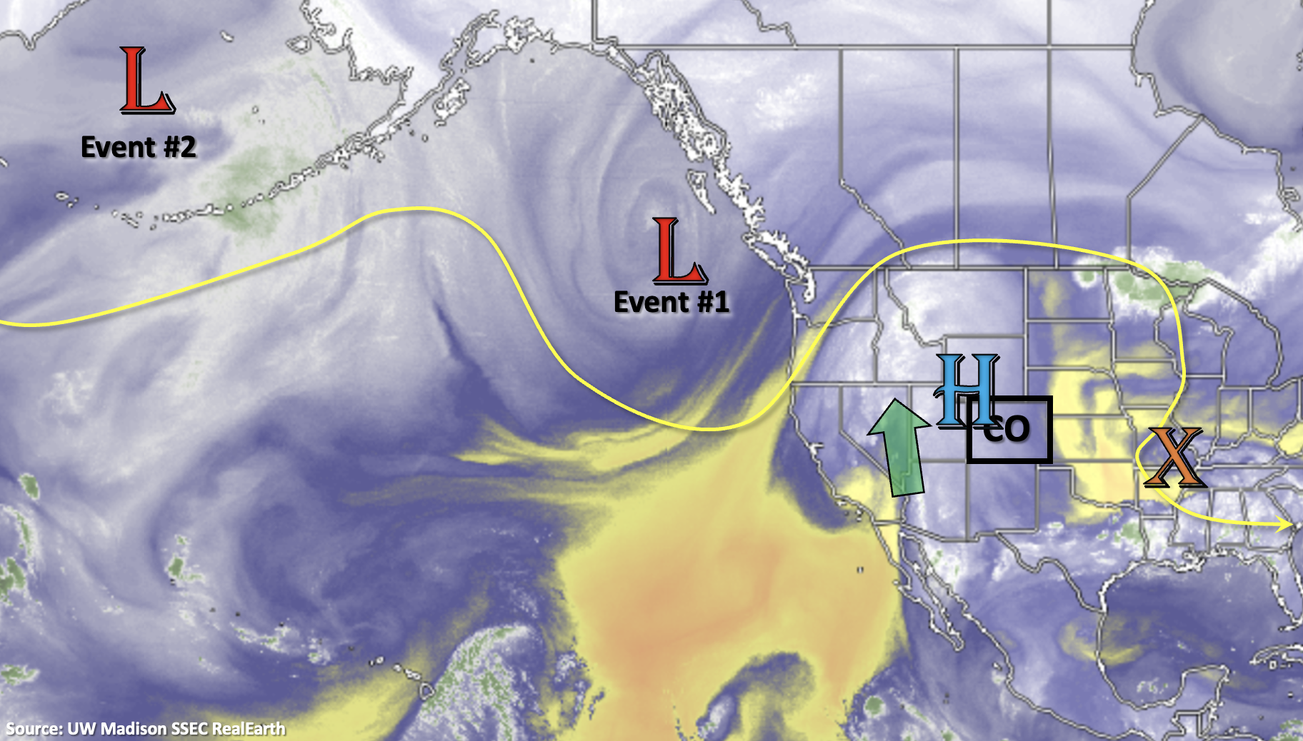
We’re well into the heart of the monsoon season now, and it has been a busy one with an early onset. Another active FTO is forecast with the nearly stationary upper-level High/Low pattern allowing for an impressive, long-lasting moisture surge over the western US into next week (Event #1). For the most part, Event #1 will affect the western portion of the state, but storm coverage is expected to increase over the eastern mountains by this weekend. In addition to the heightened moisture, there is plenty of mid-level energy forecast to move through the flow. These pockets of lift, especially when timed with peak heating, can help to expand the heavy rainfall coverage and intensity. Tracking these subtle shortwaves in the daily FTB will likely be the key to determining the heavy rainfall threat and location each day. This is especially true because there’s a chance for ongoing cloud cover with this persistent rainfall pattern, which may inhibit the amount of instability that can build.
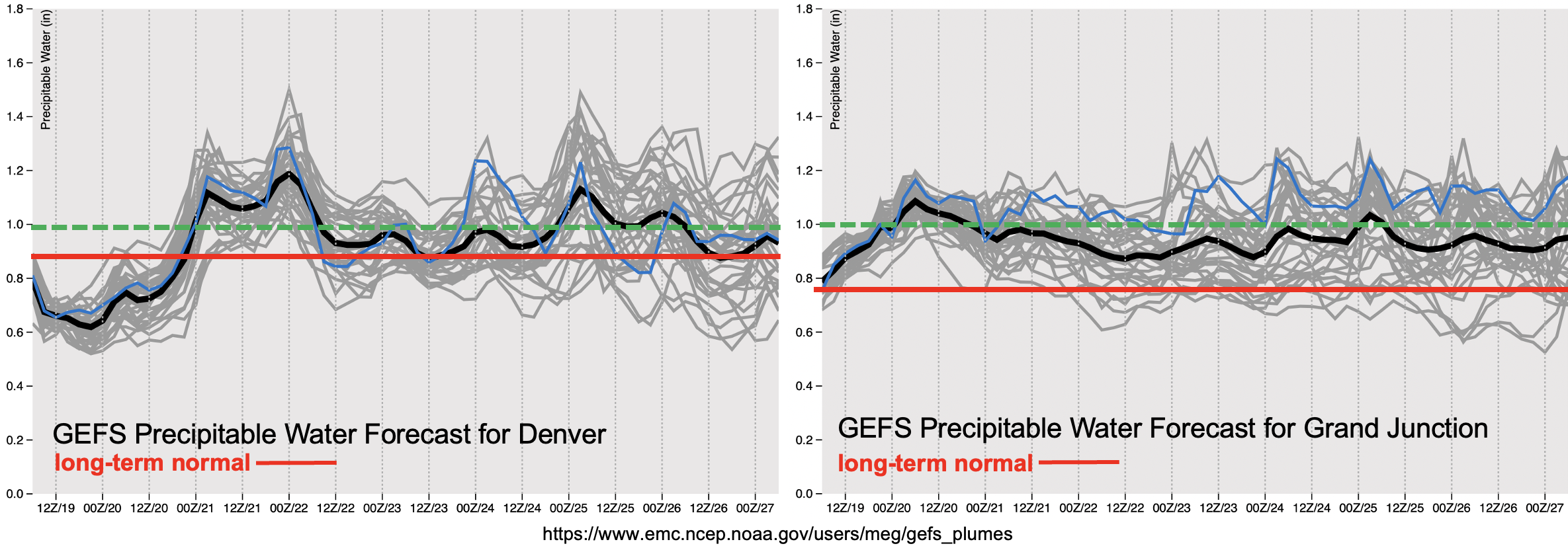
Below the PW plumes from the GEFS (below) show how impressive this surge of moisture really is in the context of climatology (red line). Keep in mind that this forecast period is at the height of PW in terms of climatology. PW values (black line), both east and west, are forecast to remain above climatology throughout Event #1. The green dashed line below shows the 1 inch PW value, which is a good proxy for the heavy rainfall threat. Even with the slight lull in PW Thursday and Friday, PW still remains above the long-term normal. For this reason, a High flood threat has been issued.
There isn’t a break before Event #2 begins mid-next week as it is, more or less, a shift of the plume eastward. At this time, it looks like moisture will remain well-above climatology with a similar High/Low pattern setting up. The one difference is that it looks like the heavy rainfall threat will shift into the high terrains east of the Continental Divide with subtle movement of the ridge axis. A High threat has been issued for Event #2.
Keep scrolling below to read more details about each of the events.
Event #1: Tuesday – Tuesday (7/20 – 7/27)
High/Elevated flood threat as a High/Low pattern holds a strong moisture plume in place over the next week.
It’s going to be rainy the next week over western Colorado, which will be welcomed by most. However, with a strong moisture plume intact, the threat for heavy rainfall increases. Highest totals are expected to over the climatologically favored San Juan and Central Mountains. This includes the elevated plateaus of the Grand Valley, Northwest Slope and Southwest Slope. One limiting factor to the heavy rainfall threat may be ongoing cloud cover, which could inhibit instability from developing and slightly lower rainfall rates. Still, even the moderate intensity storms that develop, will be capable of producing higher rainfall rates than normal with the nearly saturated environment. A peak in intensity and coverage of storms is forecast on Wednesday. Threats over steeper terrains for this event include mud flows, debris slides and excessive runoff. These threats are expected to increase after a couple days of rainfall begins to saturate the soils. Recent burn areas, especially Grizzly Creek, will be susceptible (on and off) to flooding through next week. Be sure to tune into the FTB for the latest each morning as the potential heavy rainfall threat can be better pinpointed.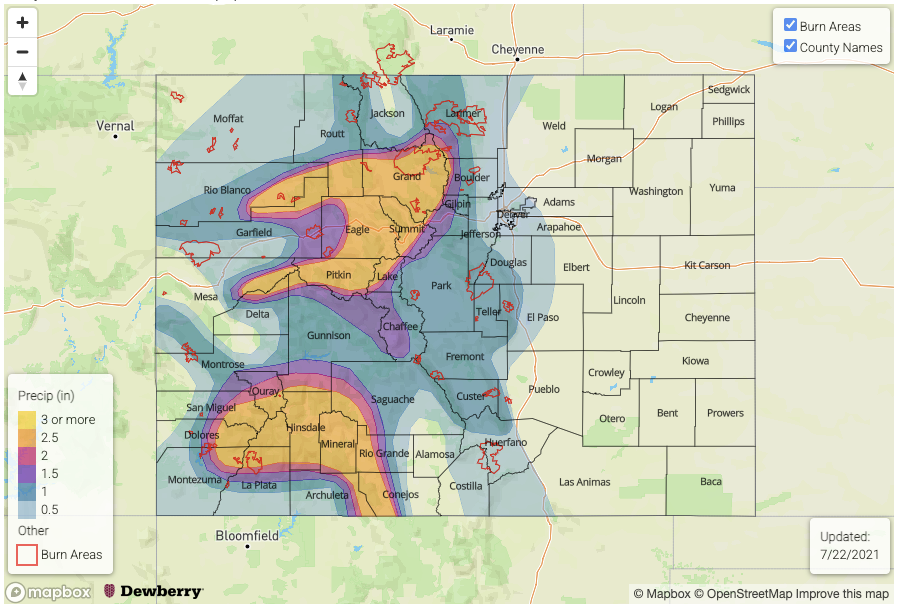
Event #2: Wednesday – Friday (7/28 – 7/30)
Slight shift in the ridge axis shifts threat east, but moisture remains above average, so a High flood threat is issued.
Not much of a break as the above average moisture rotates into eastern Colorado mid-next week. As far as the location of the heavy rainfall, went ahead with climatology for this event. Slower steering flows with the High overhead should keep most of the storms over the mountains, although there may be some spill over into the immediate adjacent plains and ridges. Be sure to tune back into the FTO on Thursday for the latest on this developing event.