Issue Date: Thursday, July 15, 2021
Issue Time: 9:30 AM MDT
Summary:
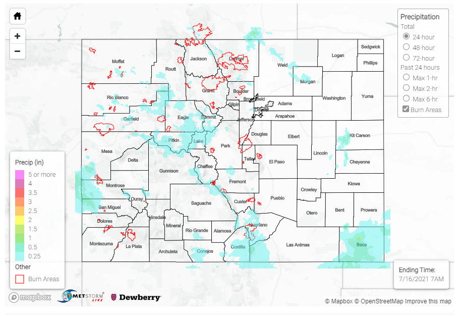
Yesterday began with early morning precipitation in the Southwest Slope and Grand Valley associated with an upper-level low, which then made its way eastward throughout the day tapping into additional moisture and providing necessary lift ahead of the disturbance. By the afternoon, much of the Northern, Central, Front Range, and Southeast Mountains were experiencing widespread showers, with isolated embedded convection producing higher rainfall totals within. Storms also spilled over in to the Urban Corridor. A late evening lines of thunderstorms produced heavy rain on the Southeast Plains.
Another day of rain in the Central Mountains translated to another I-70 closure in Glenwood Canyon due to debris flows. A flood warning was issued at 3:35 pm for the Grizzly Creek burn area, which promptly caused CDOT to close I-70. The flood warning expired at 5:30 pm, however the interstate remained closed for more than 4 hours after the afternoon rain caused two “shallow” debris flows. I-70 has since been cleared and reopened around 8:00 pm last night.
Additional flood warnings issued across the state included an urban and small stream flood advisory issued in Denver. CoCoRaHS observers and UDFD gages measured between 0.20-0.74 inches across the Denver Metro Area. Warnings were also issued for the Pine Gulch burn scar in the Northwest Slope/Grand Valley, and the Spring Burn Scar in the Southeast Mountains, however no flooding was reported on these burn scars.
Some notable rainfall totals:
- Heavy rain associated with a severe thunderstorm in Collbran, with 0.78 inches reported by a trained spotter.
- 1.46 inches from a CoCoRaHS observer in Springfield, CO on the Southeast Plains and a nearby NWS/FAA gauge reported 2.41 inches in 24-hours. Most of the rain in Springfield fell in 3-hour period, which translates to an 8-year Average Recurrence Interval based on Precipitation Frequency Estimates from NOAA Atlas 14.
For rainfall estimates in your area, check out the State Precipitation Map below.
Click Here For Map Overview
