Issue Date: Tuesday, July 13th, 2021
Issue Time: 9:30AM MDT
— A LOW flood threat has been posted for parts of the San Juan Mountains and Southeast Mountains
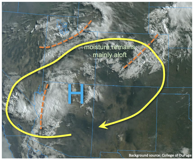
As expected, changes are in the air over Colorado today. As shown in the visible satellite image, below, one easily seen difference since yesterday morning is the expansive deck of mid-level clouds seen mainly across northern and central Colorado. These clouds were mainly located in a narrow layer roughly 15-18k feet above the surface, as seen in both the Denver and Grand Junction soundings. They are associated with multiple disturbances, of monsoon origin, that have raised Precipitable Water to about 0.8 inches at both Grand Junction and Denver. For most areas (as mentioned in yesterday’s Outlook) it will take time to moisten the boundary layer to make it conducive for heavy rainfall. Additionally, the cloud deck will significantly impede instability for most of the state leading to a light to moderate intensity rainfall this afternoon and evening, so no complaints there.
There are two areas that we are watching for heavy rainfall chances. The first will be the climatologically favored San Juan Mountains and Southeast Mountains, where instability will locally exceed 1,000 J/kg this afternoon. Rain rates have been on the higher side of our model guidance the past two days and today’s guidance has significantly increased compared to yesterday. Thus, a Low flood threat is warranted for these areas through early evening, before instability quick diminishes and precipitation transitions to a more gradual rainfall. The second area is in the Northeast Plains where a cool front/outflow boundary has moved in from the northeast. To the north of the boundary, only limited instability is expected. To the south, higher instability will support the chance of strong-to-severe thunderstorms that will be capable of heavy rainfall and damaging winds. However, the limiting factor is strong SE steering winds aloft that will limit point rainfall. Thus, rainfall rates are expected to stay just below flood thresholds.
Finally, the change to more westerly flow aloft will finally clear out the smoky skies a bit today, as will any rainfall.
Today’s Flood Threat Map
For more information on today’s flood threat, see the map below. If there is a threat, hover over the threat areas for more details, and click on burn areas to learn more about them. For Zone-Specific forecasts, scroll below the threat map.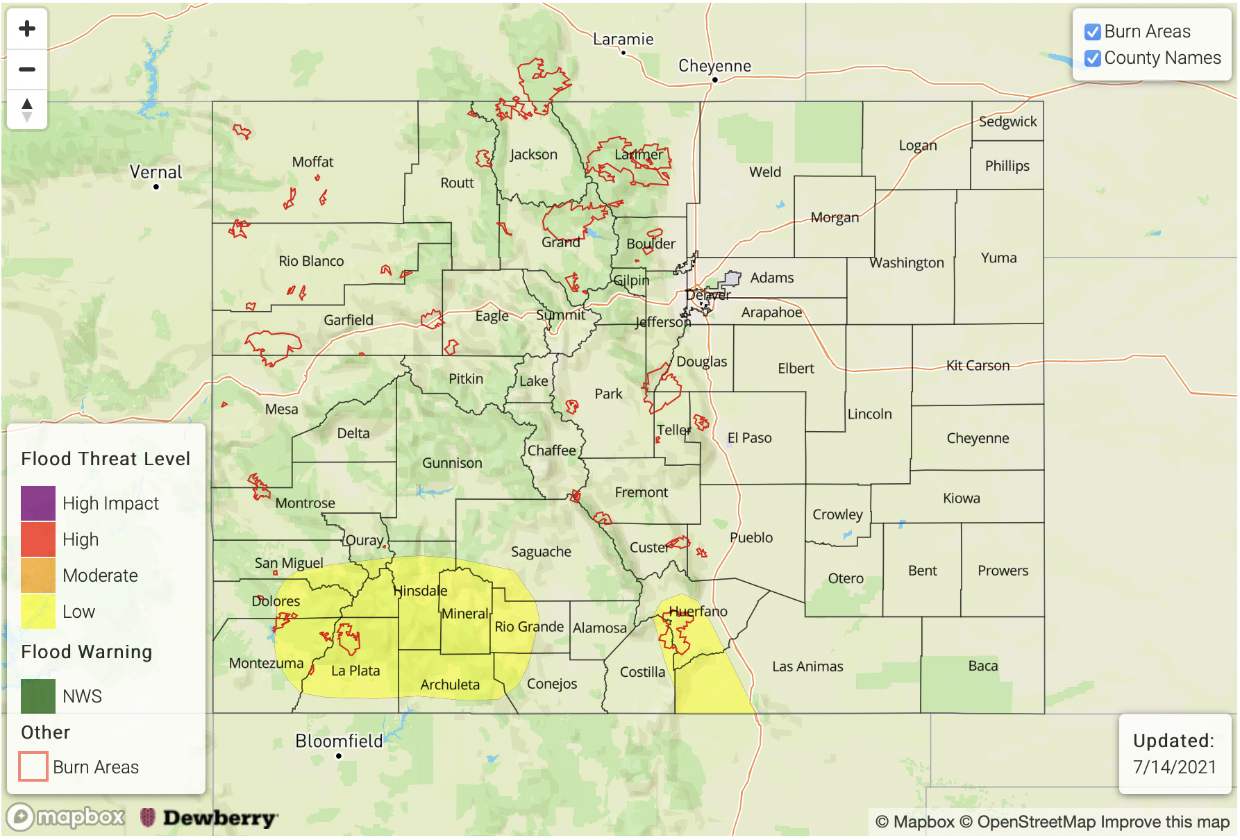
Zone-Specific Forecasts:
Grand Valley, Northwest Slope, Southwest Slope, Central Mountains, San Luis Valley, San Juan Mountains, Southeast Mountains & Northern Mountains, Front Range:
Scattered to numerous showers and thunderstorms developing, with better coverage for elevations above 7,500 feet. Max 30-minute rainfall up to 0.8 inches and max 1-hour rainfall up to 1.2 inches in southern areas, where a Low flood threat has been posted for isolated flash flooding, debris slides and mud flows. Further north, max 1-hour rainfall up to 0.7 inches is possible. Gusty winds could accompany the stronger storms, especially over northern areas.
Primetime: 12PM to 9PM
Raton Ridge, Northeast Plains, Palmer Ridge, Urban Corridor & Southeast Plains:
Partly to mostly cloudy early, then isolated to scattered showers and thunderstorms possible this afternoon. Max 1-hour rainfall up to 1.5 inches in the east and 0.8 inches for the foothills and adjacent areas. Damaging winds will be possible with the stronger storms over the Northeast Plains. However, flooding is NOT expected today.
Primetime: 1PM to 10PM