Issue Date: Monday, July 12th, 2021
Issue Time: 8:45AM MDT
— Flooding is NOT expected today
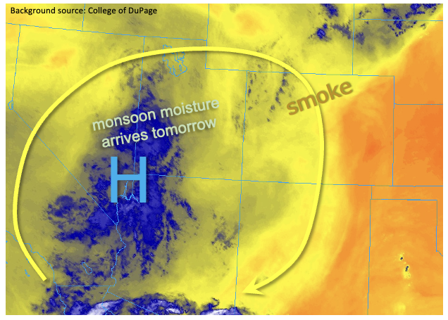
A “persistence” pattern remains overhead for today, with PW at Grand Junction and Denver holding in the 0.50 – 0.57 inch range. Slightly more moisture was noted at mid-levels today, which will increase storm coverage across the entire higher terrain compared to yesterday. However, even so, only isolated to perhaps widely scattered storms are expected, with the highest coverage continuing to be in the San Juan Mountains and Southeast Mountains along the New Mexico border. As shown in the water vapor image, below, a much more active day of rainfall is expected tomorrow as a slow-moving pool of monsoon moisture enters Colorado from the west. But for today, flooding is NOT expected.
The big story today continues to be the smoky skies across all of Colorado, arising from dozens of new and ongoing wildfires in MT, ID, OR and WA. A rough count this morning showed 26 wildfires in Montana alone, with a few exceeding 10,000 acres in size. Some reduction is smoke is expected tomorrow as our steering flow changes to more westerly and rainfall removes some ash particles from the sky.
Today’s Flood Threat Map
For more information on today’s flood threat, see the map below. If there is a threat, hover over the threat areas for more details, and click on burn areas to learn more about them. For Zone-Specific forecasts, scroll below the threat map.

Zone-Specific Forecasts:
Grand Valley, Northwest Slope, Southwest Slope, Central Mountains, San Luis Valley, San Juan Mountains, Southeast Mountains & Northern Mountains:
Becoming partly cloudy, hot and continued smoky and hazy skies. Isolated to widely scattered showers and thunderstorms are expected early afternoon through the evening hours. Max 1-hour rainfall 0.3 inches, except up to 0.6 inches along the New Mexico border. Flooding is NOT expected today.
Primetime: 1PM to 9PM
Front Range, Raton Ridge, Northeast Plains, Palmer Ridge, Urban Corridor & Southeast Plains:
Hazy conditions will continue today with the ongoing fire activity. Isolated to perhaps widely scattered storms are possible over the higher terrain above 8,000 feet today. Max 1-hour rainfall up to 0.3 inches possible. Flooding is NOT expected today.
Primetime: 1PM to 8PM