Issue Date: Friday, July 9th, 2021
Issue Time: 9:15AM MDT
— Flooding is NOT expected today
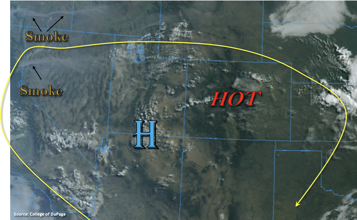
It’s going to be a scorcher today with the 5940m height over the state. High temperatures across the lower elevations of the Grand Valley are forecast to reach 100-105F, so a Heat Advisory has been issued. Also noticeable in the visible satellite imagery below are lots of smoke plumes from the ongoing fires across the west. Guidance indicates some modest near surface smoke will move into the Northwest Slope and Grand Valley this evening and overnight.
A shortwave, currently located over Idaho, is expected to rotate around the High today, which will push the High west but will also help provide some extra lift for thunderstorm development out in front of it. As far as rainfall chances, PW at Grand Junction and Denver was measured at 0.80 and 0.70 inches, respectively. Much of this moisture is in the mid-levels of the atmosphere, so with a large spread between dew points and temperature near the surface, the main threat from the high-based storms that fire this afternoon and evening will be strong outflow winds again. With PW increasing to 1.11 inches over North Platte, NE, more measurable rainfall is anticipated for storms as they move into the Northeast Plains and far eastern border counties. A jet, accompanying the shortwave, should keep storms moving at ~20 mph to the southeast, which will limit the flood threat today. Additionally, the extra dynamics over the Northeast Plains may help produce an isolated severe thunderstorm or two late this afternoon into this evening. Flooding is NOT expected today.
Overnight a cold front drops in from the north over eastern Colorado, which could produce some very strong gusts over the foothills and I-25 Corridor as it moves south.
Today’s Flood Threat Map
For more information on today’s flood threat, see the map below. If there is a threat, hover over the threat areas for more details, and click on burn areas to learn more about them. For Zone-Specific forecasts, scroll below the threat map.
Zone-Specific Forecasts:
Northeast Plains, Palmer Ridge & Southeast Plains:
Scattered storms are expected to move into these areas by mid-afternoon (north) and early evening (south) as the shortwave makes it way east. The earlier storms, to the north, are expected fire over the Cheyenne Ridge and move across the border with the northwest steering flow. With the jet and shortwave overhead, an isolated, low-end severe thunderstorm or two may be possible over the far northeast corner of the state. Faster steering flow should limit the heavy rainfall threat today with max 1-hour rain rates up to 1 inch possible. Further south, storms will move into the area later this afternoon into this evening. There is less of a risk for any severe thunderstorm development, but storms could produce some very strong outflow winds. Max 1-hour rain rates up to 0.75 inches will be possible. Due to the faster steering flows, flooding is NOT forecast today. Strong winds could develop late tonight as the cold front drops south through eastern Colorado.
Primetime: 3:30PM to 11PM
Front Range, Southeast Mountains, Raton Ridge & Urban Corridor:
Daily high temperature records may be broken today, so be sure to carry water with you if you’re outside. Scattered storms should fire over the elevated ridges and eastern mountains by early afternoon. Better coverage of storms looks to be south over the Southeast Mountains and across the southern Front Range. High storm bases will limit the rainfall potential with max 1-hour rain rates up to 0.20 inches forecast. The main threat from storms that develop this afternoon is expected to be gusty outflow winds again. Flooding is NOT forecast. Strong wind gusts overnight (up to 55mph) will be possible across the I-25 Corridor and foothills as the next cold front drops south.
Primetime: 1:30PM to 8:30PM
Central Mountains, San Luis Valley, San Juan Mountains, Northern Mountains, Grand Valley, Northwest Slope & Southwest Slope:
A Heat Advisory has been issued for the lower elevations of the Southwest Slope and Grand Valley today. Hot temperatures, low relative humidity and increasing surface winds will also cause an uptick in fire danger north. A Red Flag Warning has been issued for the Northwest Slope. Best chance for measurable rainfall will be over the San Juan Mountains again where a little better moisture can hang on. Storms are expected to be scattered in nature and only produce isolated rain totals around 0.15 inches, so flooding is NOT anticipated.
Primetime: 1PM to 8:30PM