Issue Date: Friday, July 9, 2021
Issue Time: 9:50 AM MDT
Summary:
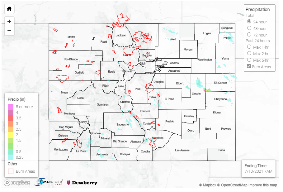
Yesterday was a hot one, which increased atmospheric stability across the state and limited precipitation overall. Still, isolated high elevation showers began to pop in the early afternoon and filled in as the afternoon progressed with a general eastward movement.
Light accumulations were reported by CoCoRaHS observers in the Northern, Central, and Front Range Mountains, as well as some in the Urban Corridor. Between 0.01-0.0.5 was reported across Fort Collins and Loveland. Totals were higher from isolated cells in the Southwest Slope and San Juan Mountains, including 0.31 inches in Nathrop, 0.46 inches in southern Saguache County, and 0.5 inches northwest of Pagosa Springs.
A flash flood warning was issued for the Spring Burn Scar in Costilla and Huerfano Counties after Doppler radar indicated heavy rain over the area. The Ute Creek SNOTEL station to the west of the burn scar reported 0.6 inches of rain throughout the day, confirming some heavy rainfall. However, no flooding was ultimately reported.
Looking at the State Precipitation Map below, there is an area of what appears to be very high rainfall on the Lincoln-Kit Carson-Cheyenne County borders. This is a radar artifact from a large wind farm producing clutter. There were still some isolated accumulations of note on the Eastern Plains though, 0.3-0.4 was reported in Cheyenne Wells. Additionally, a severe thunderstorm produced a short-lived dust storm that reduced visibility to near zero on the Colorado-Kansas border on I-70.
For rainfall estimates in your area, including antecedent rainfall totals, check out the State Precipitation Map below.
Click Here For Map Overview
Note: The 24-hour, 48-hour and 72-hour total precipitation do not contain bias corrections today due to errors in the CoCoRaHS data. This means there may be underestimations in QPE over the southwest and southeast corners of the state.
