Issue Date: Thursday, July 8th, 2021
Issue Time: 8:55AM MDT
— Flooding is NOT expected today
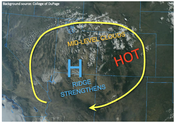
Gradual drying of the atmospheric column continues over Colorado today with PW dropping to 0.63 and 0.66 inches at Grand Junction and Denver, respectively. More importantly, the boundary layer continues to dry with dewpoint temperatures falling about 2-5F compared to yesterday morning. As shown in the visible satellite image, below, a deck of mid-level clouds was noted along the UT border from a weak disturbance. However, with mid-level temperatures continuing to warm today, instability will be limited with rainfall having a difficult time making it to the ground. The best chances for light showers and isolated weak storms will be over the higher terrain, especially over southern Colorado. Gusty winds will likely accompany any stronger storm that does manage to form. However, flooding is NOT expected today.
The big story today will be the return to much above normal temperatures, pushing above 100F below 5,000 feet. For reference, the record high temperature today in Grand Junction is 104F, while Denver’s is 103F. Both sites have very long periods of record dating back to the late 1800s, so any records would be impressive.
Today’s Flood Threat Map
For more information on today’s flood threat, see the map below. If there is a threat, hover over the threat areas for more details, and click on burn areas to learn more about them. For Zone-Specific forecasts, scroll below the threat map.

Zone-Specific Forecasts:
Northern Mountains, Central Mountains, San Juan Mountains, Southeast Mountains, Front Range and Palmer Ridge:
Isolated to widely scattered showers and thunderstorms this afternoon and evening. Max 1-hour rainfall up to 0.3 inches north of I-70 and 0.6 inches south of I-70 especially towards the New Mexico border. Gusty winds will accompany the strongest storms. Flooding is NOT expected today.
Primetime: 12pm to 9pm
Urban Corridor, Northeast Plains, Southeast Plains, Raton Ridge and San Luis Valley:
Very hot with isolated showers and perhaps a weak storm possible this afternoon and evening. Gusty winds will be possible with any stronger storm. Max 1-hour rainfall up to 0.3 inches. Flooding is NOT expected today.
Primetime: 2pm to 10pm
Northwest Slope, Grand Valley and Southwest Slope:
Very hot today with mostly dry conditions. An isolated shower or storm cannot be ruled out especially in the foothills. Max 1-hour rainfall up to 0.2 inches. Winds will pick up this afternoon, and a Red Flag Warning has been posted for parts of the region.