Issue Date: Wednesday, July 7th, 2021
Issue Time: 9:10AM MDT
— Flooding is NOT expected today
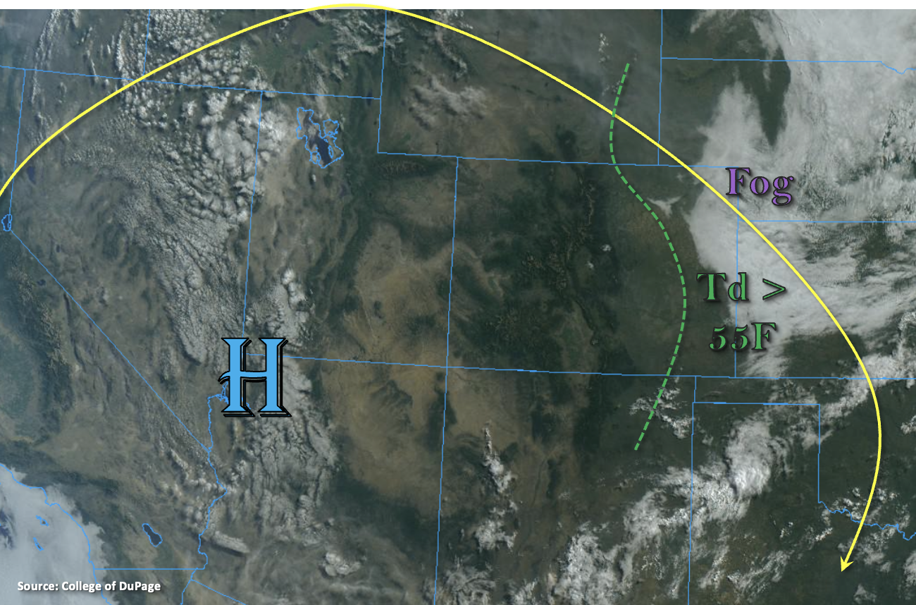
High surface moisture and cool temperatures over the far eastern plains are helping to create some dense fog this morning. This should burn off by late morning with a little heating from the strong July sunshine. While dew points are still greater than 55F to the east of the green dashed line below, the morning sounding at Denver shows much drier conditions above ~700mb. That means that as the day continues, the surface moisture should have an easier time mixing out of the boundary layer. PW was measured at 0.74 inches and 0.66 inches at Denver and Grand Junction, respectively, which are lower than yesterday. So, with this drier air mass establishing itself over the state, a break from heavy rainfall is anticipated today. The eastward moving ridge will also aid in supporting subsidence (sinking) and warming temperatures.
Best chance for measurable rainfall today will exist along the southern border over the higher terrains. Isolated storms may drop small pockets of rainfall up to 0.25 inches. Weaker storms will also be possible along and near the Continental Divide, although accumulations should stay under 0.10 inches and most storms will only produce cloud cover and virga. This break in rainfall is very welcome as it will allow soils over the mountains to dry out, which have received quite a bit of precipitation over the last week or so. As anticipated, flooding is NOT forecast.
Today’s Flood Threat Map
For more information on today’s flood threat, see the map below. If there is a threat, hover over the threat areas for more details, and click on burn areas to learn more about them. For Zone-Specific forecasts, scroll below the threat map.

Zone-Specific Forecasts:
Front Range, Southeast Mountains, Raton Ridge, Urban Corridor, Northeast Plains, Palmer Ridge & Southeast Plains:
Highs over the lower elevations will reach into the upper 80Fs and low 90Fs with mid 80Fs forecast for the elevated ridges. Mountain valleys will reach into the upper 70Fs and low 80Fs. With plenty of sunshine and only a few isolated, weak storms forecast, it’s going to be a beautiful day ahead. Best chance for measurable rainfall will be over the Southeast Mountains/Raton Ridge intersect where isolated rain totals up to 0.25 inches will be possible. Flooding is NOT forecast today.
Primetime: 3PM to 7PM
Central Mountains, San Luis Valley, San Juan Mountains, Northern Mountains, Grand Valley, Northwest Slope & Southwest Slope:
Hot temperatures are again forecast over the lower elevations of the Southwest Slope and Grand Valley, and highs could reach 100F. Other lower elevation valleys are expected to reach up to 90F with upper 80Fs forecast for the mountain valleys. Best chance for isolated, weak storm or two will be over the southern San Juan Mountains. A quick 0.25 inches could fall with the fast-moving storms, but flooding is NOT forecast.
Primetime: 2:30PM to 9PM