Issue Date: Thursday, July 1st, 2021
Issue Time: 3PM MDT
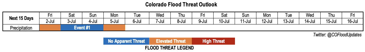
Valid Dates: 7/2-7/16
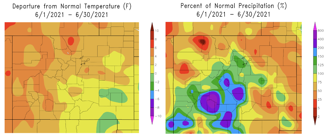
Before heading into today’s Outlook, below are June’s temperature departure from normal, and precipitation anomalies (%). A very wet and cold end to the month averaged out some of the intense early and mid-month heat, as well as brought precipitation to above normal for the southern high terrain. This was a welcome relief given that the wildfire season started with a roar during the first part of June. There are still several wildfires burning over the Western Slope, however, containment efforts have greatly improved recently with the higher humidity and widespread precipitation.
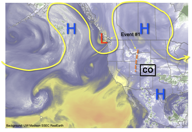
For this Independence Day weekend edition of the Outlook, we anticipate a single precipitation event (Event #1) that will last through the weekend. As shown in the water vapor image, below, Colorado remains in a typical summertime weak-flow pattern. This is courtesy of the strong ridge that has moved eastward over southern Canada, allowing disturbances to basically sit over the Rocky Mountain states without much steering flow. It is important to remember that elevated heating over our high terrain acts as a disturbance maker during most summer afternoons. This is incredibly difficult to resolve in even the highest resolution weather models.
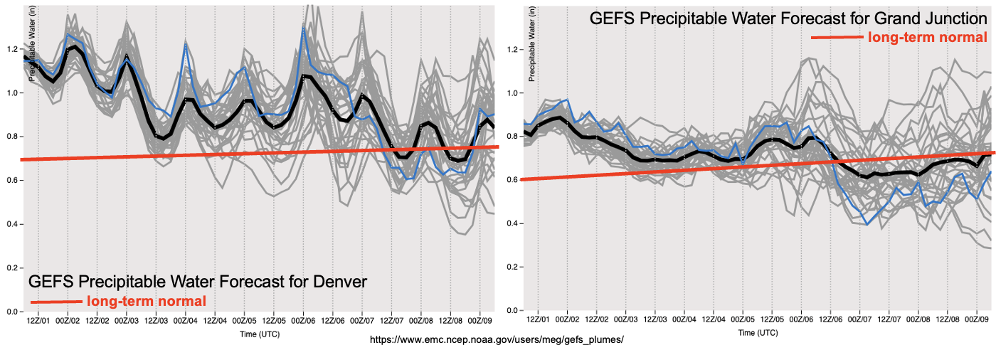
The real forcing behind today’s High Threat precipitation event is not so much the dynamics, which, as mentioned, are rather unimpressive, but the very high moisture content. With sufficient instability and absent a mechanism to remove this moisture, we foresee daily rounds of shower and storm activity especially over the climatologically favored higher terrain. As shown below, forecasts do suggest moisture levels will come down gradually over the next 96 hours, but they will still be well above normal east of the Continental Divide. So, with some hesitation, we label Event #1 as a blend of Elevated threat and No Apparent Flood Threat. However, it is possible that the surprise will be to the upside given the elevated moisture. Please check in with daily Flood Threat Bulletins for much more refined daily forecasts. Overall though, worst-case, we expect heavy rainfall to be limited to very isolated storm cells.
Below we describe the identified precipitation events in more detail.
Event #1: Friday – Monday (July 2 – July 5)
Low-end Elevated Flood Threat Friday, followed by weaker intensity Saturday/Sunday; a cool front will bring back an Elevated threat Monday
On Friday, we expect plenty of residual moisture to fuel mainly high elevation showers and thunderstorms, although some storms may make it farther east especially over the Southeast Plains. The flood threat should stay limited to isolated higher terrain cells that could stay nearly stationary and produce over 1 inch per hour of rainfall. Lower coverage is expected on Saturday and Independence Day (Sunday), with almost all measurable rainfall likely limited to the higher terrain. By Monday, a cool front and disturbance is expected to move southward into Colorado, which will boost storm coverage over the Northeast and Southeast Plains as well as the foothills east of the Continental Divide. However, at this time, only a low-end Elevated Flood threat is expected.