Issue Date: Tuesday, June 29th, 2021
Issue Time: 9:45AM MDT
— A LOW flood threat has been posted for parts of the San Juan Mountains, Central Mountains, Southwest Slope and Grand Valley
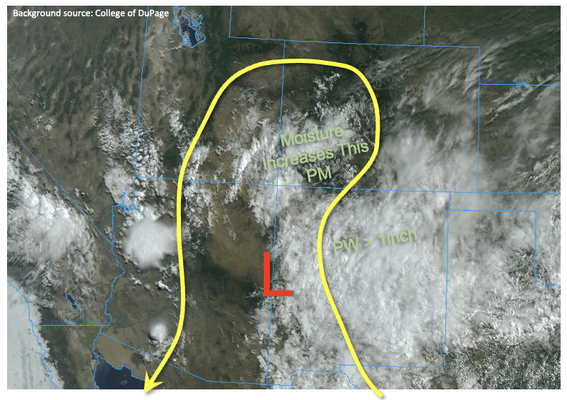
A plume of monsoonal moisture will advect into southwest Colorado later this afternoon, providing beneficial rainfall to the drought-stricken region. As shown in the visible satellite image, below, the main wildcard will be the degree to which sunshine can boost instability. Pockets of clear skies over the San Juan Mountains this morning indicate that sufficient instability will develop to boost instability (CAPE) to as high as 1,000 J/kg locally. PW at Grand Junction has increased notably from 0.64 to 0.79 inches today. Although boundary layer moisture is limited at Grand Junction, a much moister boundary layer was noted from the Albuquerque, NM sounding with a PW of 1.03 inches. Numerous to widespread showers and thunderstorms are expected over southwest Colorado later this afternoon, warranting a Low flood threat. Where instability is limited, max 3-hour rainfall could still approach 1.6 inches. On the other hand, for regions with higher instability, max 1-hour rainfall up to 1.1 inches will be possible. In either situation, a Low flood threat is appropriate for the threat of isolated flash flooding, debris slides and mud flows, especially over steeper terrain.
East of the Continental Divide, some warming aloft will limit instability this afternoon. However, with marginal moisture still in place, isolated to scattered thunderstorms will once again be possible especially over the higher terrain. However, flooding is not expected for these areas.
Today’s Flood Threat Map
For more information on today’s flood threat, see the map below. If there is a threat, hover over the threat areas for more details, and click on burn areas to learn more about them. For Zone-Specific forecasts, scroll below the threat map.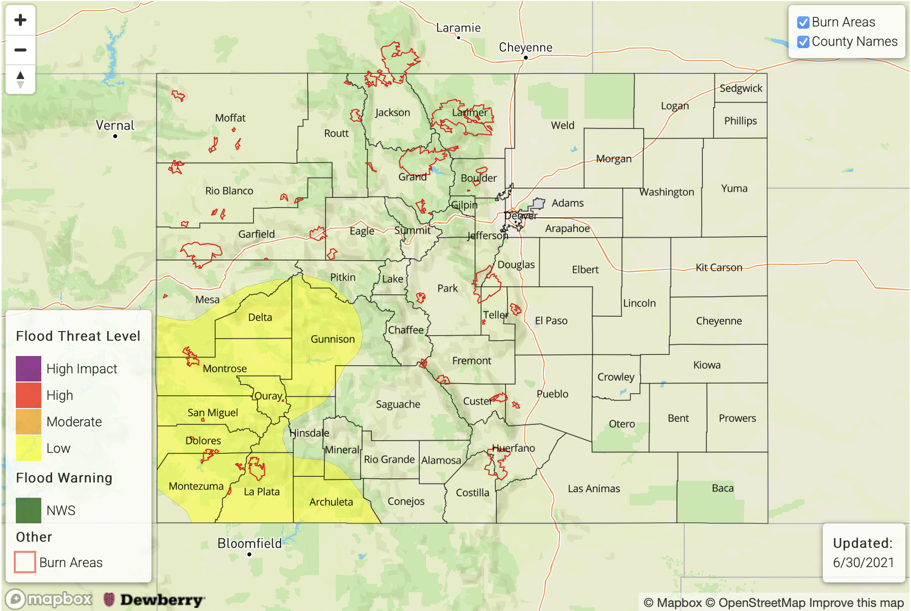
Zone-Specific Forecasts:
San Juan Mountains, Central Mountain, Grand Valley, Southwest Slope and San Luis Valley:
Mostly cloudy with numerous to widespread showers and thunderstorms this afternoon and into late evening. Coverage will be highest of the higher terrain, but even valleys will see measurable rainfall. Max 30-minute rainfall up to 0.7 inches, max 1-hour rainfall up to 1.1 inches and max 3-hour rainfall up to 1.6 inches will be possible, warranting a Low flood threat for parts of the region. Coverage will gradually subside after sunset but isolated heavy rainfall could continue until midnight.
Primetime: 11:30AM through 12AM
Southeast Mountains, Front Range, Urban Corridor, Raton Ridge, Palmer Ridge, Northeast Plains & Southeast Plains:
Isolated to scattered showers and thunderstorms, mainly limited to the higher terrain and adjacent foothills. Max 30-minute rainfall up to 0.5 inches and max 1-hour rainfall up to 0.8 inches especially over northern areas. Over southern areas, a lighter, more stratiform rainfall is expected. Flooding is NOT expected today, but nuisance urban street ponding is possible under stronger storm cores.
Primetime: 12PM through 9PM
Northern Mountains, Northwest Slope:
Isolated to widely scattered showers and thunderstorms possible this afternoon and into evening. Max 1-hour rainfall up to 0.5 inches. Flooding is NOT expected today.
Primetime: 12PM through 8PM