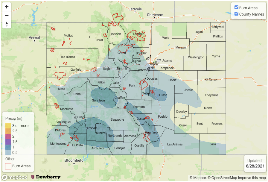
Issue Date: Monday, June 28th, 2021
Issue Time: 2:40PM MDT
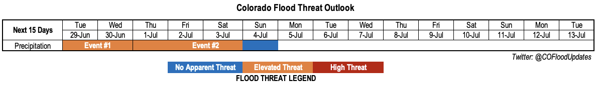
Valid Dates: 6/29-7/13
One key difference between summertime and springtime dynamics across Colorado is the former is oftentimes marked by weak steering flow. A prolonged period of weak flow is expected to develop shortly across Colorado, and with plenty of moisture around, isolated heavy rainfall will likely remain in the forecast through most of the week. Unfortunately, with weak flow situations, it is very difficult to determine which regions are most likely to be affected by the heavy rainfall.
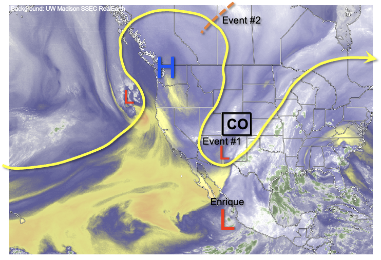
As shown in the water vapor image, below, the remarkably strong upper-level ridge continues to be positioned over the Pacific Northwest. Although it will weaken over the next 48-hours, it will continue to maintain a position well northwest/north of Colorado. This will allow for disturbance to enter Colorado both from the south, initially, and then from the north. The first disturbance, Event #1, will be in association with a weak monsoonal pulse (for CO; it will be much more strongly felt in NM and AZ) that will affect mainly the southern high terrain. The second disturbance, Event #2, will affect both eastern and western Colorado as monsoonal moisture is also aided by multiple shortwaves expected to move in from the north.
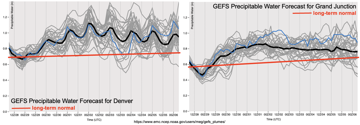
As shown in the GEFS plumes, significantly higher than normal PW is forecasted for both Denver and Grand Junction over the next 7 days. However, with relatively weak flow and low to moderate instability, we expect on short-term heavy rainfall to be the predominant threat as organized long-duration storms will be unlikely. Nonetheless, with this much moisture available, an Elevated flood threat is warranted especially over higher terrain where it only takes about 1 inch per hour of rainfall to begin to cause runoff issues.
In addition to the long stretch of above normal moisture, we are also expecting generally below normal temperatures especially east of the Continental Divide. After Event #2, however, there are indications of a return to warmer and drier weather, so let’s welcome any rainfall we can get until then.
Below we describe the identified precipitation events in more detail.
Event #1: Tuesday-Wednesday (June 29 – June 30)
Low-end Elevated Flood Threat Friday-Sunday for mainly higher terrain
Daily rounds of scattered to numerous afternoon and evening thunderstorms are expected mainly over the higher terrain of the Southeast Mountains, San Juan Mountains, Central Mountains, Palmer Ridge, Raton Ridge and southern Front Range. Moisture will be abundant, but marginal instability and weak wind shear suggests the primary threat of 30-60 minute rainfall. Intensity up to 1.2 inches per hour will be possible, which is enough to trigger steeper terrain flash flooding, mud flows and debris slides. With enough moisture present, storms will likely make it into the lower elevations as well. Over the 48-hour period, up to 1.5 inches of rainfall will be possible over localized parts of the climatologically favored San Juan Mountains, Central Mountains, Southeast Mountains and the Pikes Peak region.
Event #2: Thursday-Sunday (July 1 – July 4)
Elevated Flood Threat to persist through Saturday
With moisture persisting, a series of disturbances are expected to enter Colorado from the north trigger more organized storms especially east of the Continental Divide. Higher terrain showers and storms will stay in the forecast, much like Event #1, but there will also be potential for activity over the Northeast and Southeast Plains. At this time, the most favored region appears to be along the NE border where max 1-hour rainfall exceeding 1.5 inches will be possible as the disturbances pass through. Over the higher terrain, max 1-hour rainfall up to 1.0 inch per hour also appear possible. Thus, overall, we expect a low-end Elevated Flood Threat to continue through at least Saturday, although stay tuned to Flood Threat Bulletins for updates on the location. By Sunday, current guidance suggests a decrease in moisture along with rising heights that should suppress rainfall coverage a bit for the 4th of July.