Issue Date: Thursday, June 24th, 2021
Issue Time: 3PM MDT
Valid Dates: 6/25-7/9
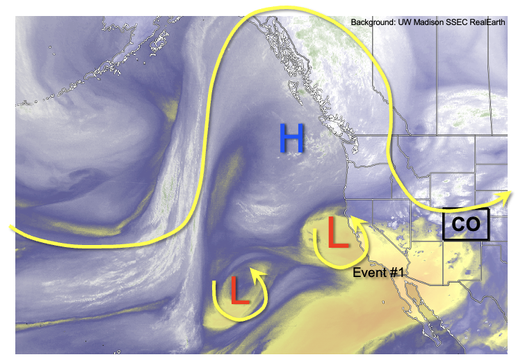
A record-breaking heat wave is expected over the Pacific Northwest this weekend and into early next week, and as shown in the water vapor image, below, the near-stationary position of this upper-level ridge will help boost Colorado’s precipitation chances. Flow of disturbances to the south of the ridge will initially provide Colorado with an Elevated flood threat through the weekend (Event #1). Thereafter, these disturbance will form a trough over the central United States, which will reinforce a generally cooler than normal pattern east of the Continental Divide and seasonable to slightly above average west of the Continental Divide. This will also lead to plenty of residual moisture trapped in the vicinity of the Four Corners, warranting the identification of Event #2. The coverage and intensity of rainfall is highly uncertain with Event #2, but it does appear that daily rounds of showers and weak storms will be likely at least over the favored higher terrain of southern and central Colorado.
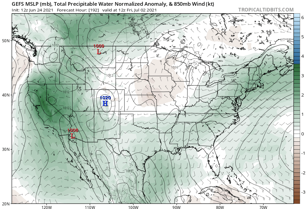
Our typical source of PW forecast plumes is unavailable today, but below is the PW anomaly forecast from the GEFS ensemble for next Friday, July 2nd. As can be seen, above normal moisture is forecasted over the entire southwest United States. Whether this will actually be converted to rainfall is a different matter, but it appears that areas in southern Colorado will have the best instability, and distance away from the Pacific Northwest ridge to see meaningful precipitation. Unfortunately, it appears that the northwest part of the state will continue to see above normal temperatures, which is not good news given the outbreak of early season wildfire activity there.
Below we describe the identified precipitation events in more detail.
Event #1: Friday – Monday (June 25 – June 28)
Elevated Flood Threat Friday-Sunday for isolated flash flooding
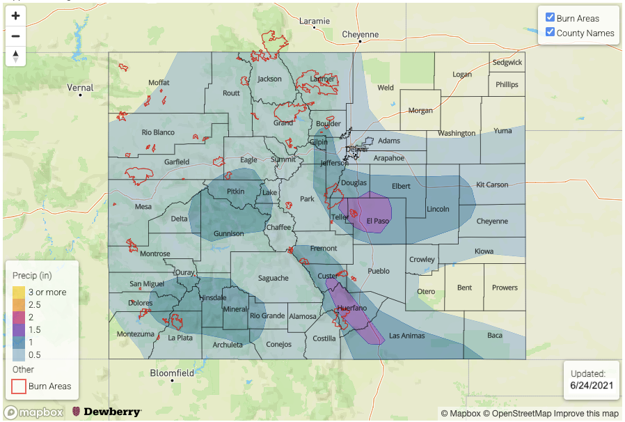
Numerous storms are expected nearly statewide on Friday, with the highest coverage over the central and northern high terrain in closest proximity to the upper-level disturbance. Rain rates will likely be a bit higher than today, with max 1-hour rainfall up to 1.4 inches possible west of the Continental Divide. This is enough to cause isolated flash flooding, mud flows and debris slides especially over steeper terrain. By Saturday and Sunday, activity will shift eastward and then southward as some dry air overtakes western Colorado. Scattered to numerous storms are expected along and east of the high terrain east of the Continental Divide with max 1-hour rainfall up to 1.2 inches. Eastward, over the plains, there will likely be some organized storm activity making it off the high terrain. The best chances of this will be east of the Palmer and Raton ridges, as downsloping will limit rainfall over northern Colorado. Over the plains, max 1-hour rainfall exceeding 2 inches per hour will be possible on Saturday and Sunday, given PW above 1 inch along the NE, KS and OK borders. This will be capable of producing isolated flash flooding, further supporting the Elevated flood threat for this event. On Sunday, some moisture will wrap back around southern Colorado, which will help the San Juan Mountains experience some increase in rainfall activity. However, rainfall will likely stay below 1.0 inch, which does not support flooding concerns at this time.
Event #2: Thursday – Saturday (July 1 – July 3)
No Anticipated Flood threat at this time
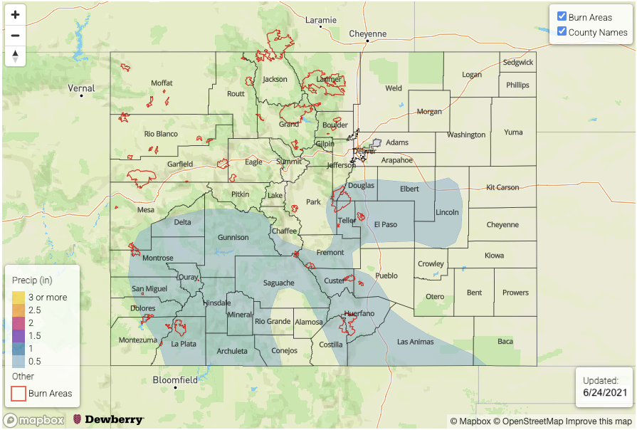
There is significant uncertainty as to the period following Event #1, but current guidance suggests some subtle drying before a nearly-stationary trough develops over the Central Plains. While this setup is not particularly conducive to widespread rainfall across Colorado, with plenty of residual moisture (PW > 0.8 inches at Denver and > 0.7 inches at Grand Junctions), at least scattered showers and storms are expected over the climatologically favored southern and central high terrain. At this time, we anticipate 0.5-1.0 inch of rainfall over a 3-day period and there is no anticipated flood threat. However, this could change if moisture is even higher than currently forecasted.


