Issue Date: Thursday, June 24, 2021
Issue Time: 9:00 AM MDT
Summary:
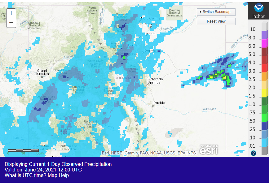
A widespread swath of Colorado saw some light, but much needed, rain yesterday. A pulse of monsoonal moisture arrived in the Southwest Slope and resulted in showers in the evening. This moisture was advected northeastward as the evening progressed into night, generally rotating around the surface low-pressure system located to the east of the state. The result was overnight showers in the San Juan, Central, and Northern Mountains, and finally the Front Range and Urban Corridor into the early morning hours.
Again, precipitation totals were generally light with these showers, but they did bring up to 0.15-0.18 inches to some locations, especially at high elevations. While this may not be apparent in the MetStorm Live grids displayed in the SPM, QPE estimates from NOAA show the spatial distribution of rainfall across the state yesterday, though likely with a high bias in terms of magnitude.
To the east, a cell developed in the late afternoon along the Palmer Ridge before pushing eastward (which can also be seen in the NOAA QPE, also likely biased high). As the storm approached the dryline on the Colorado-Kansas border, it was able to intensify and a severe thunderstorm warning was issued for high winds and large hail. No severe reports were ultimately made for this storm, possibly due to remote location away from observation locations.
No flooding was reported in Colorado on Wednesday. For rainfall estimates in your area, including antecedent conditions, check out the State Precipitation Map below.
Click Here For Map Overview
